This is the third of four posts about our 2025 vacation in the Giant Mountains (Krkonoše / Karkonosze), see Vacation in the Giant Mountaints for an introduction.
We wanted to have a change from the typical Polish food in the evening, and, thus, decided to climb up to Horní Malá Úpa on the Czech side of the Giant Mountains, have lunch there, walk a bit along the ridge, and return to Karpacz.
Ascent, Part 1
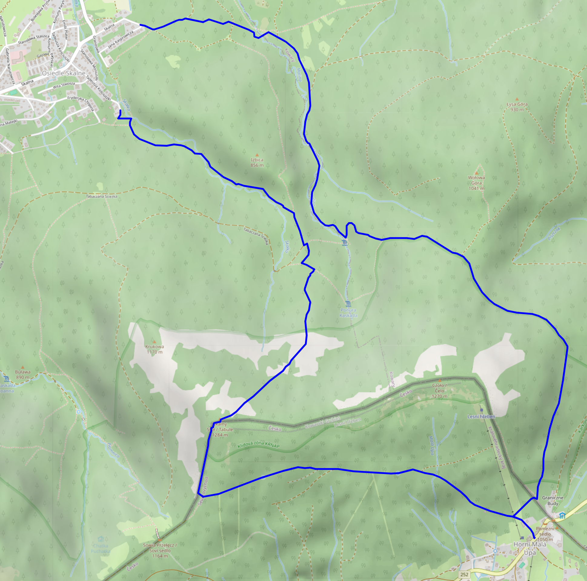
We started at around 10:30 from the very West of Karpacz, specifically its Osiedle Skalne suburb. From there, we took a path along (and, as often as not, across) the Malina stream (Langwasserbach). Some crossings came with bridges, others with broken bridges, and some with just a few strategically placed rocks. The latter parts of the path are helpfully marked with exclamation marks, likely indicating precisely these challenges. Anyhow, we enjoyed the quiet we had in this part of the forest, and made it through all fords without surprise baths.


Budniki
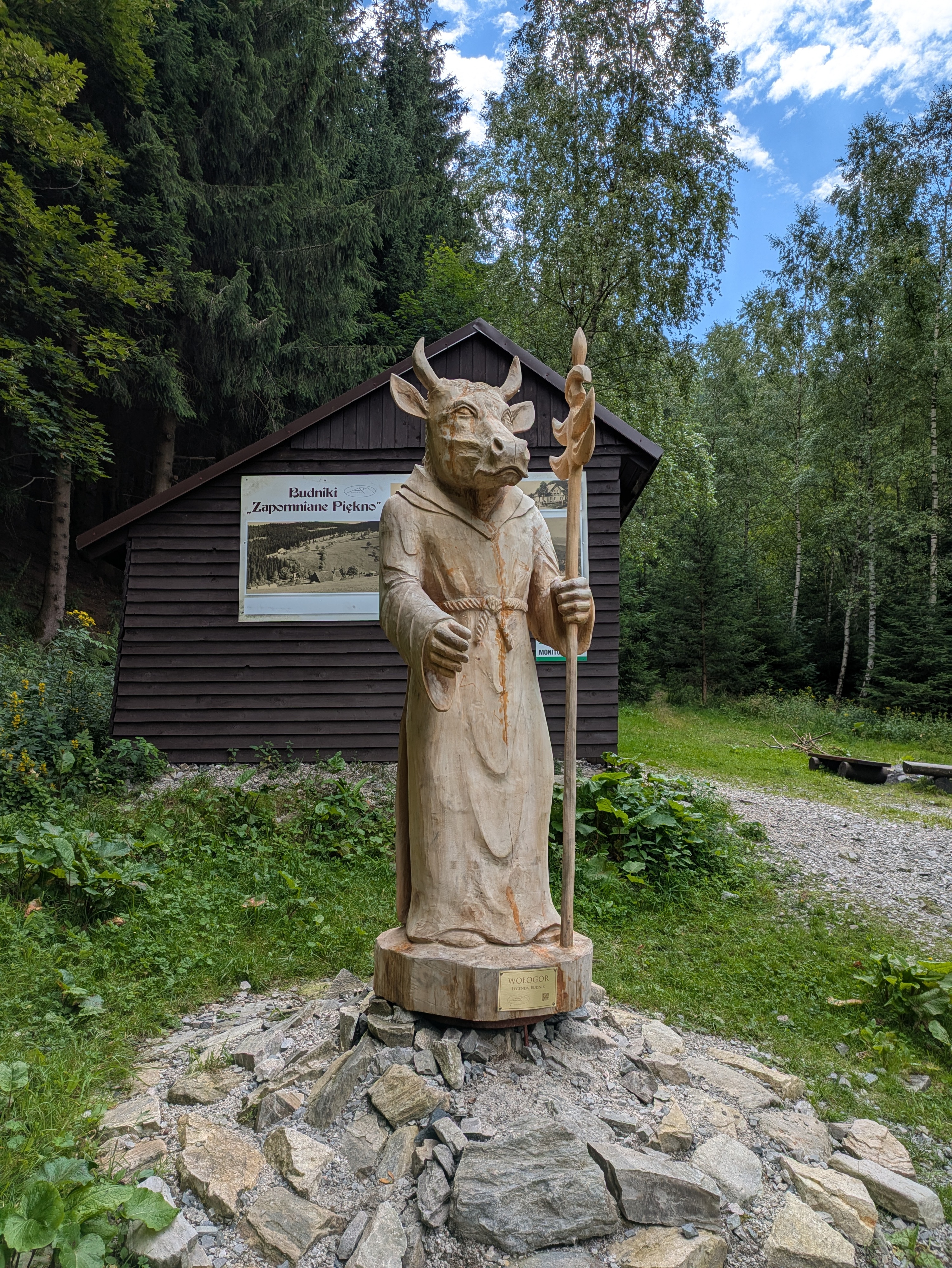
At 12:00, about a third of the way up, we reached former Budniki (Forstbauden / Forstlangwasser). We weren't aware of this site when planning the trip, so that was a pleasant surprise. Essentially, Budniki is a former settlement that, due to its location very close to the peaks of the Giant Mountains, had the peculiarity of not receiving any direct sunlight for 110 days a year. Apparently, it was abandoned around 1950 due to preparations / explorations for uranium mining operations. We also learnt about Wołogór, which doesn't seem to have an English or German Wikipedia page that I can link. Furries, they're everywhere!


We also found out that the bread we had brought along was not a proper dark bread, but simply wheat with activated charcoal. That's the kind of surprises you can get when you aren't fluent in Polish.
Ascent, Part 2
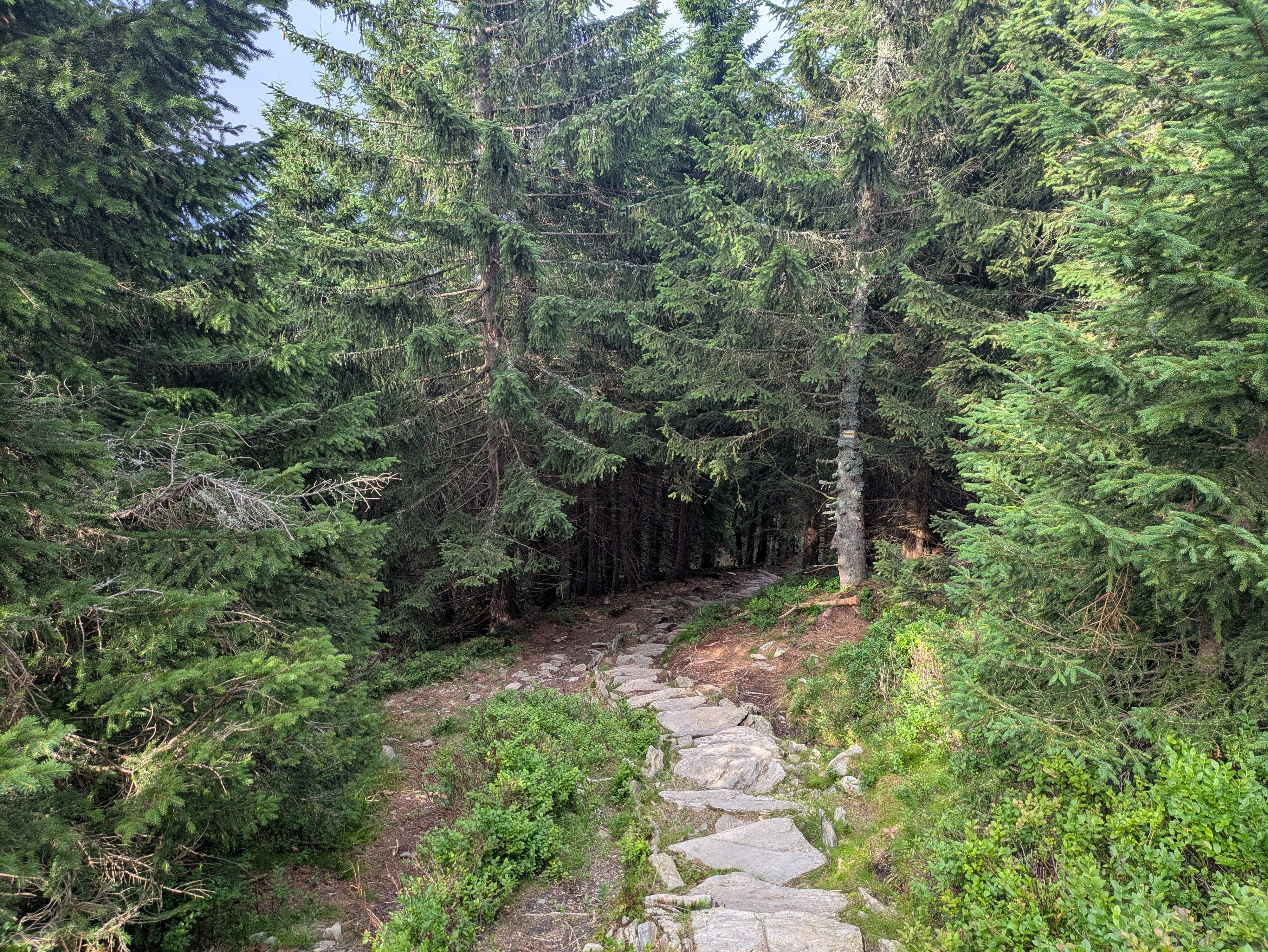
From Budniki on, the remaining 400-or-so metres of elevation got quite challenging, with uneven and pretty steep terrain that just kept going on and on. When we finally reached a more even path close to the ridge line, we were greeted with the usual occasional flooding, lush green, and (at about 14:00) a sign welcoming us to Česká Republika.


Horní Malá Úpa
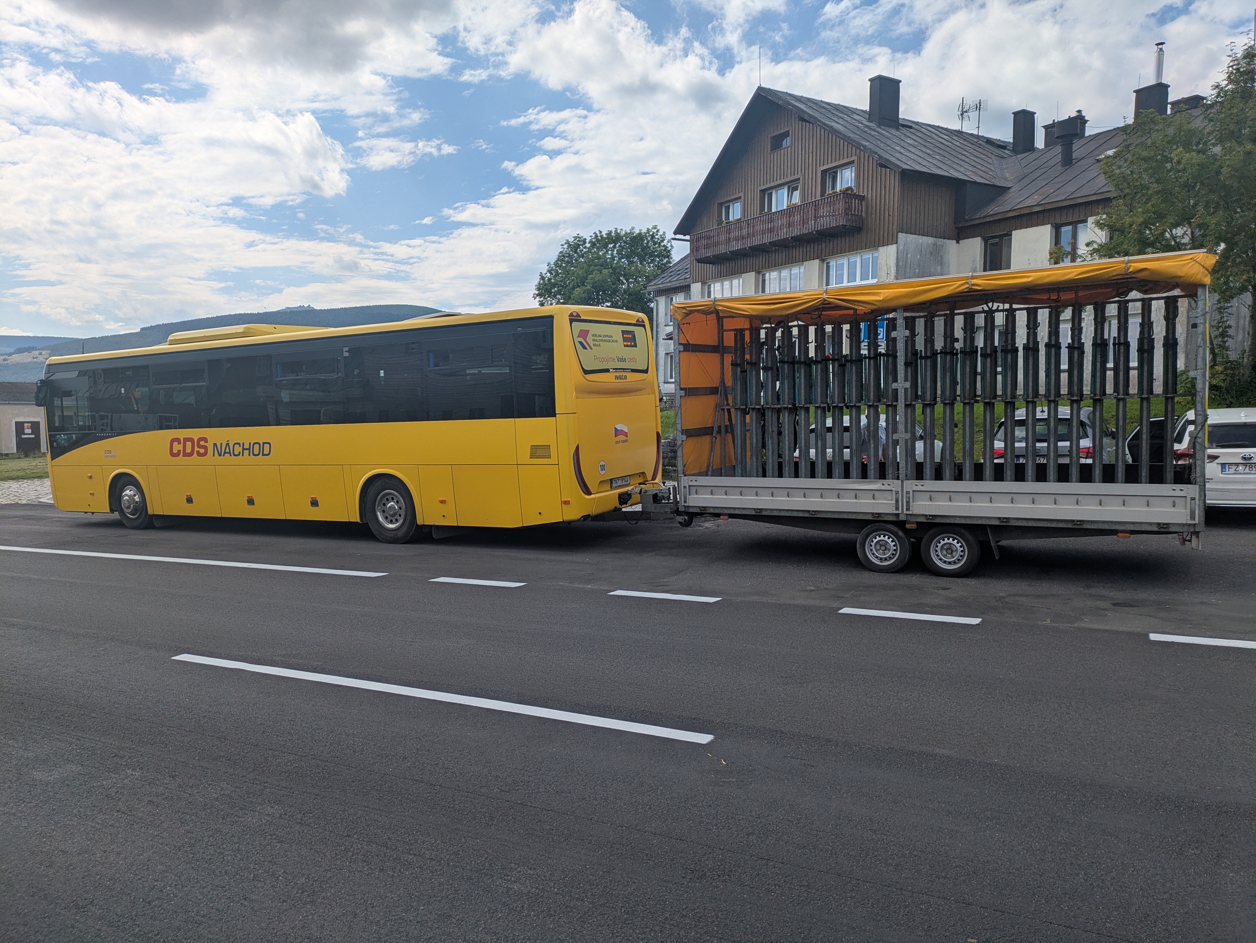
For English speakers, the jokes related to the name of Horní Malá Úpa (Ober-Kleinaupa / upper Malá Úpa) write themselves. So naturally, we had to pose for the obligatory photos near the entrance sign. Apart from that, the municipality is unspectacular. There's some border stones that still bear markings of the former ČSSR (Tschechoslowakei), some skiing infrastructure, and buses that are specifically outfitted for taking on bikes (or, possibly, skis). We had lunch at Pivovar Trautenberk, which I can recommend. Also, the nice part about Česká is that if you order lemonade, there's a high likelihood that you'll be served kofola 😋.


Tabule
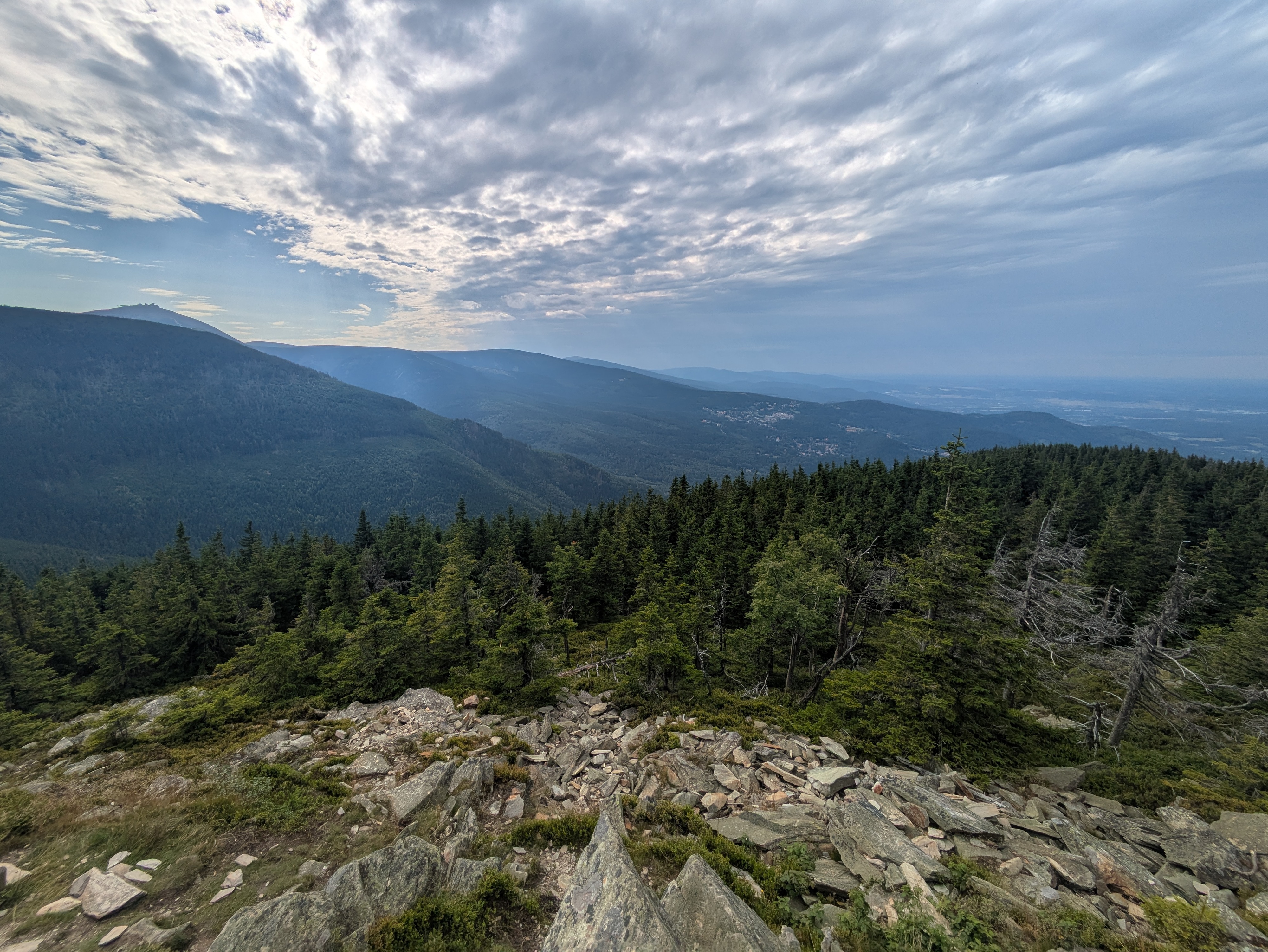
After some exploration and our lunch break, we left Horní Malá Úpa for the final climb up the nearest peak at around 15:30. We started out in a dense forest, and then, as the vegetation grew thinner, got some views towards other parts of the Giant Mountains.
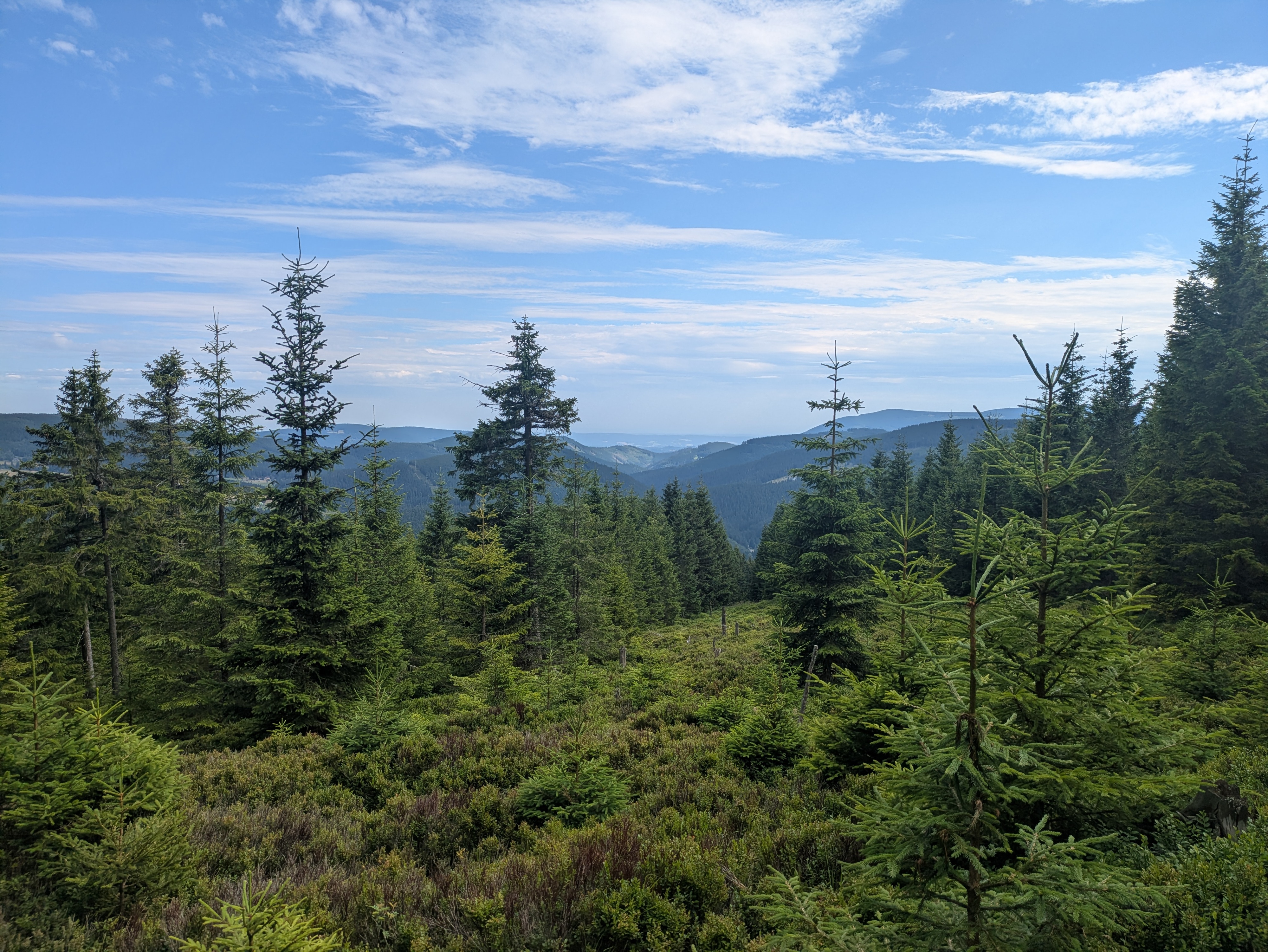

We reached Tabule (Tafelstein / table peak) at about 17:00, and took in some more scenery. Once again, we could spot Sněžka in the distance, and also a little bit of Karpacz and the Polish lowlands.

Descent
The descent took us slightly west of the path we used for the ascent, and was just as steep. It also really drove home just how much its height (and, likely, other factors) affect the vegetation – we got everything from low bushes to coniferous and birch forests.


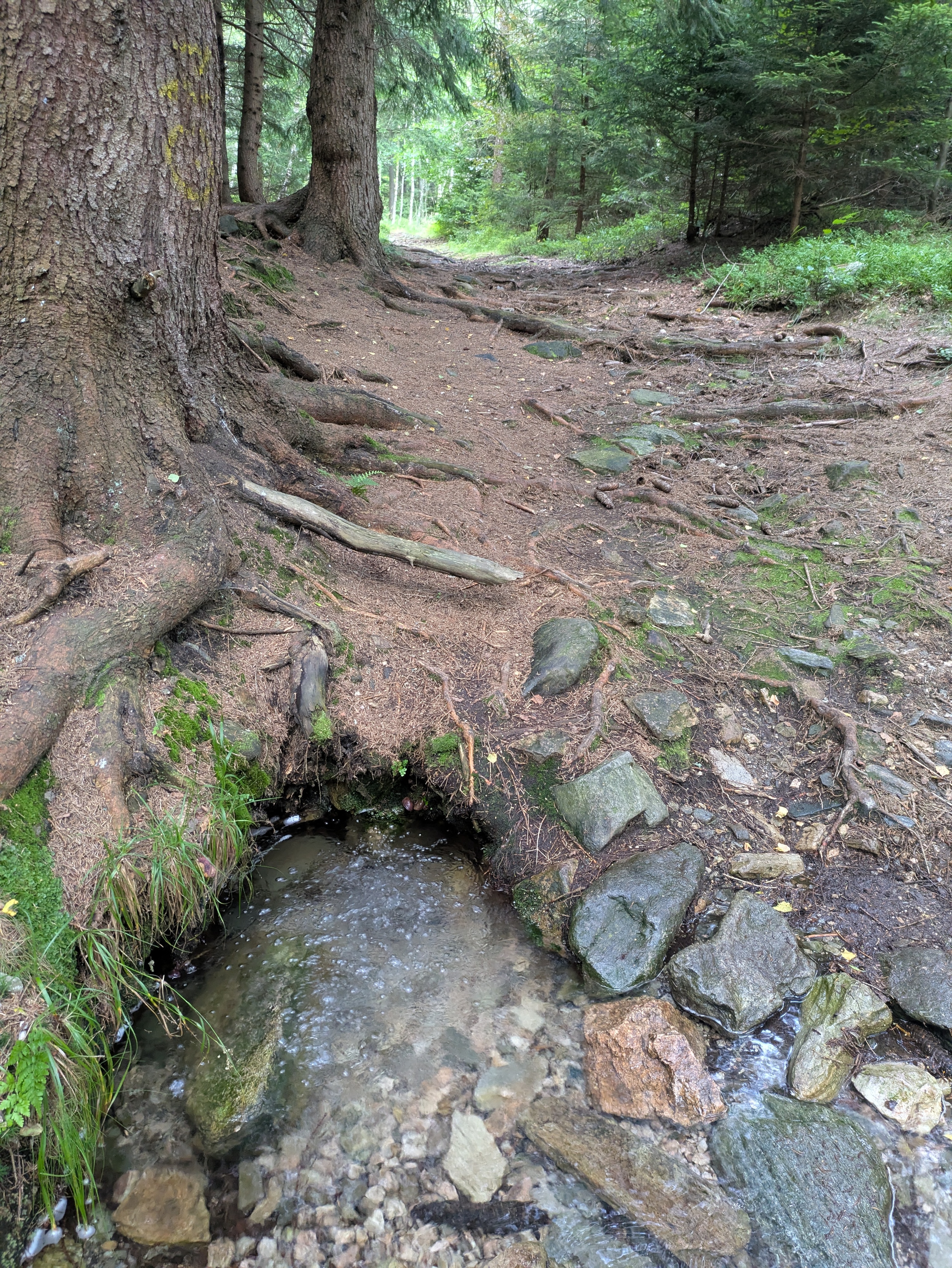
We passed Budniki once more, and then followed the Skałka stream for a bit. Here, we were faced with another surprise: a (possibly carbonated) spring that not even OpenStreetMap knew about.


We got back to Karpacz at about 19:00. As usual, more photos are available at lib.finalrewind.org/Tabule 2025.