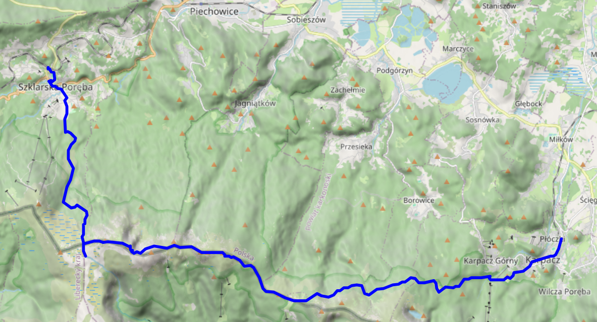
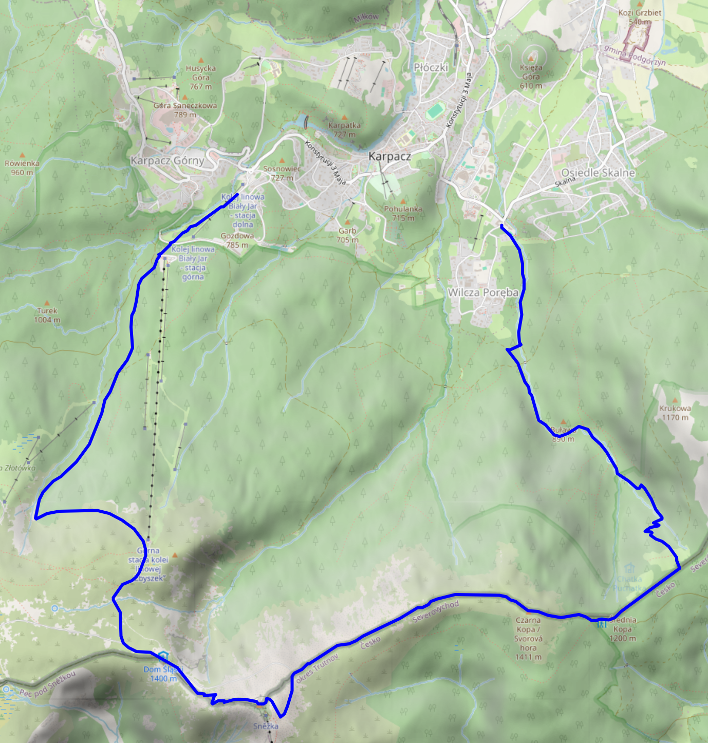
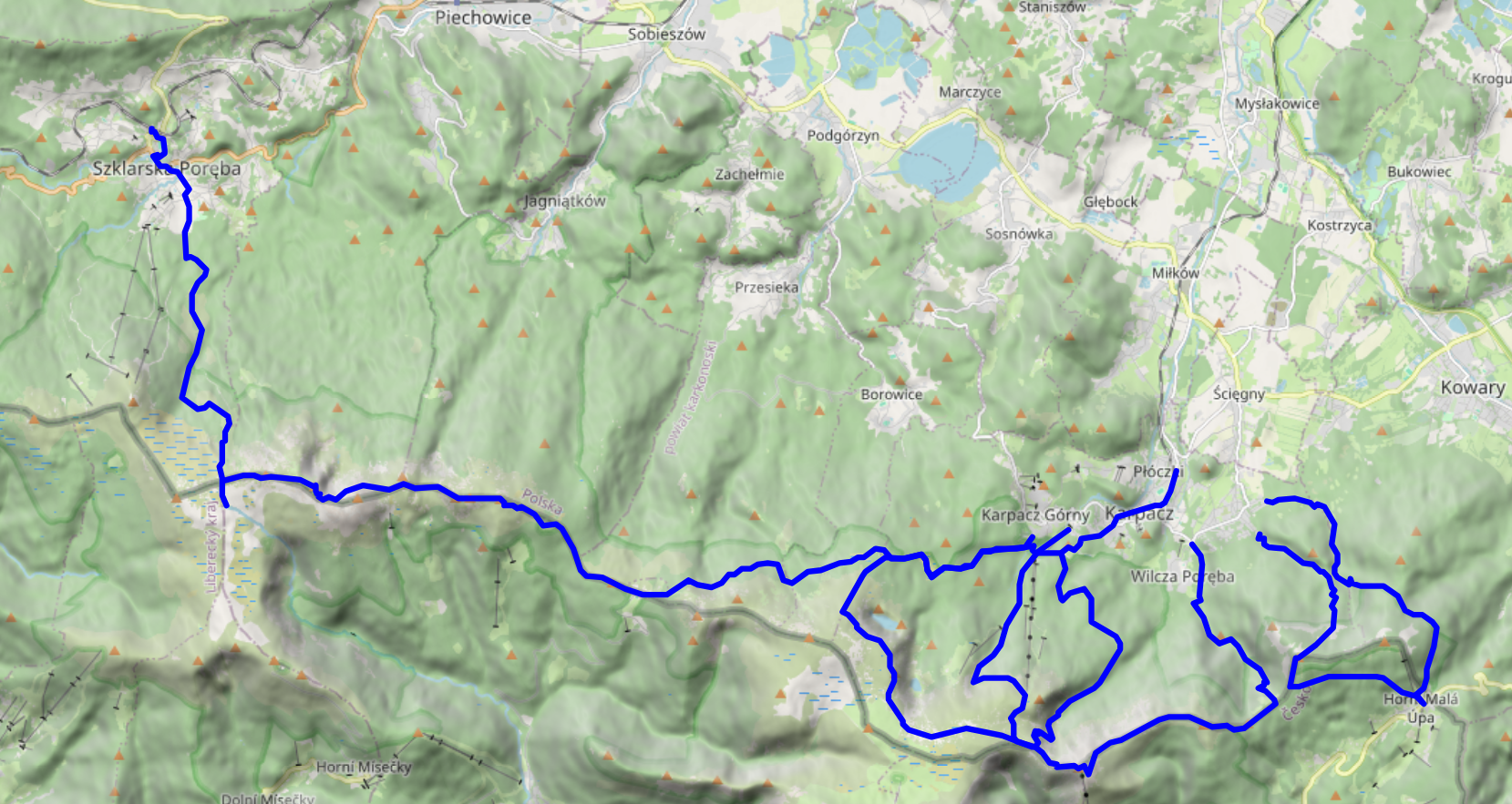
On the fourth and final full day of our vacation in the Giant Mountains, we decided to go for a change of scenery: take the train to Szklarska Poreba (Schreiberhau), walk up to Pramen Labe (Elbquelle / spring of the Elbe river), and then, depending on time of day and our appetite for more, either take the train back to Karpacz or walk back there across the peaks of the Giant Mountains. Unsurprisingly, we ended up walking the 20km or so from Pramen Labe back to Karpacz, and I can only say that that was the best decision we could have made.
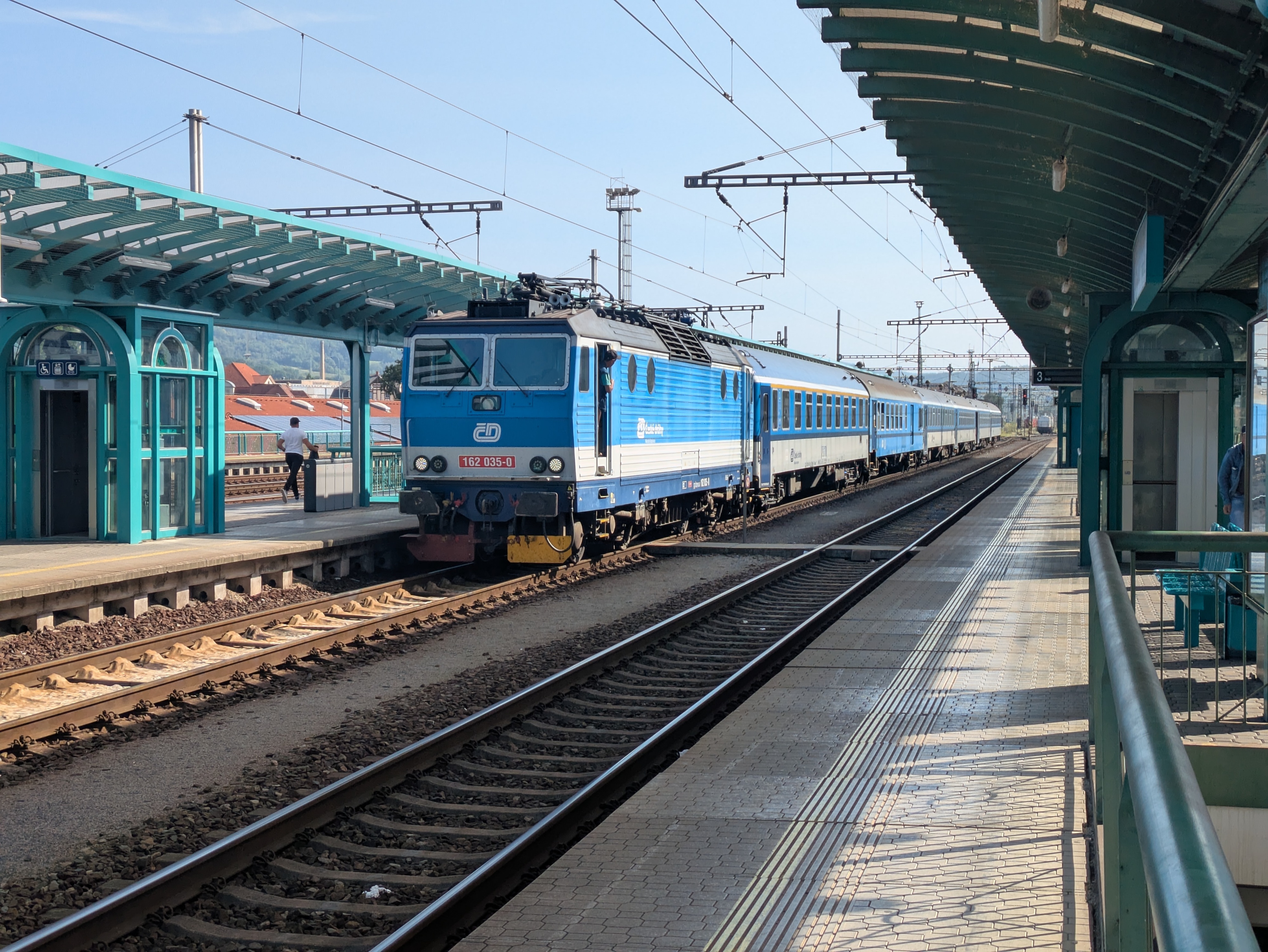
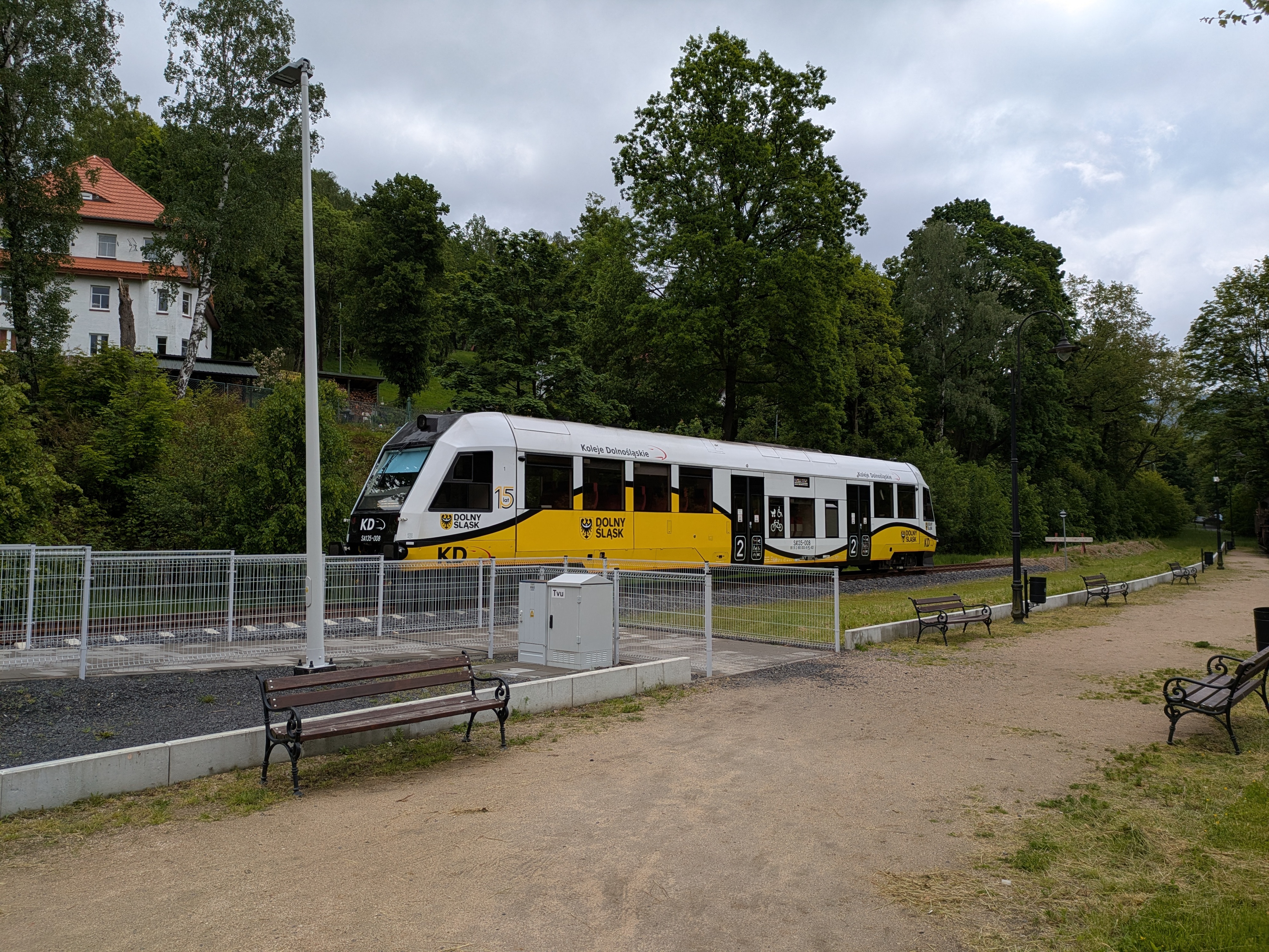
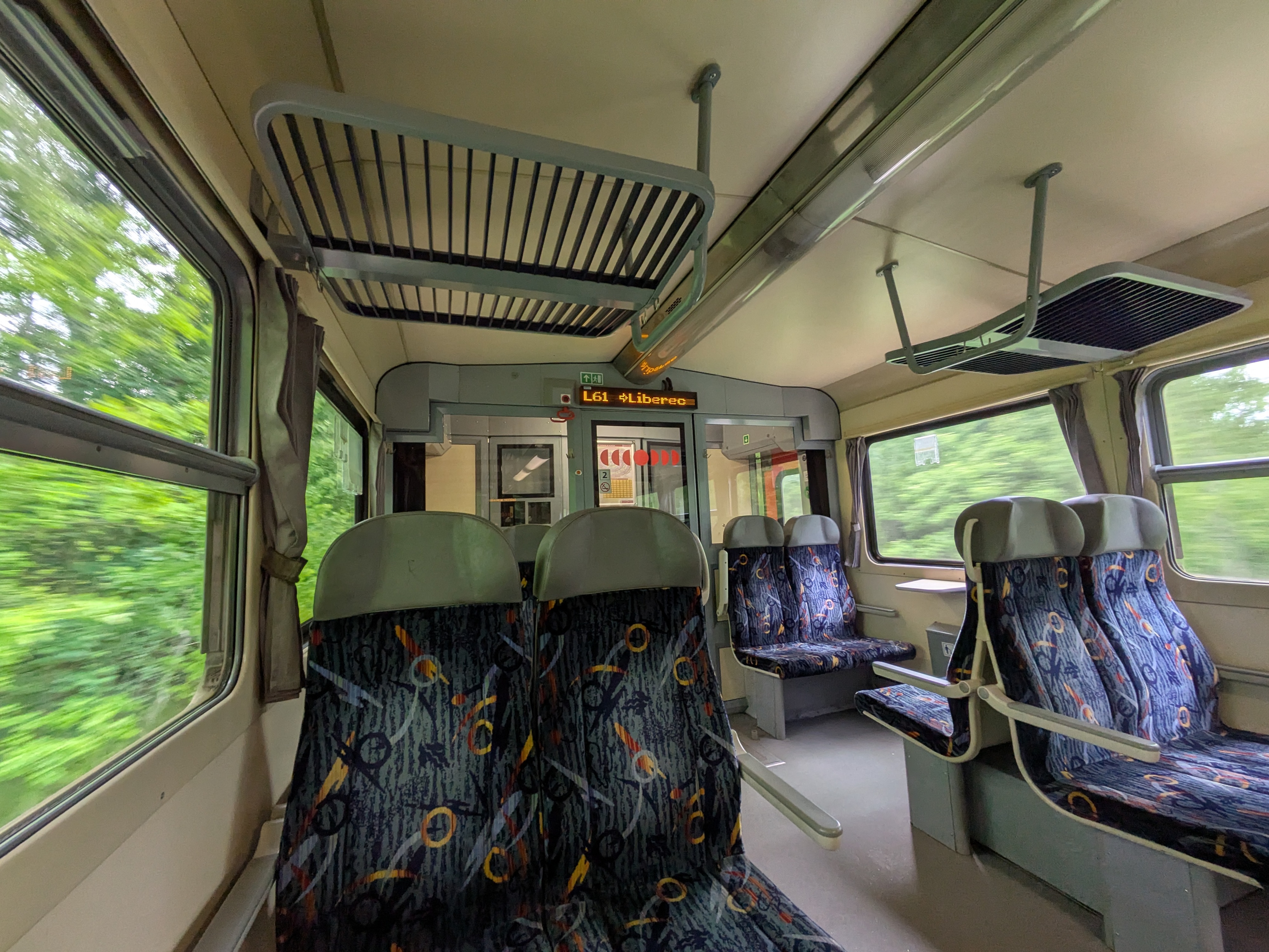
- KD D62 Karpacz (09:00) → Jelenia Góra (09:18)
- KD D6 Jelenia Góra (09:24) → Szklarska Poreba Górna (10:15)
Pramen Labe
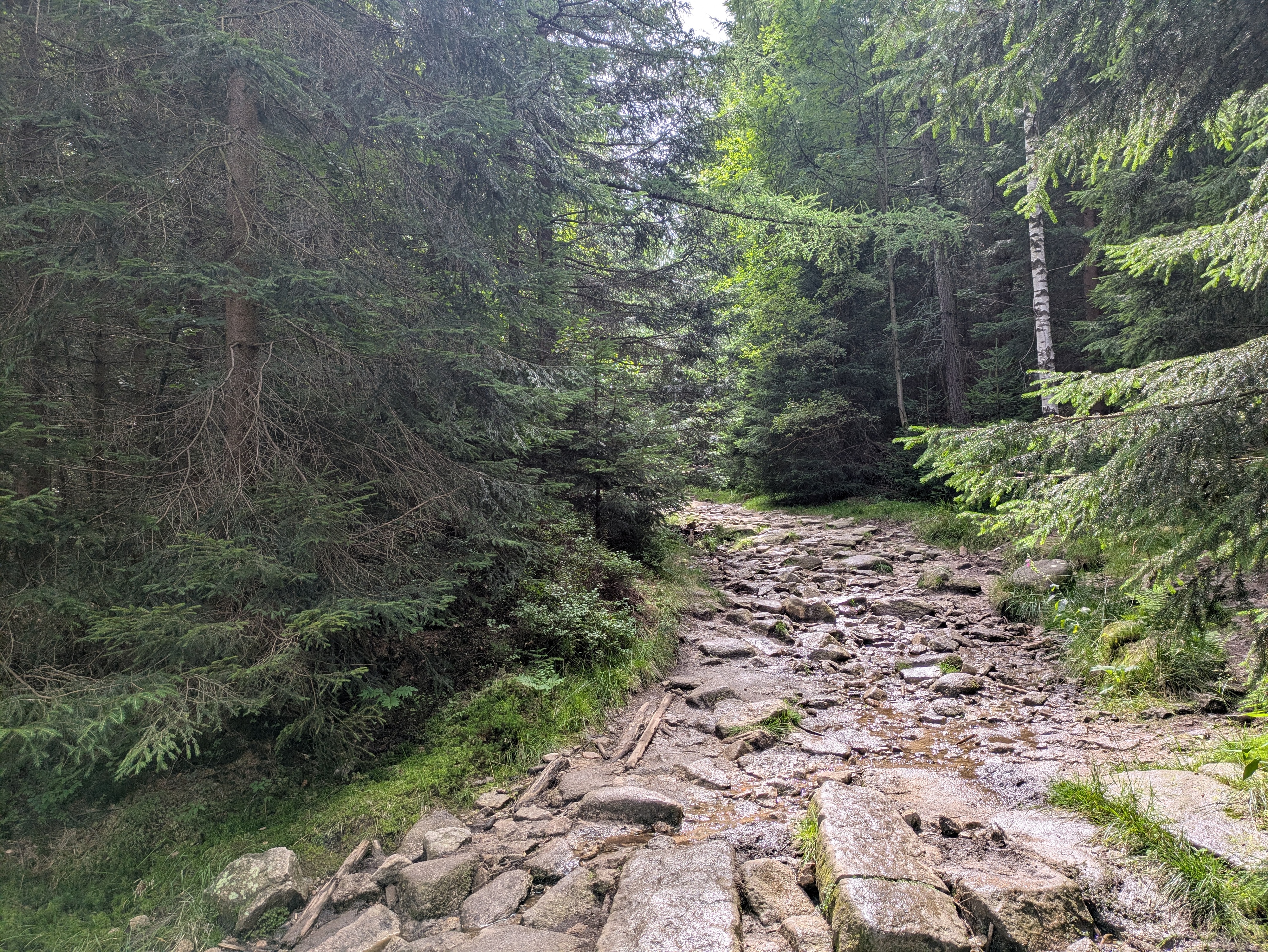
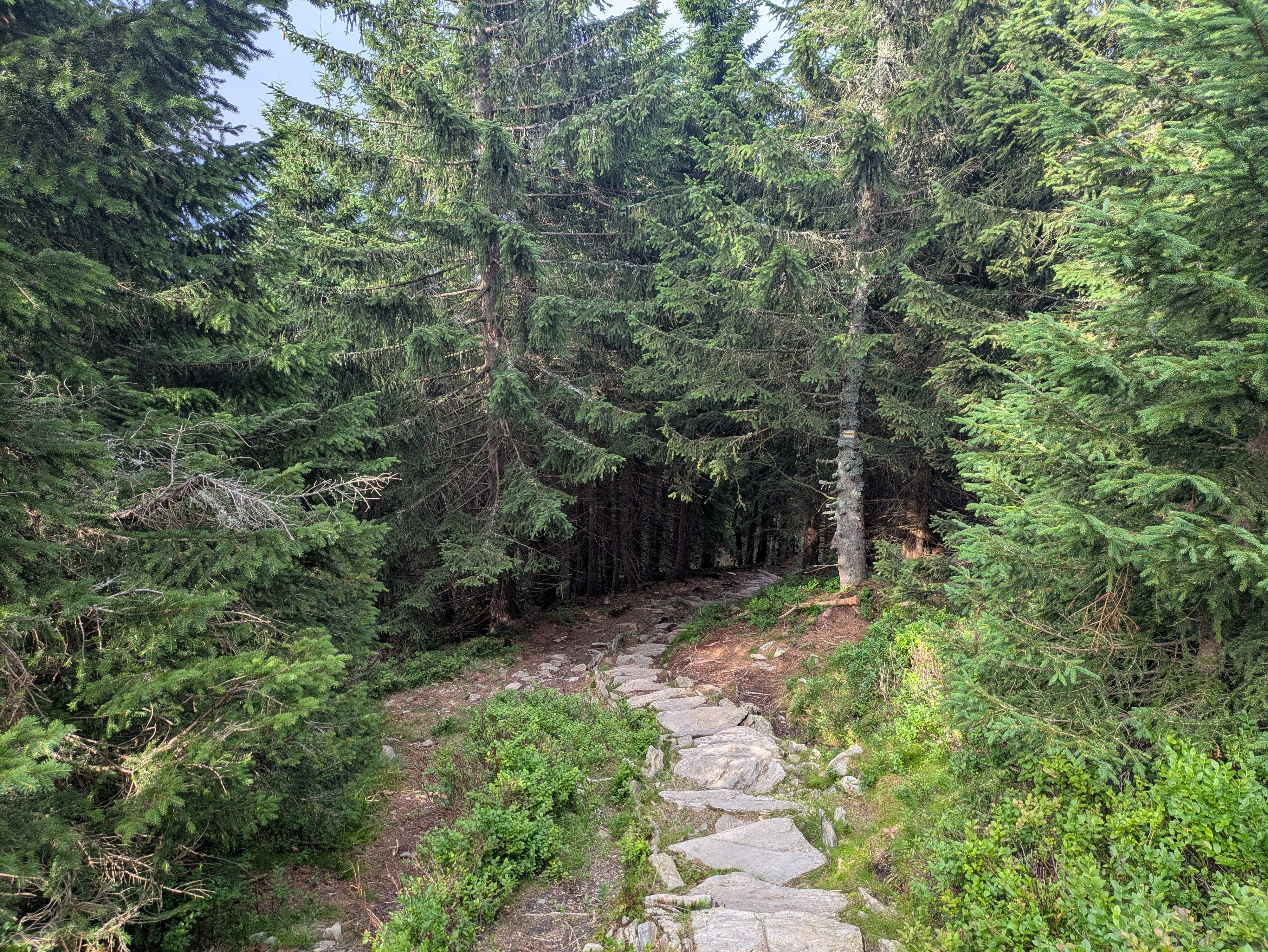
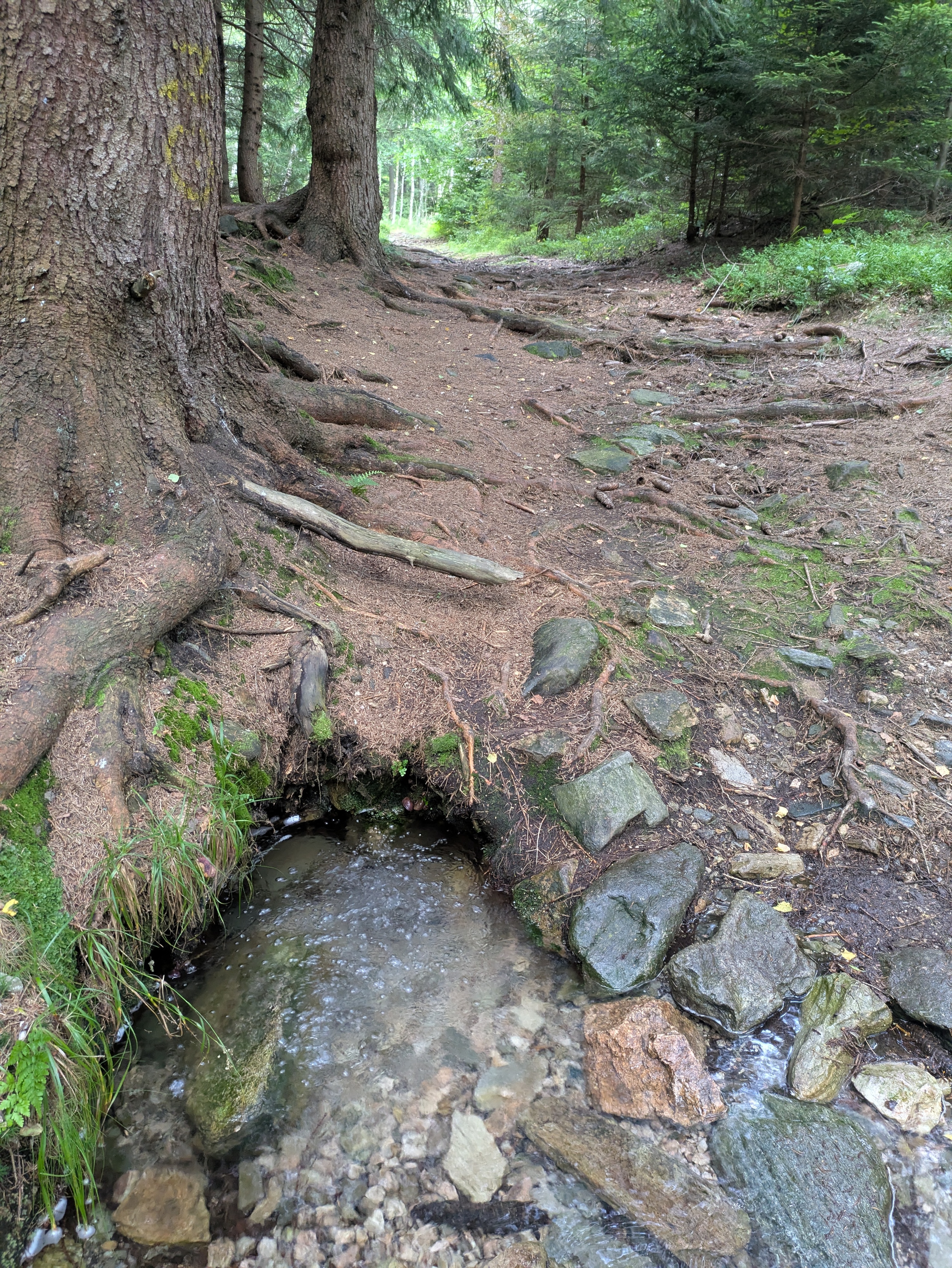
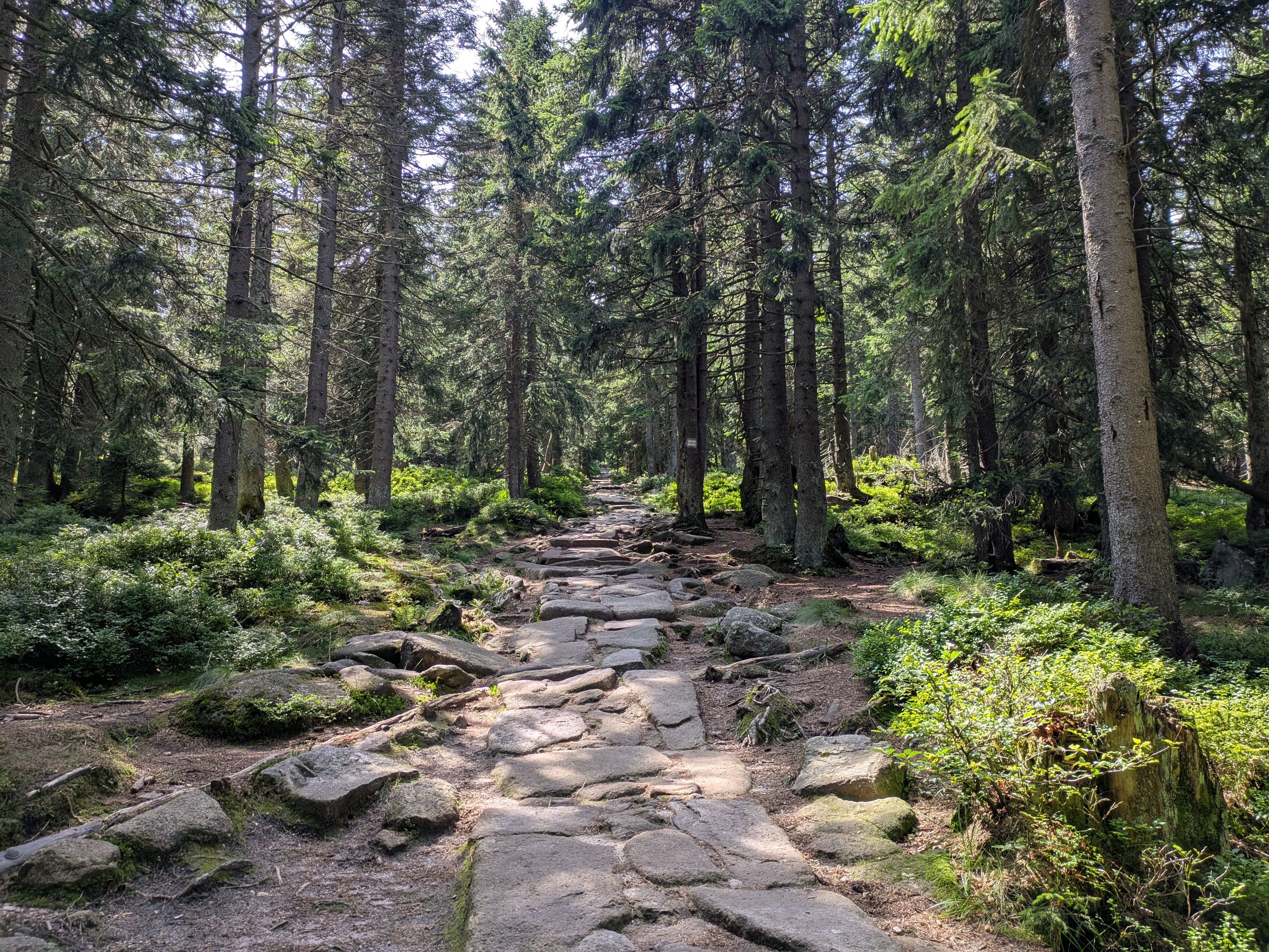
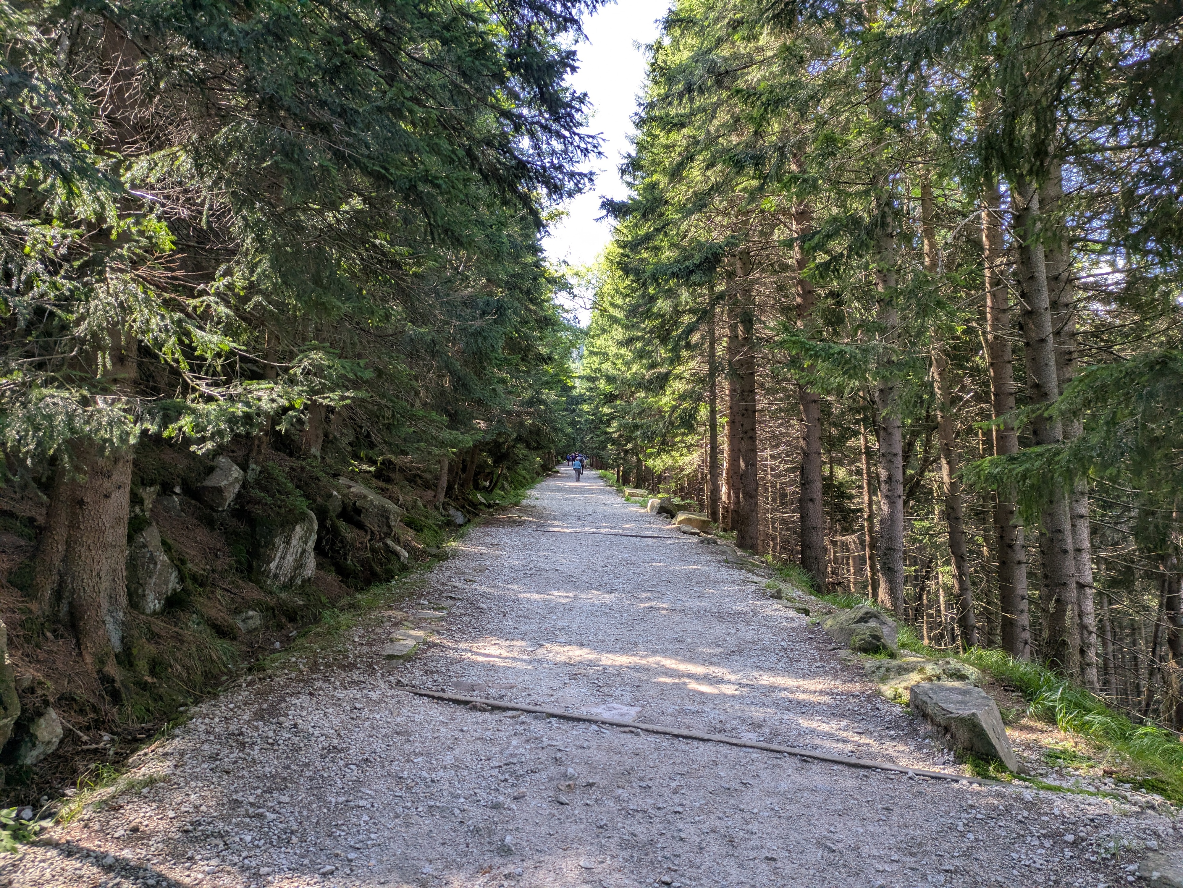
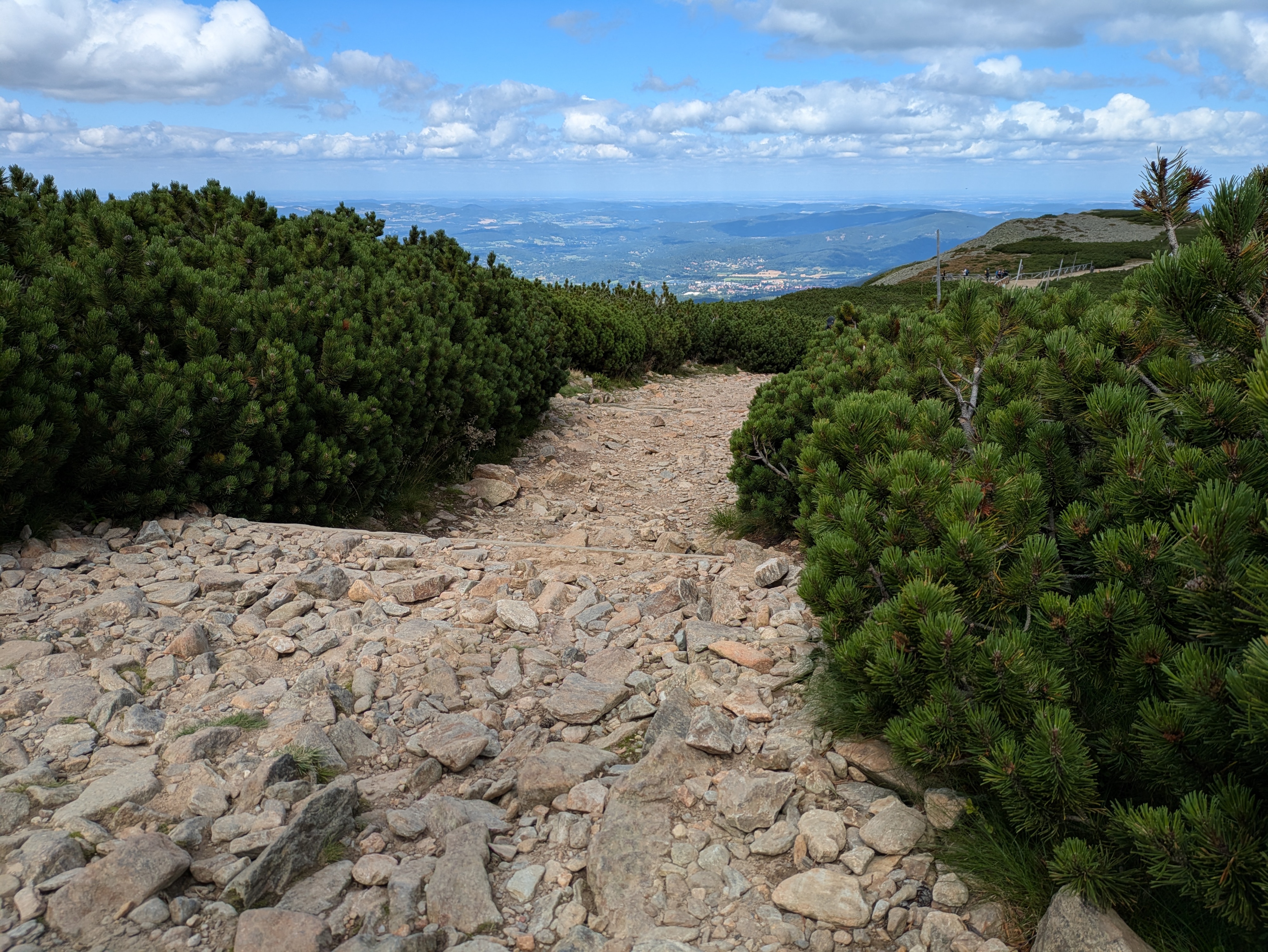
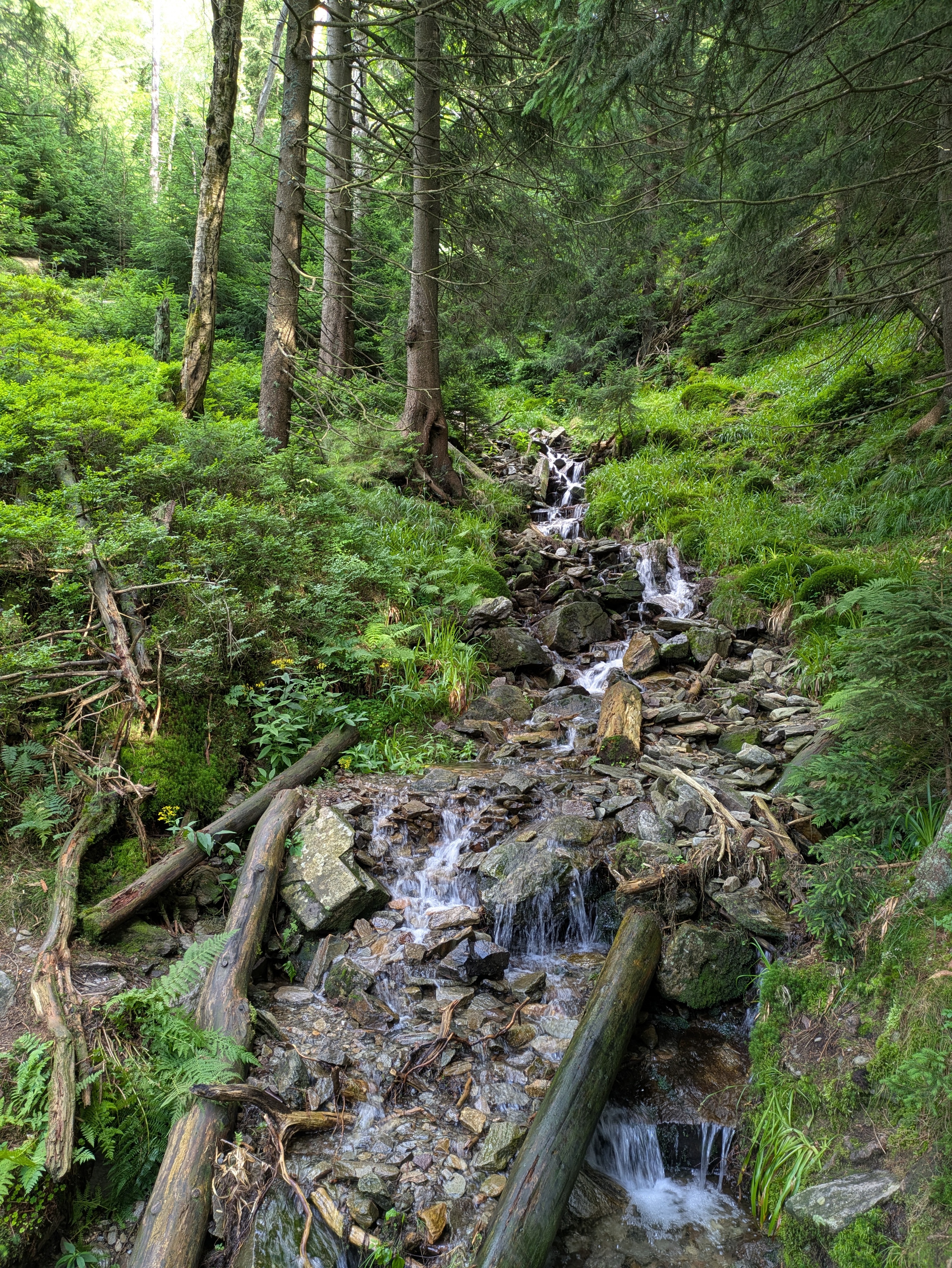
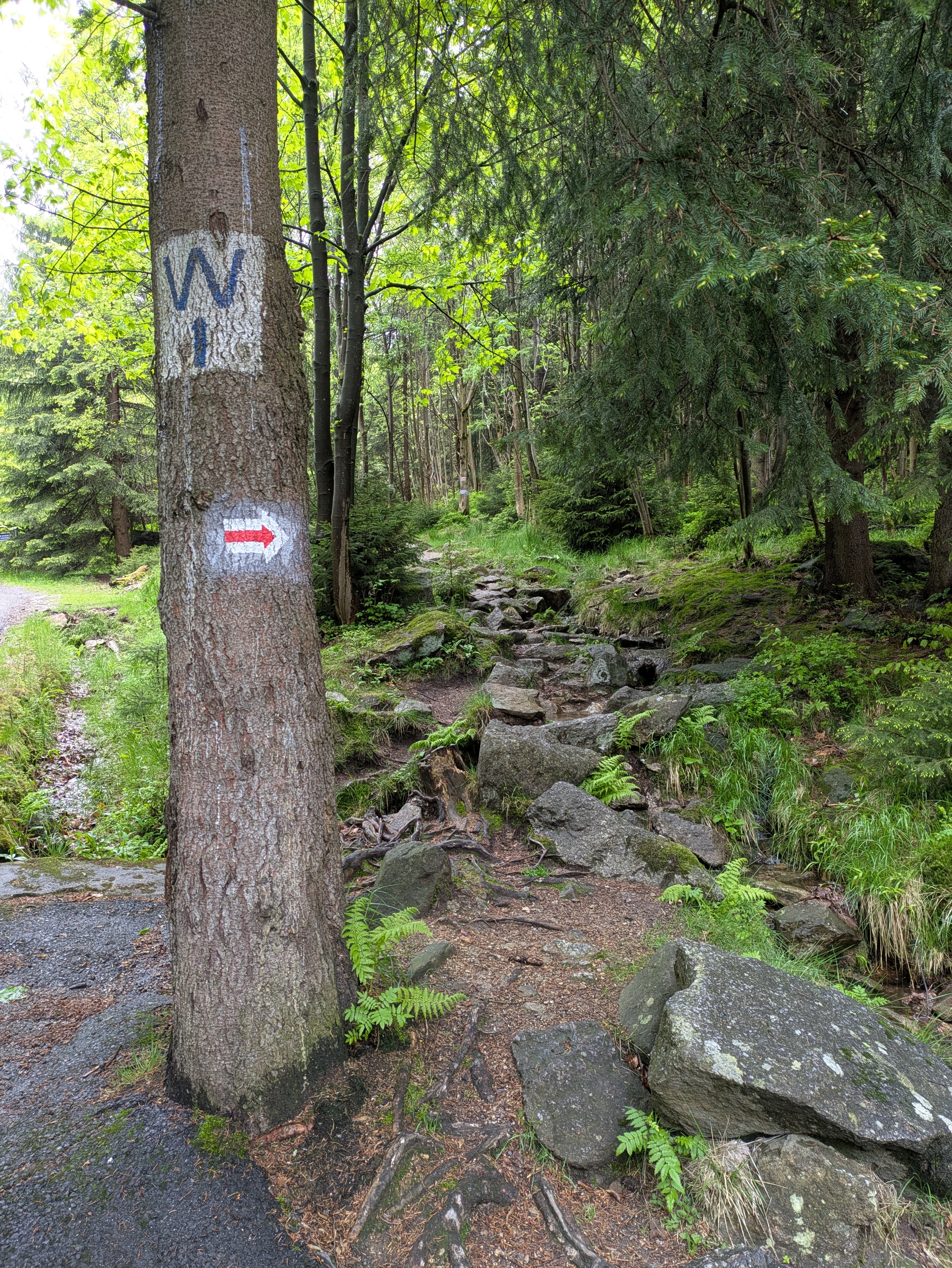
Szklarska Poreba is a comfortable little town, and seems like less of a tourist attraction than Karpacz. Only downside: it's located in a valley, with the train station where we got off sitting on the hills on one side and the Giant Mountains on the other. So, we first had to lose some precious elevation only to climb back up again on the other side. Apart from that, the way up went as usual: it started out relatively smooth and even, and then got steep and stony. There were some more stone formations and water streams, but nothing out of the ordinary.
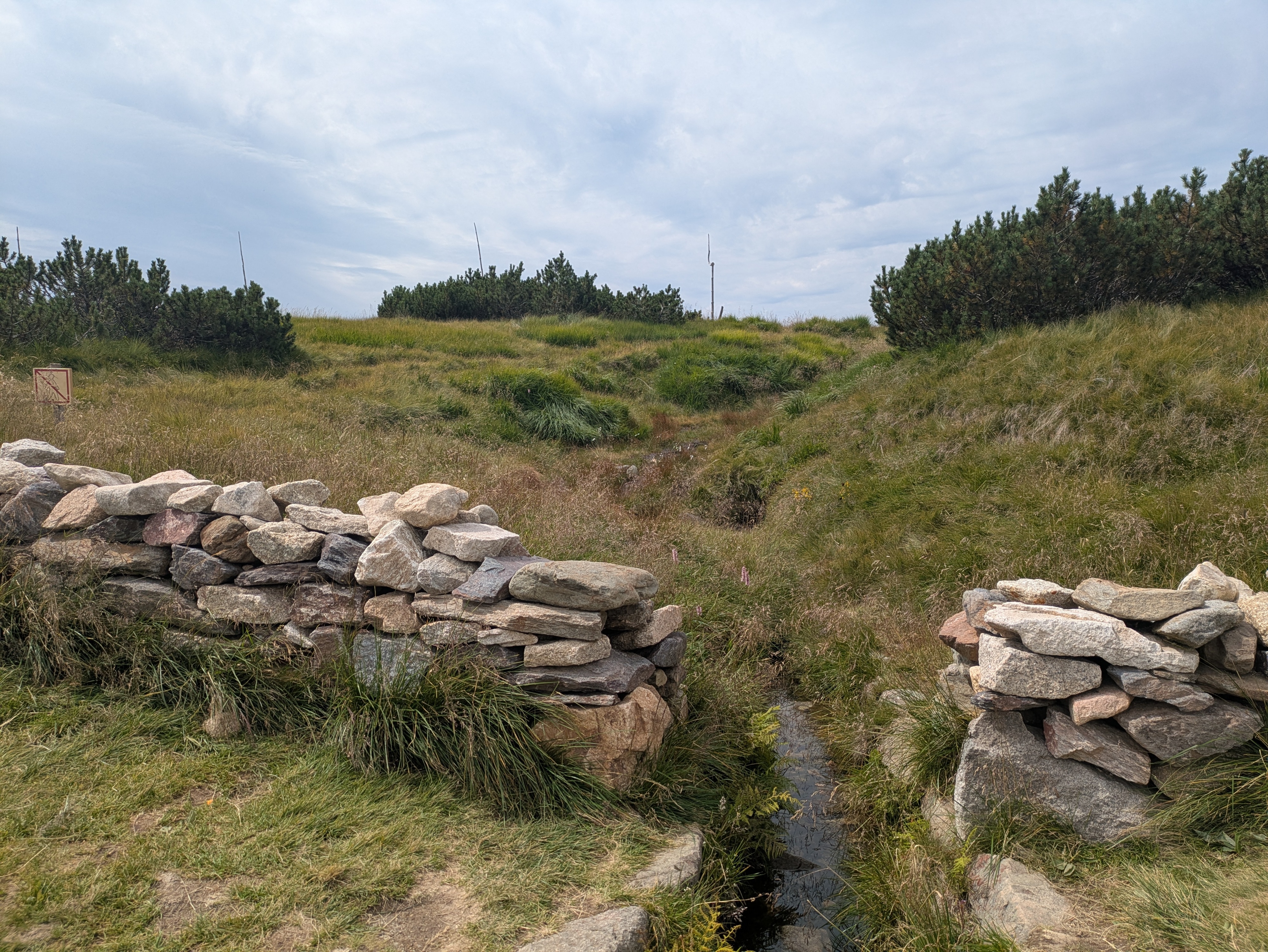
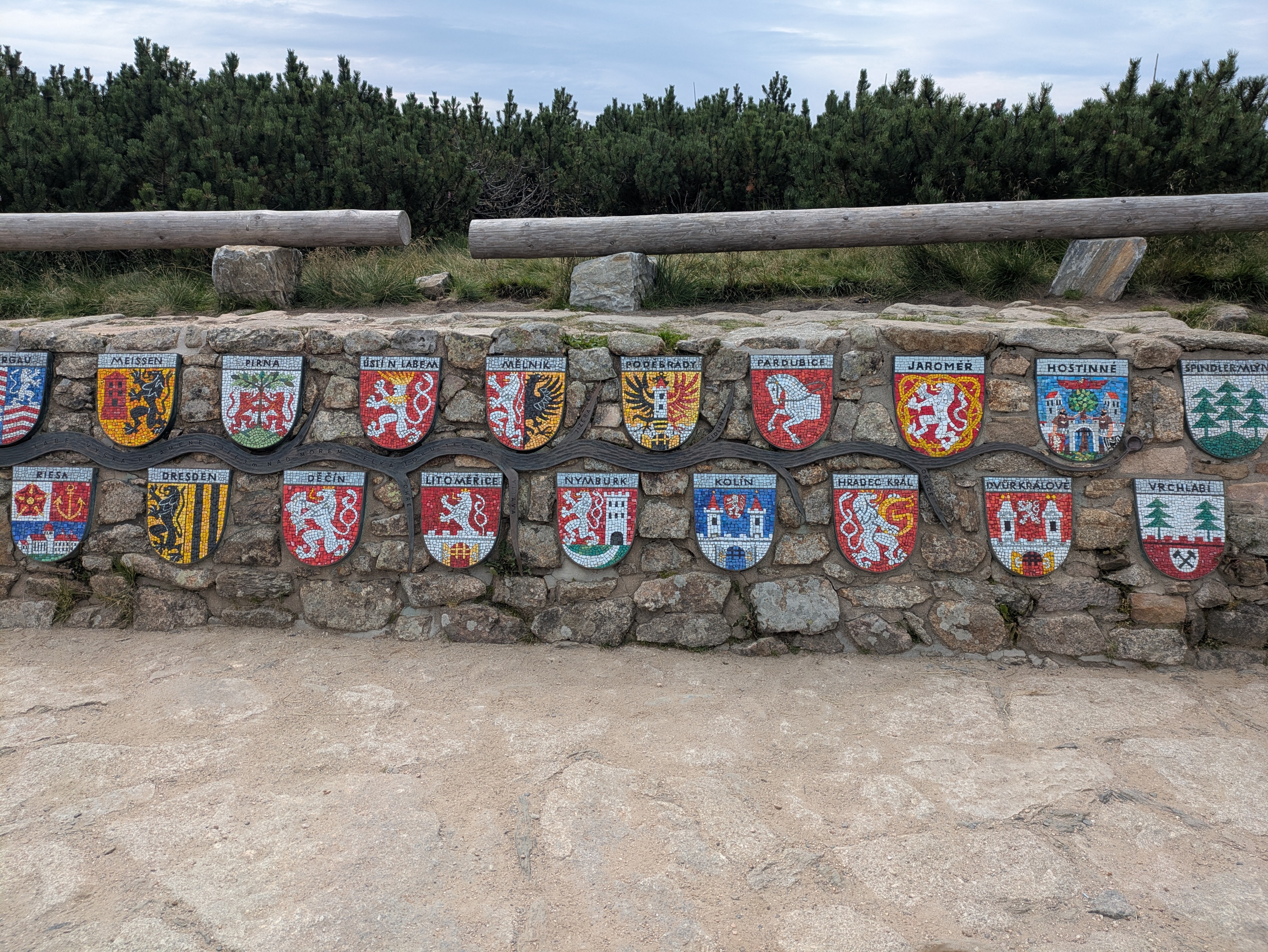
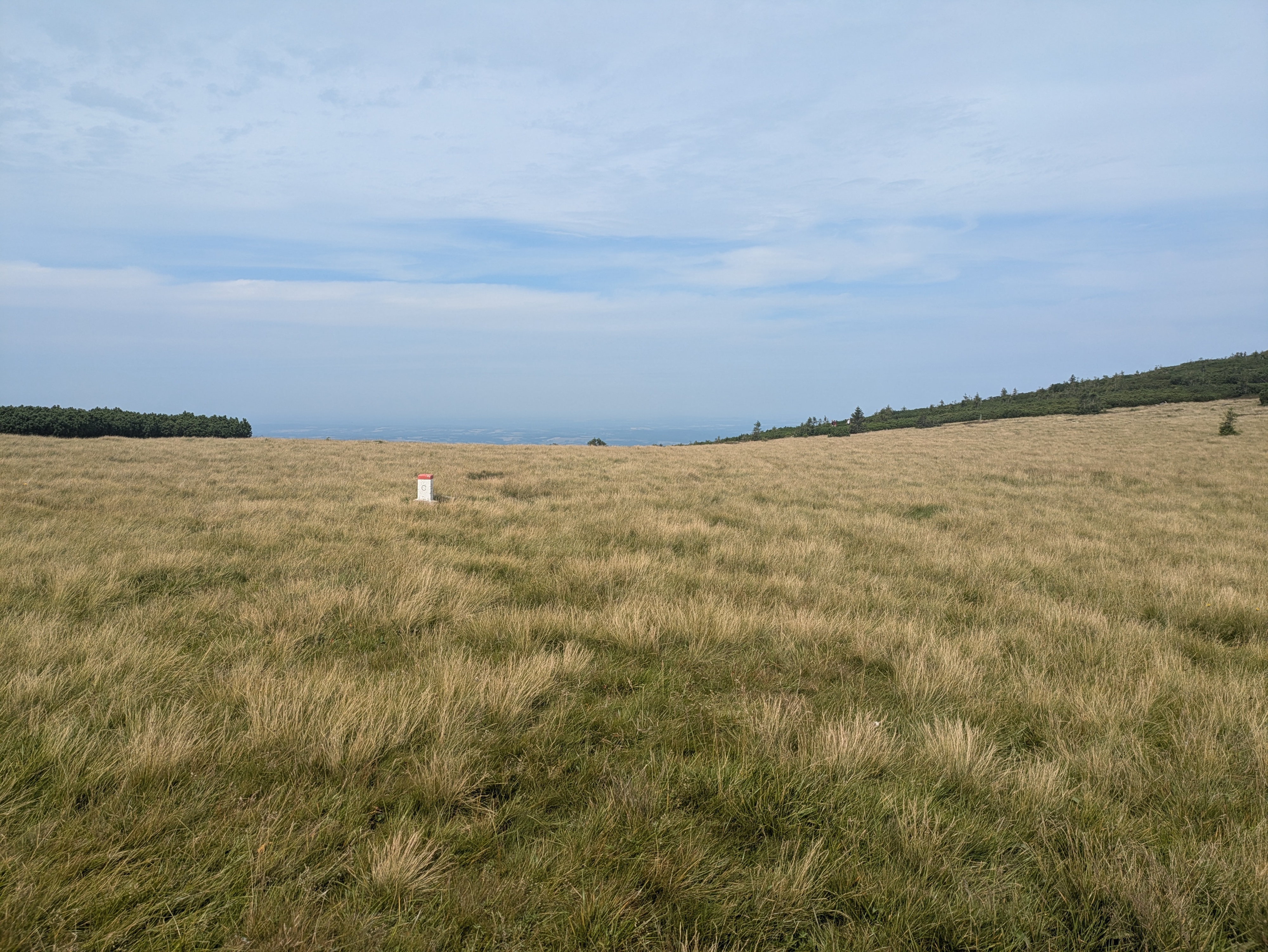
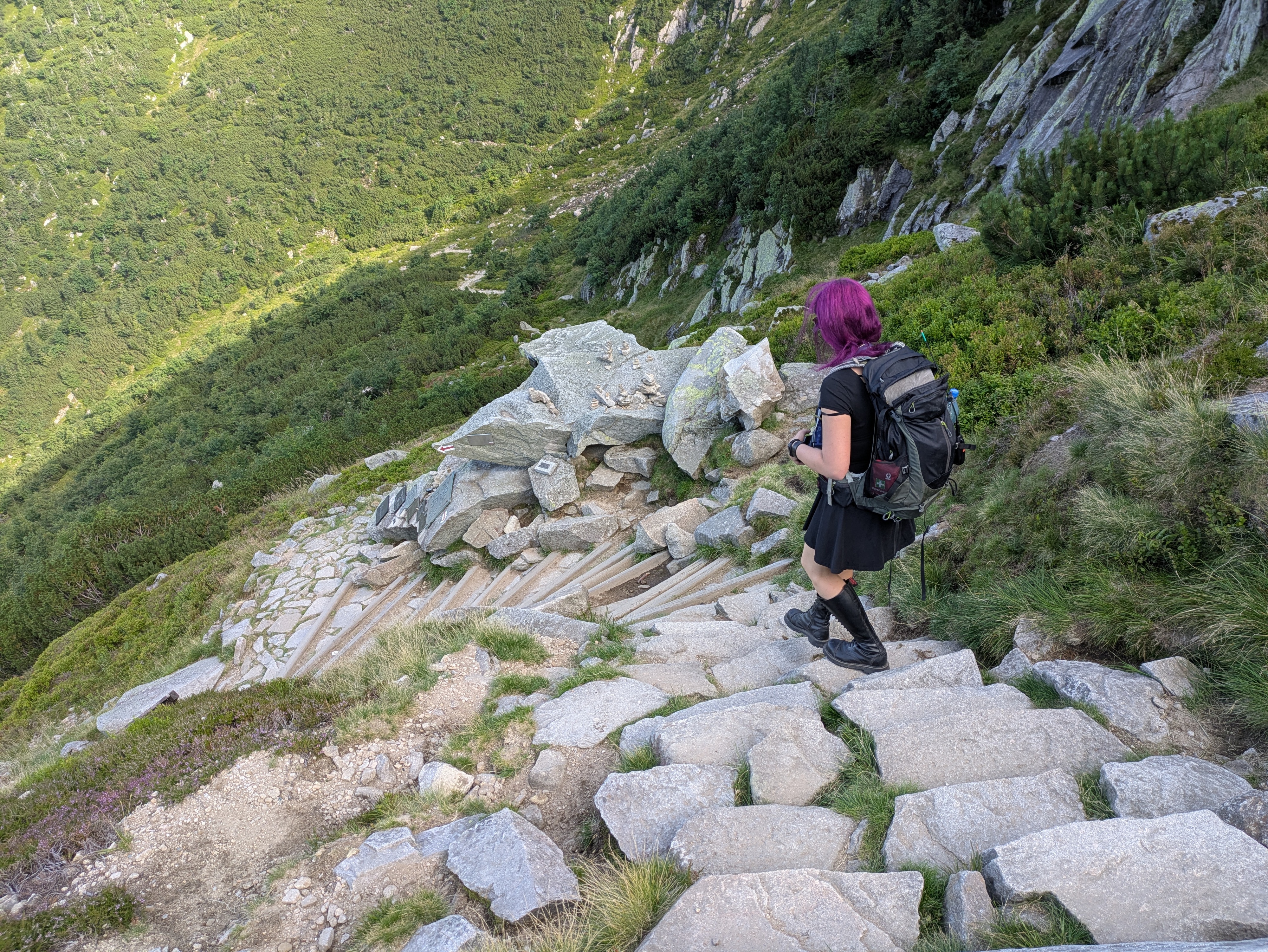
Pramen Labe was pretty crowded, so we didn't stay for too long (13:30 to 14:00 or so). The spring itself is your typical ordinary spring, augmented with a nice list of some of the towns and cities it passes before it finally flows into the North Sea. It's located on a relatively large plateau, so from the spring itself, you don't have that much of a view into the surrounding mountain- or countryside.
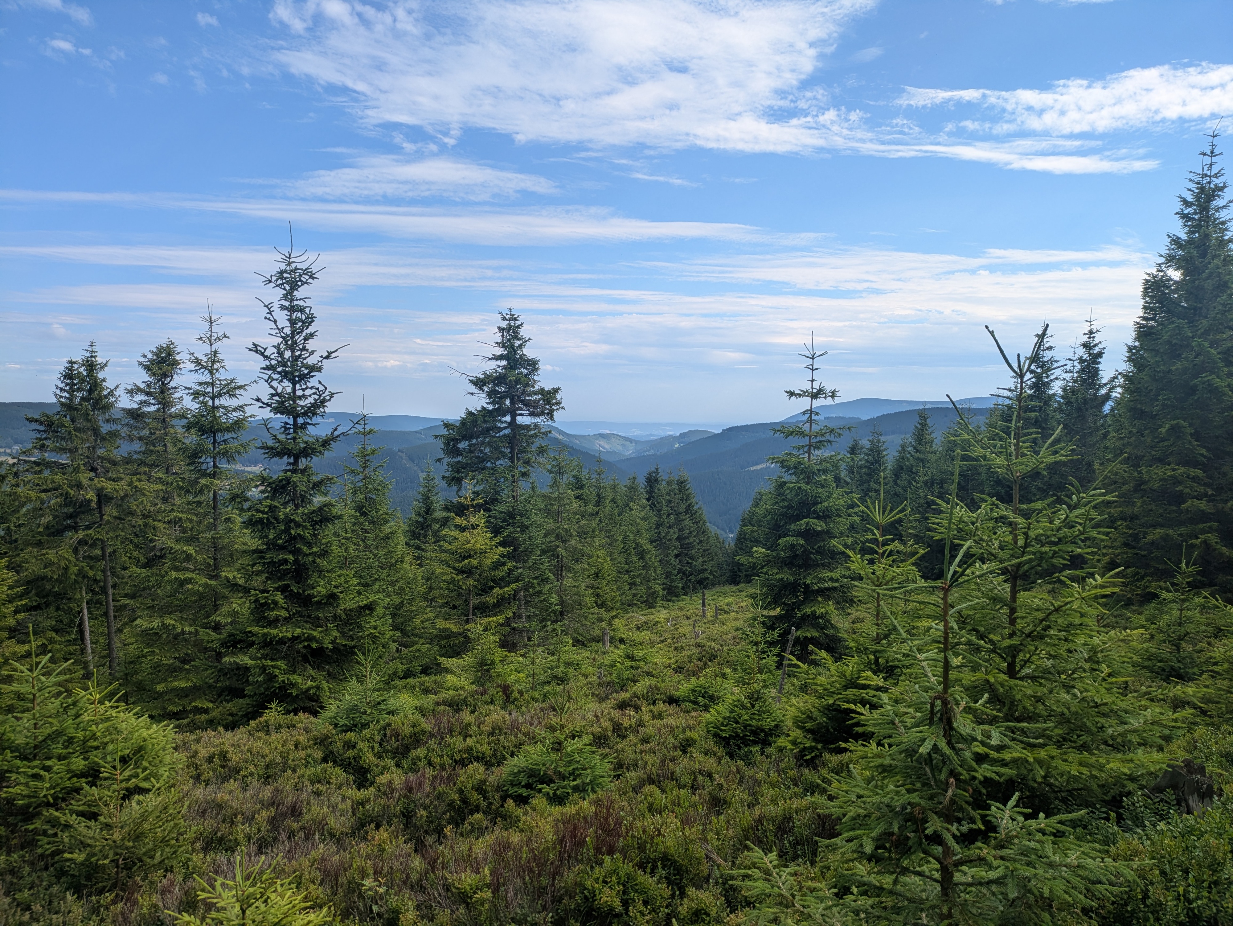
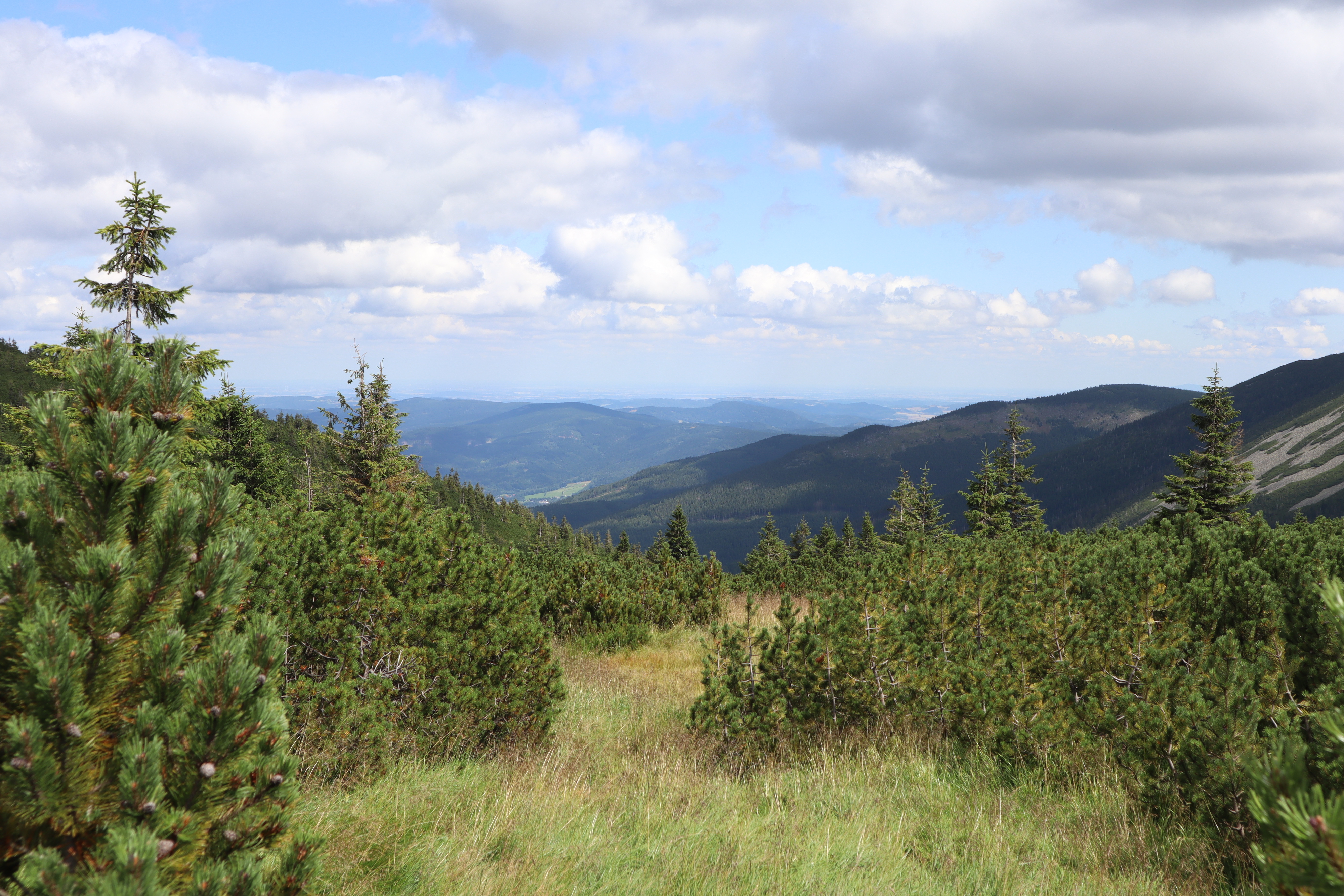
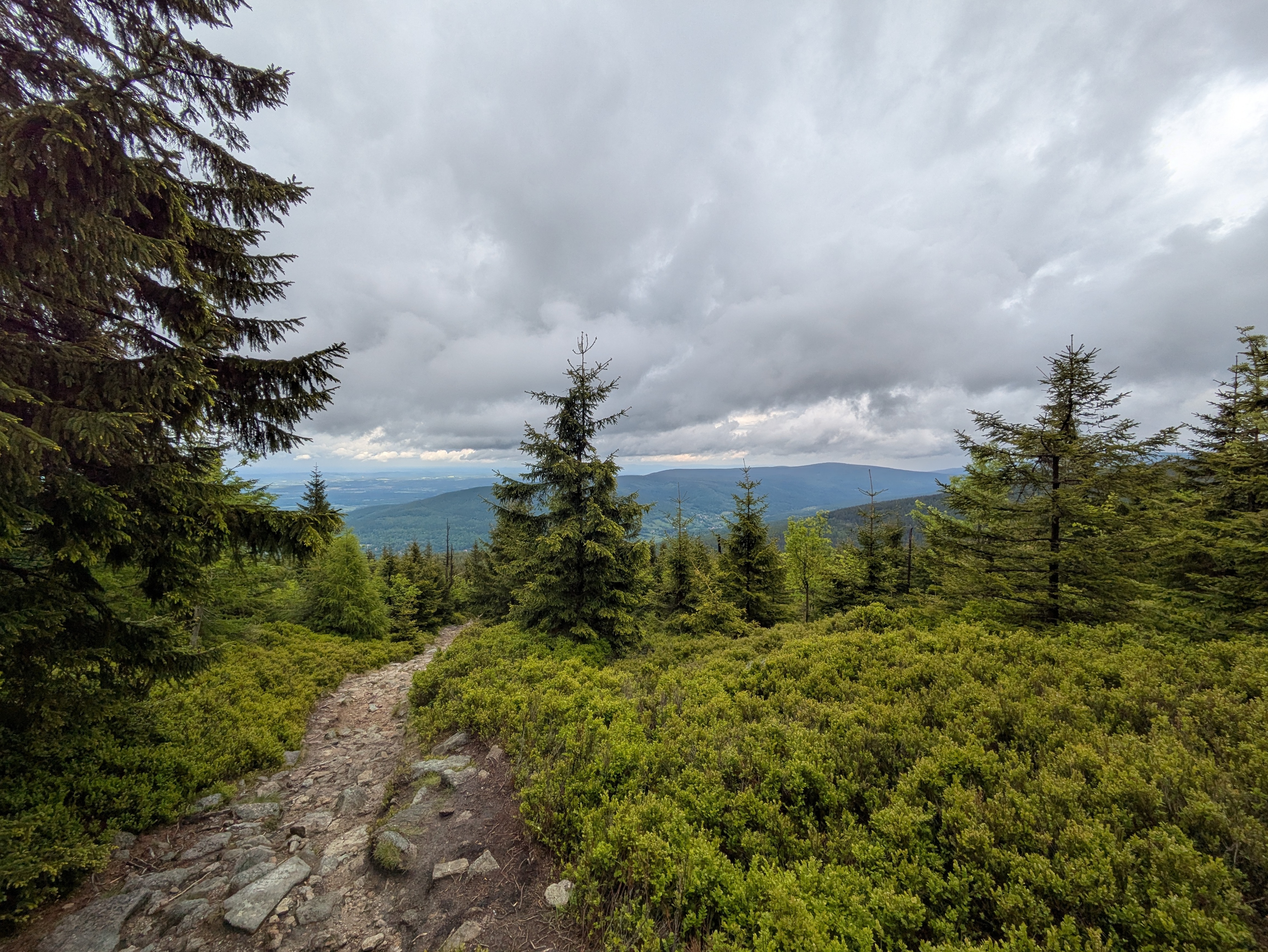
The Ridge
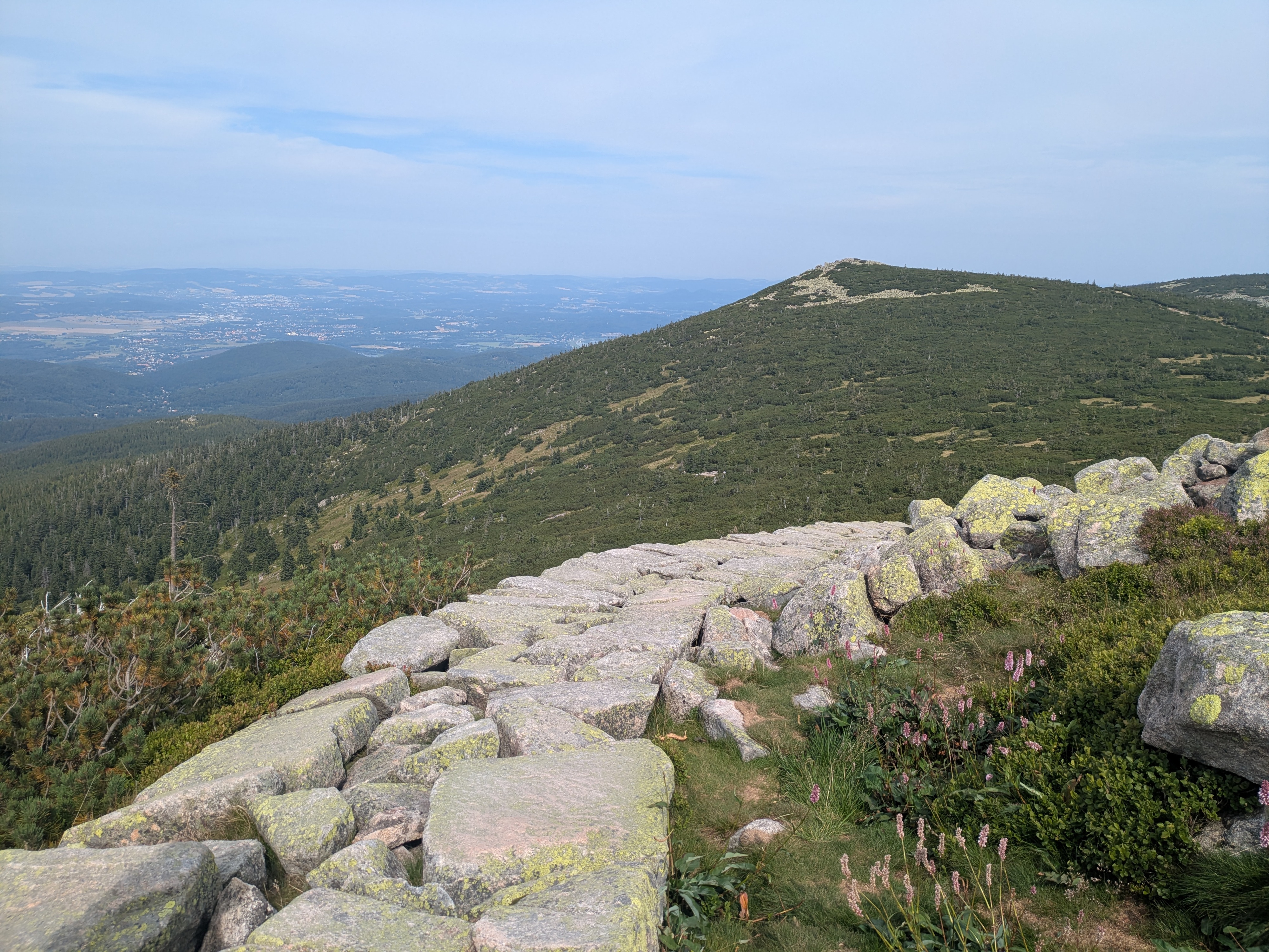
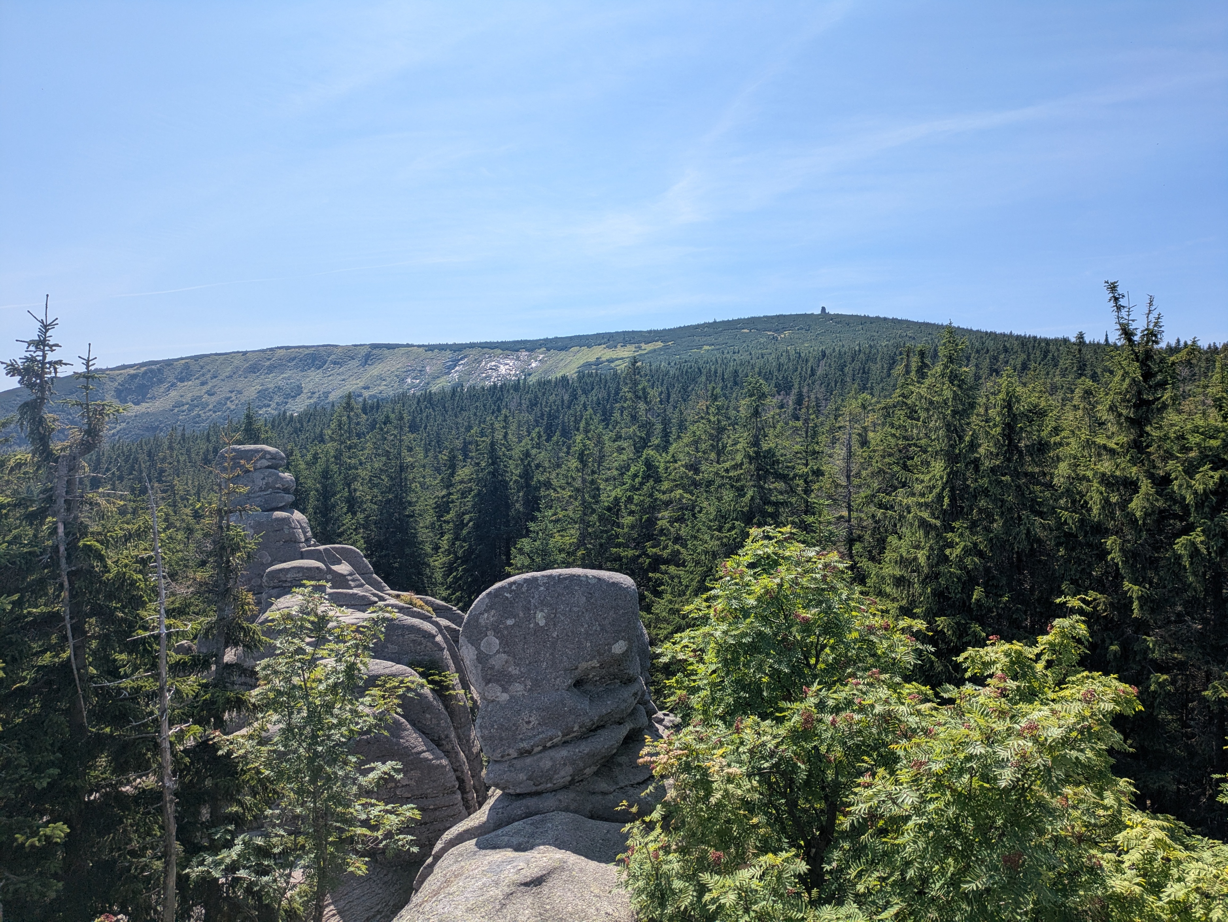
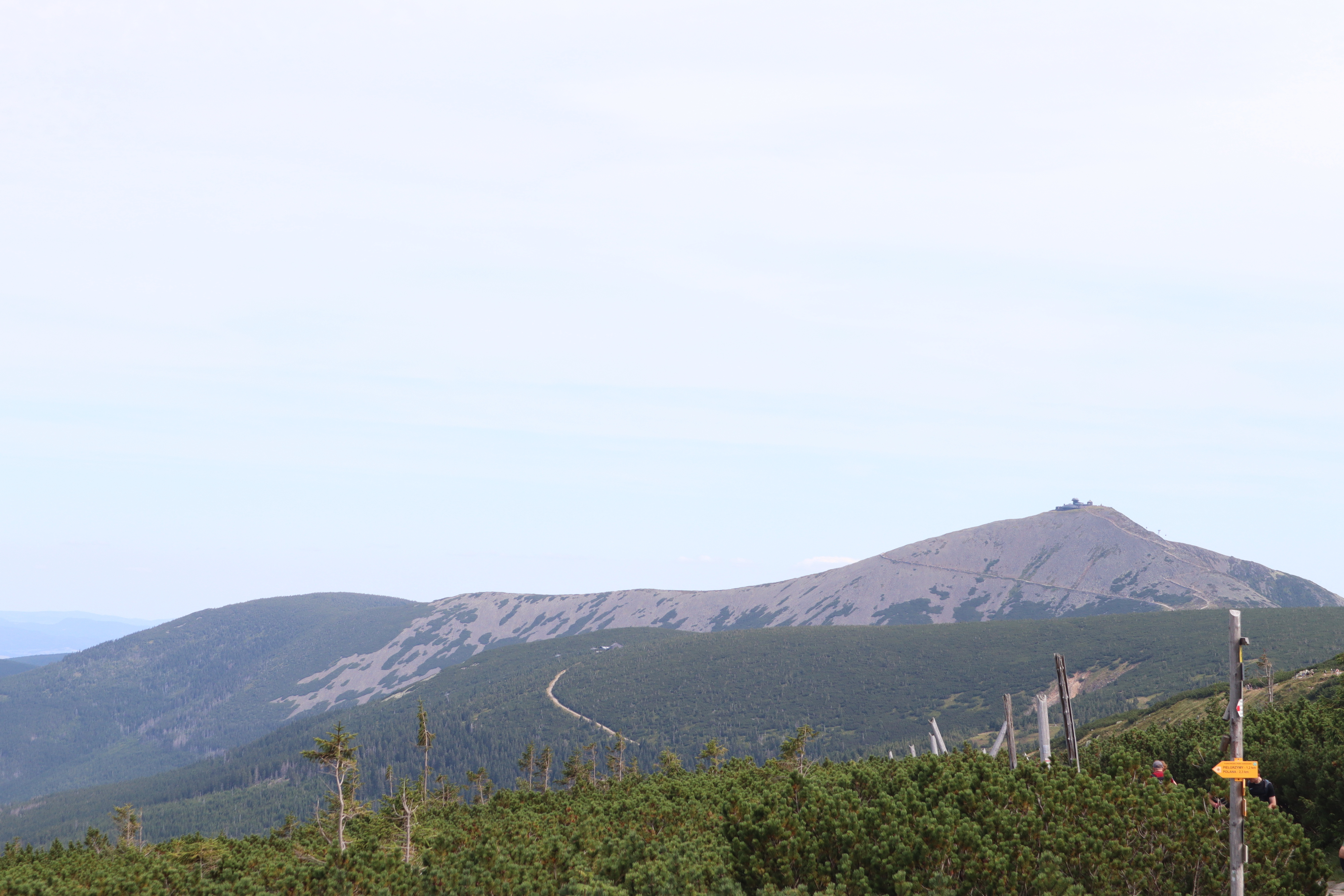
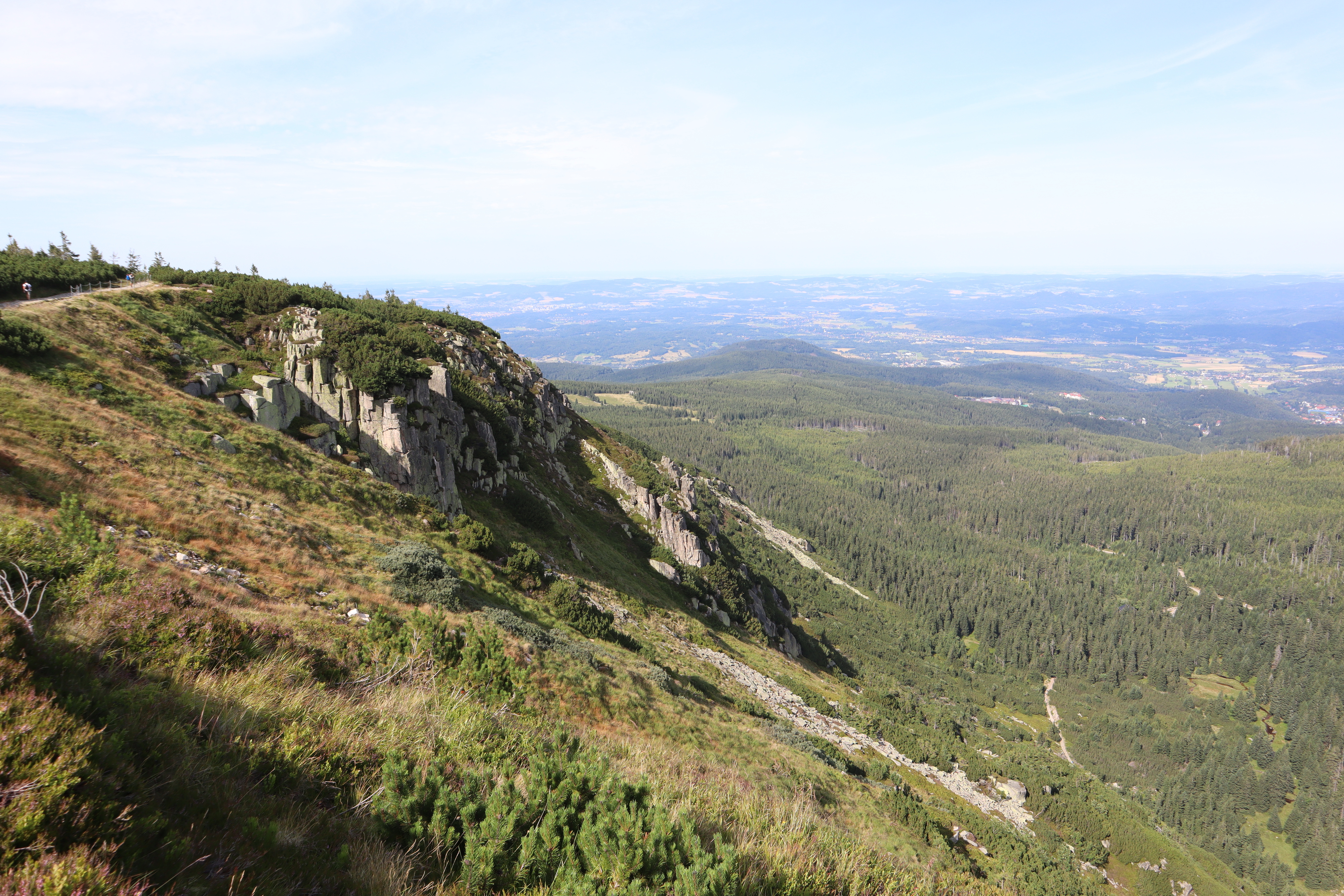
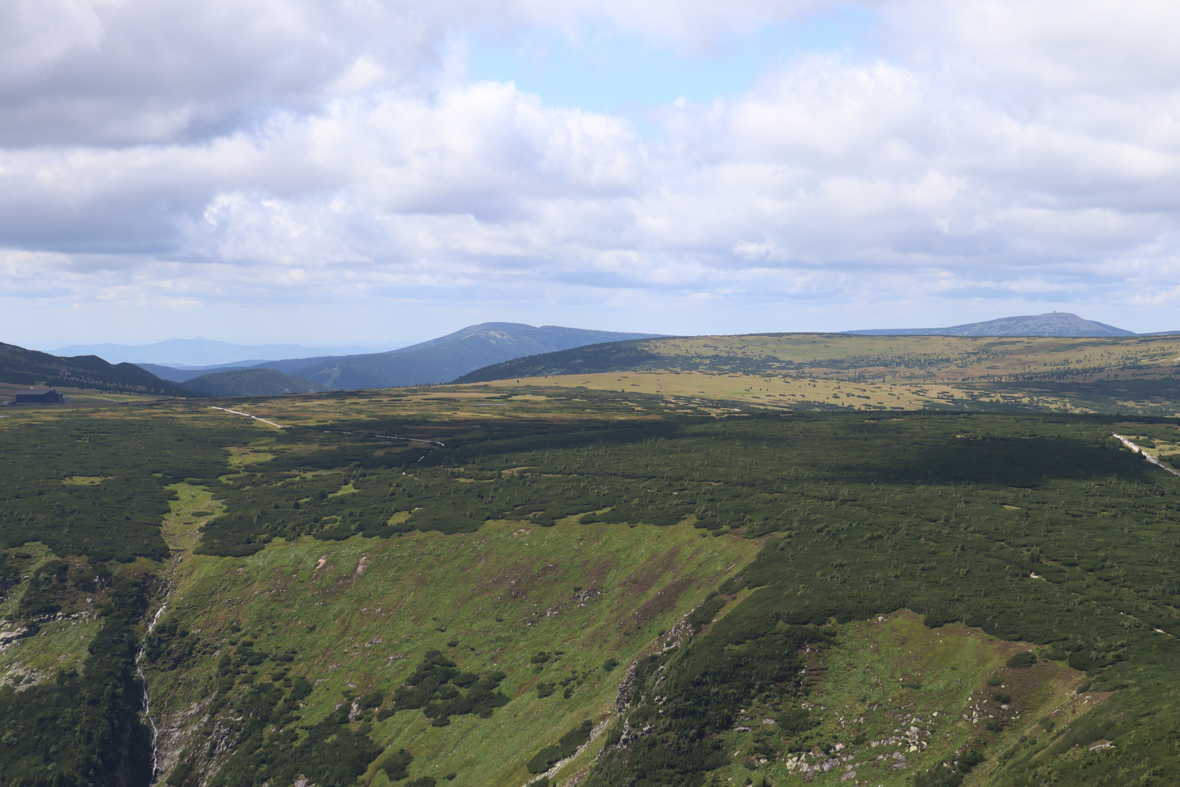
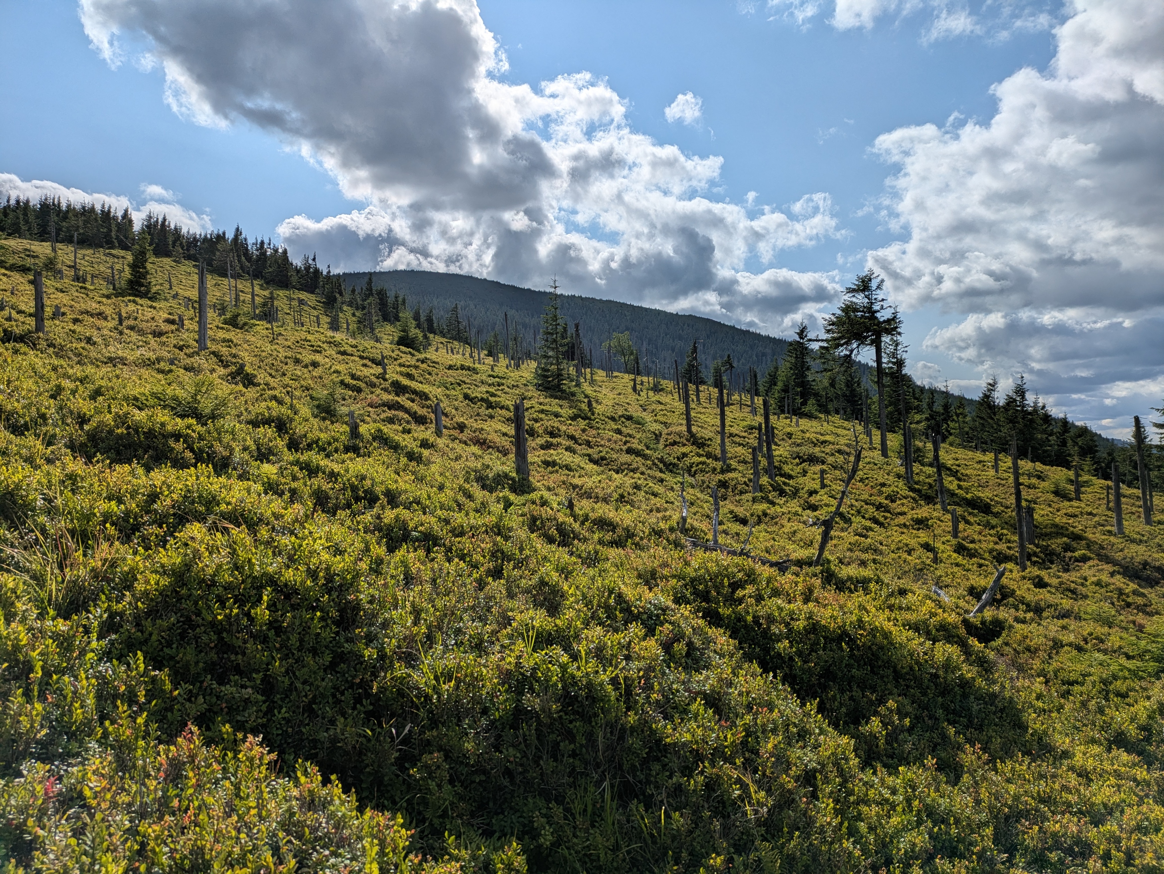
The first peak we passed was Violik / Łabski Szczyt (Veilchenstein / violet peak). Apparently, its granite rock is slowly ground down by freezing water, leading to its slightly unnatural look as if someone had used a large shovel to pile up a heap of stones. It was also home to some prime specimen of some kind of moss, possibly Trentepohlia iolithus (Veilchenmoos) or Psilolechia lucida (Schwefelflechte).
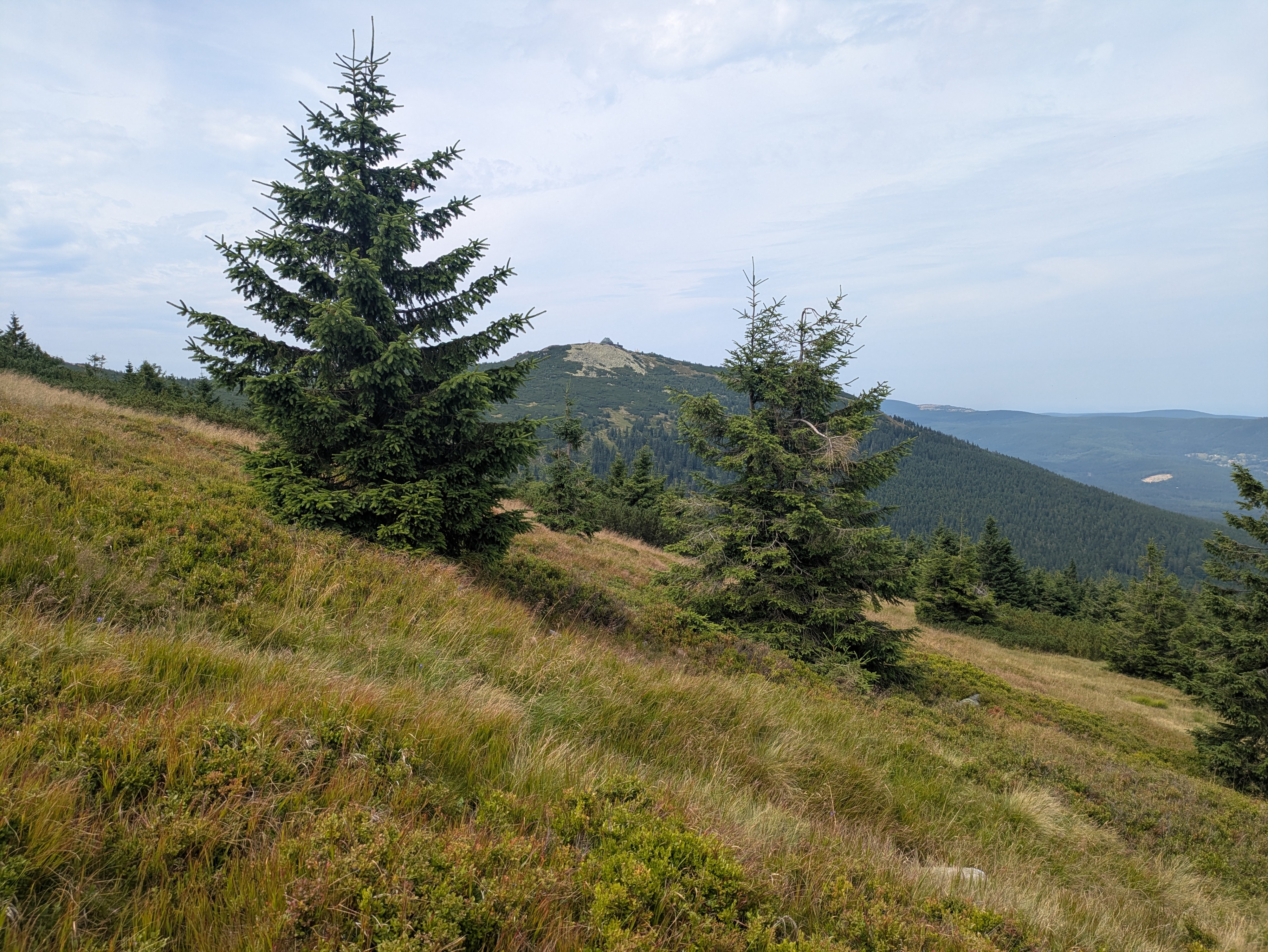
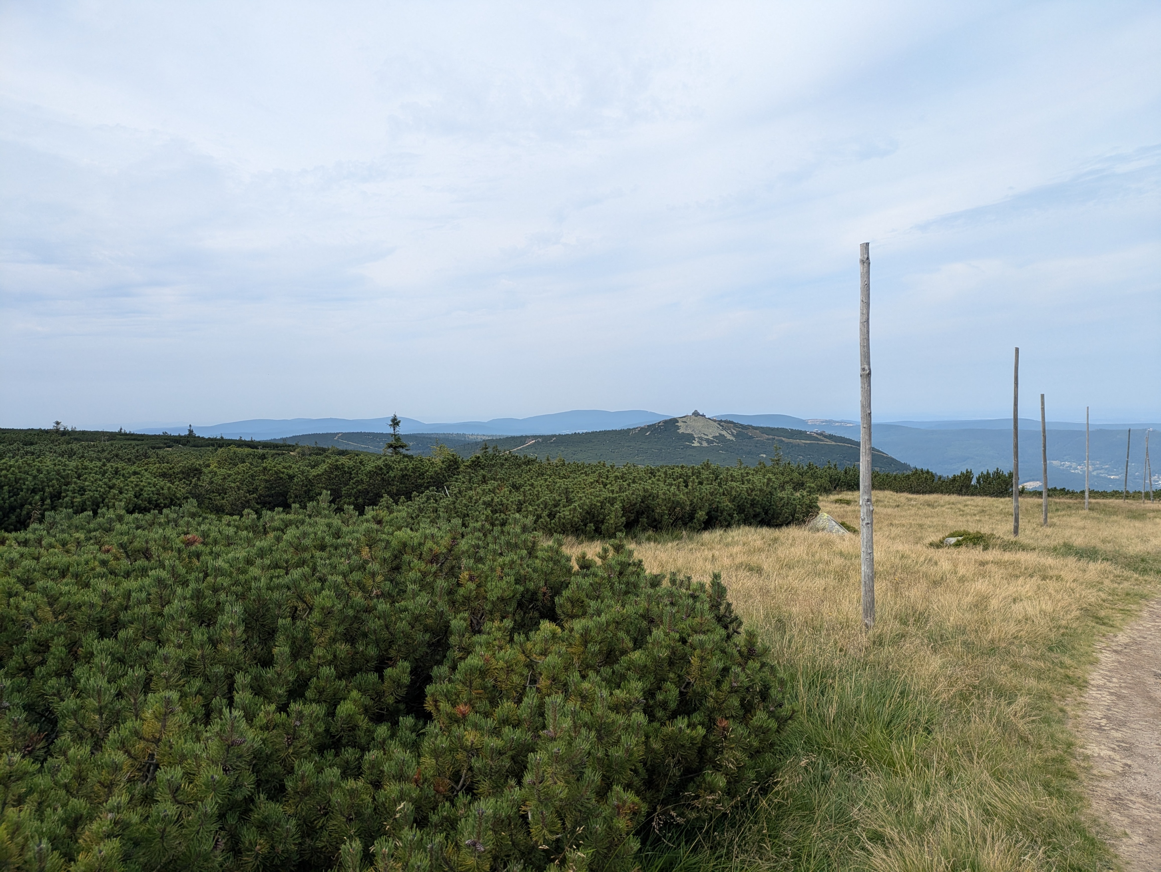
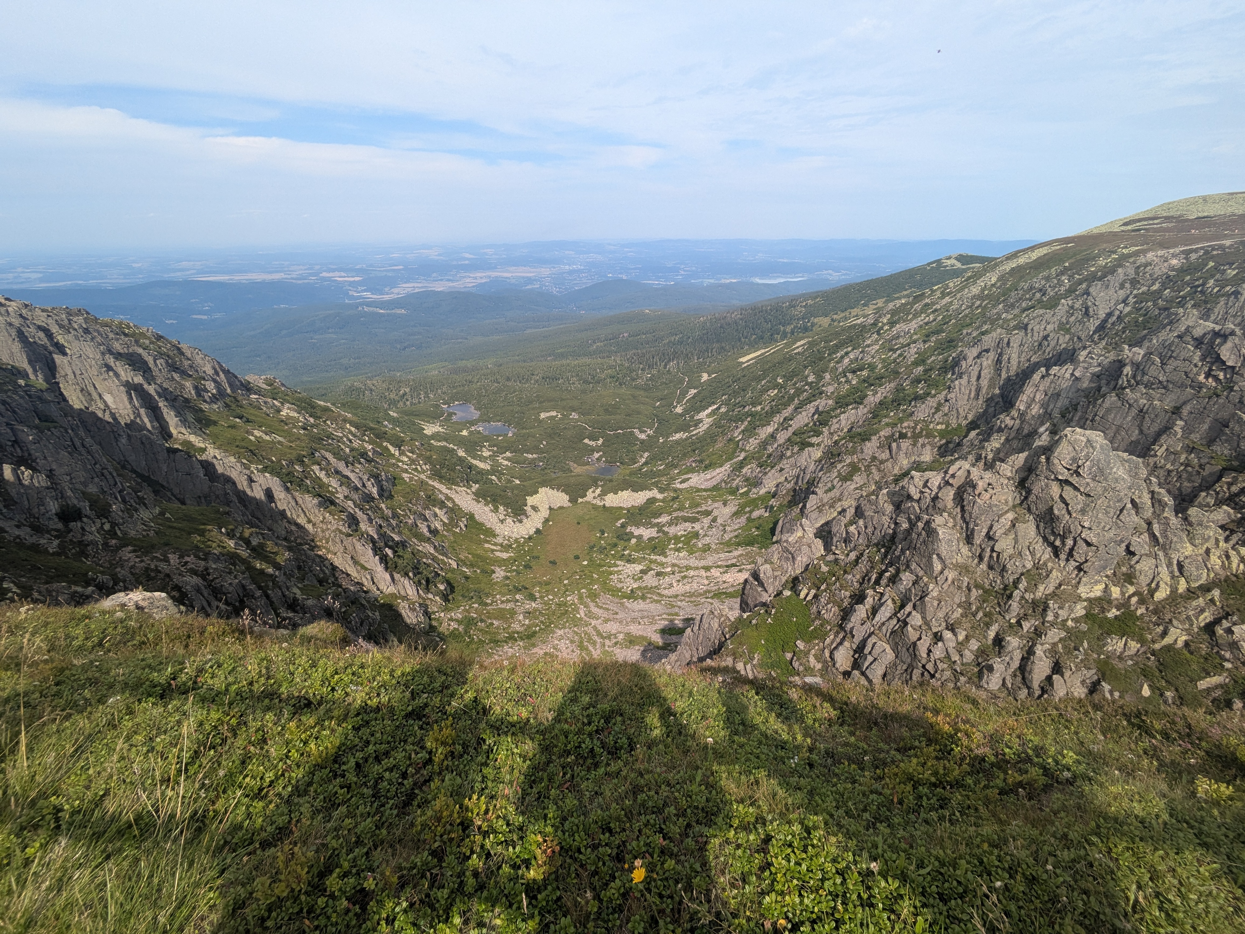
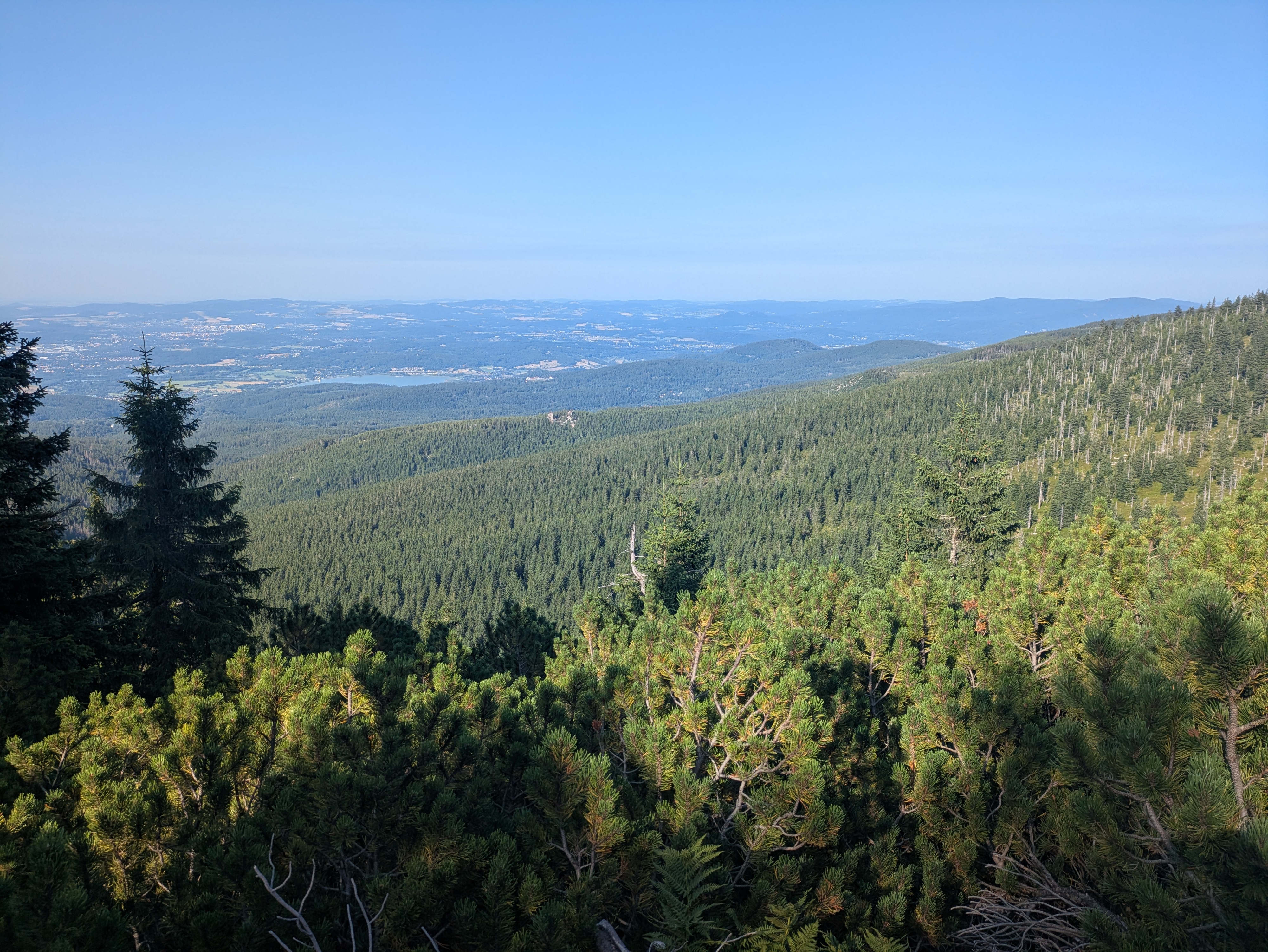
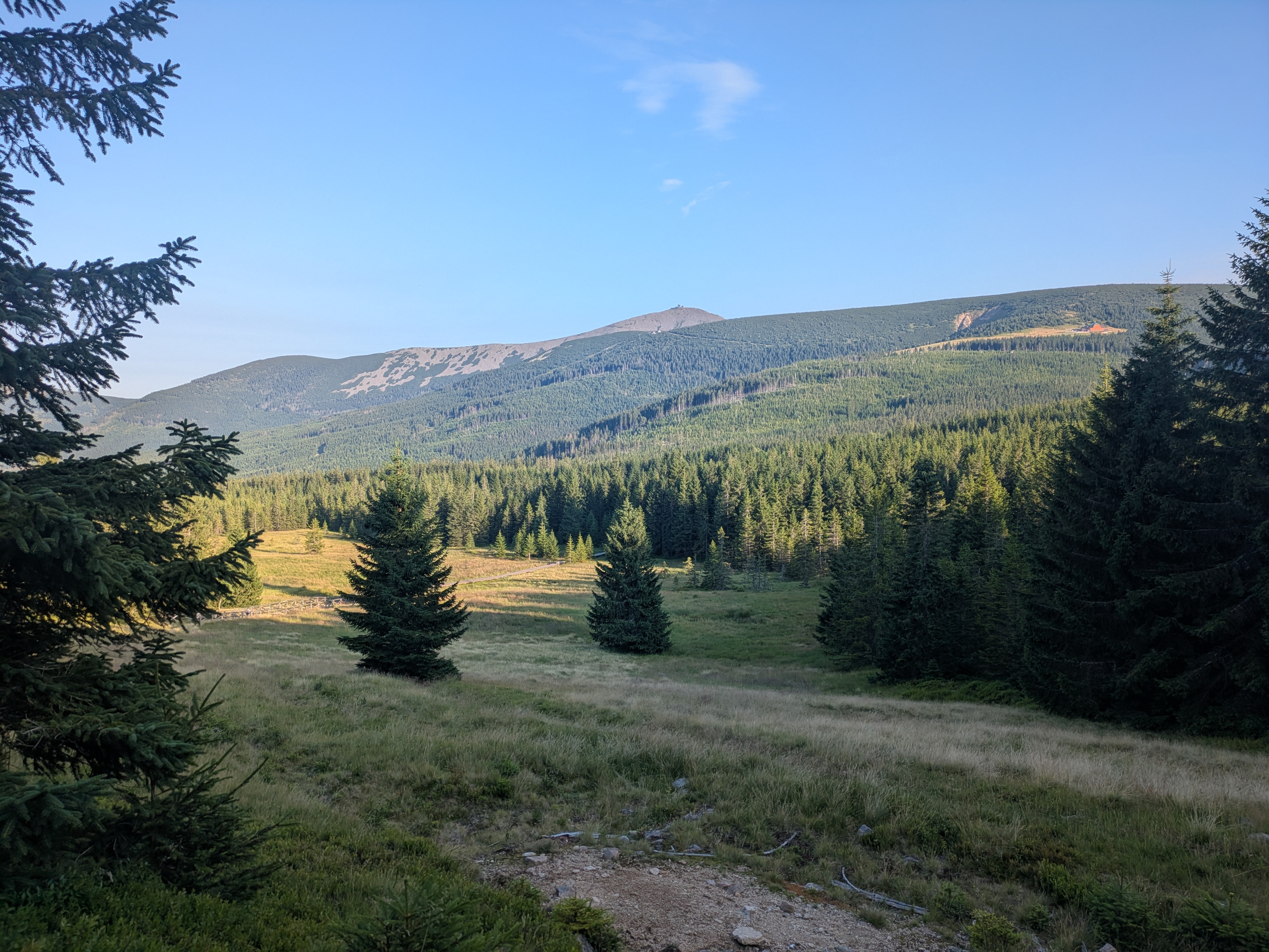
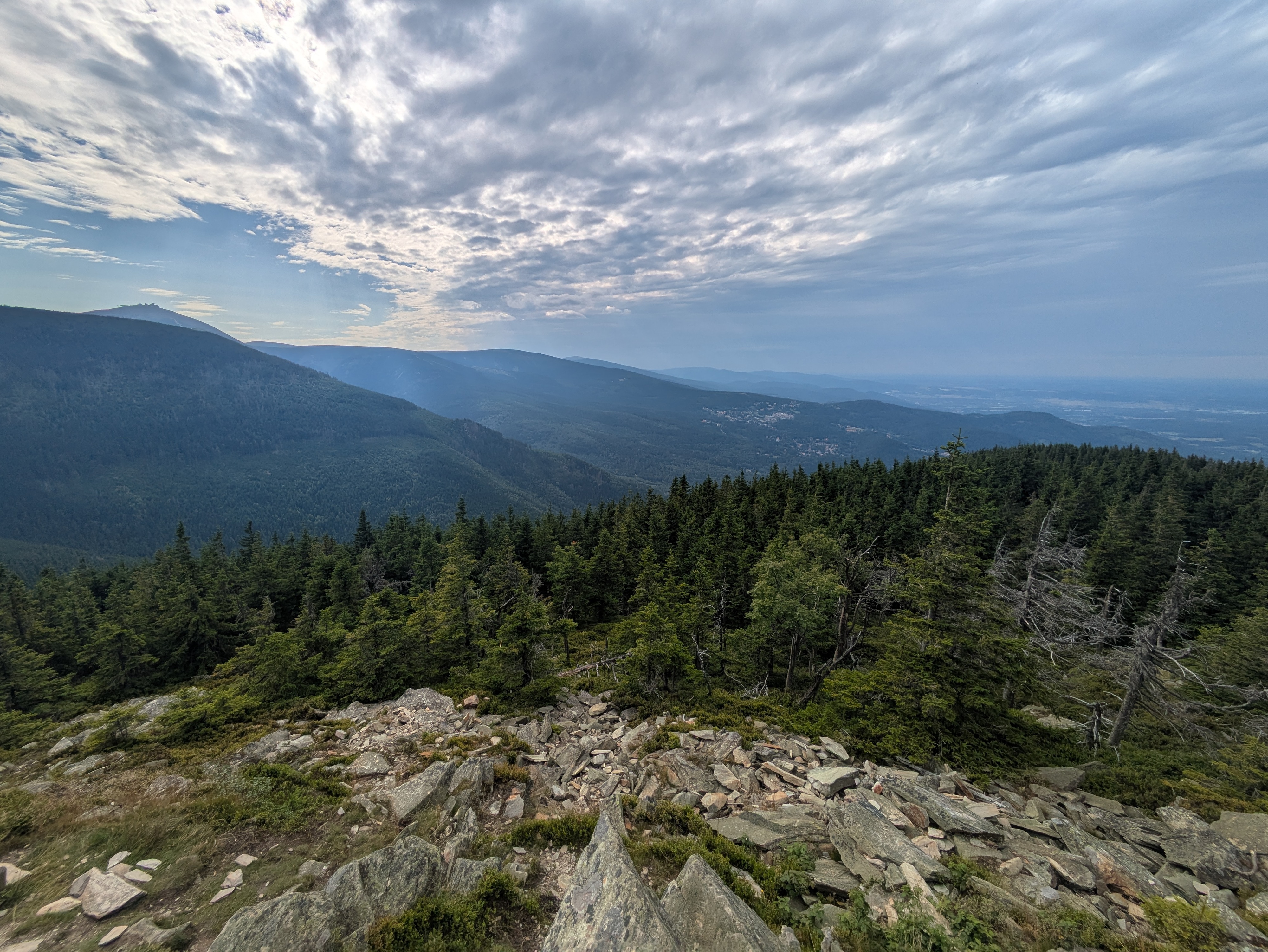
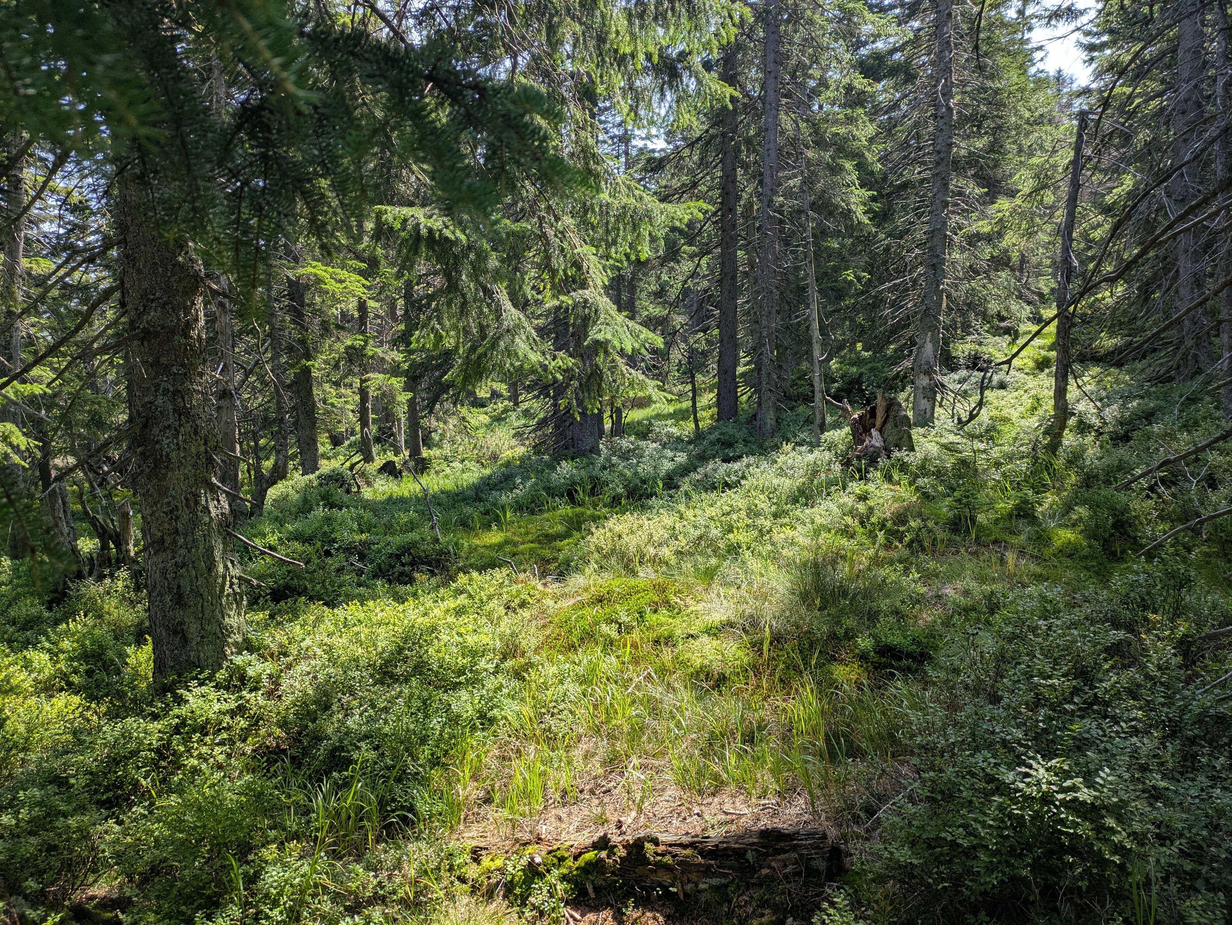
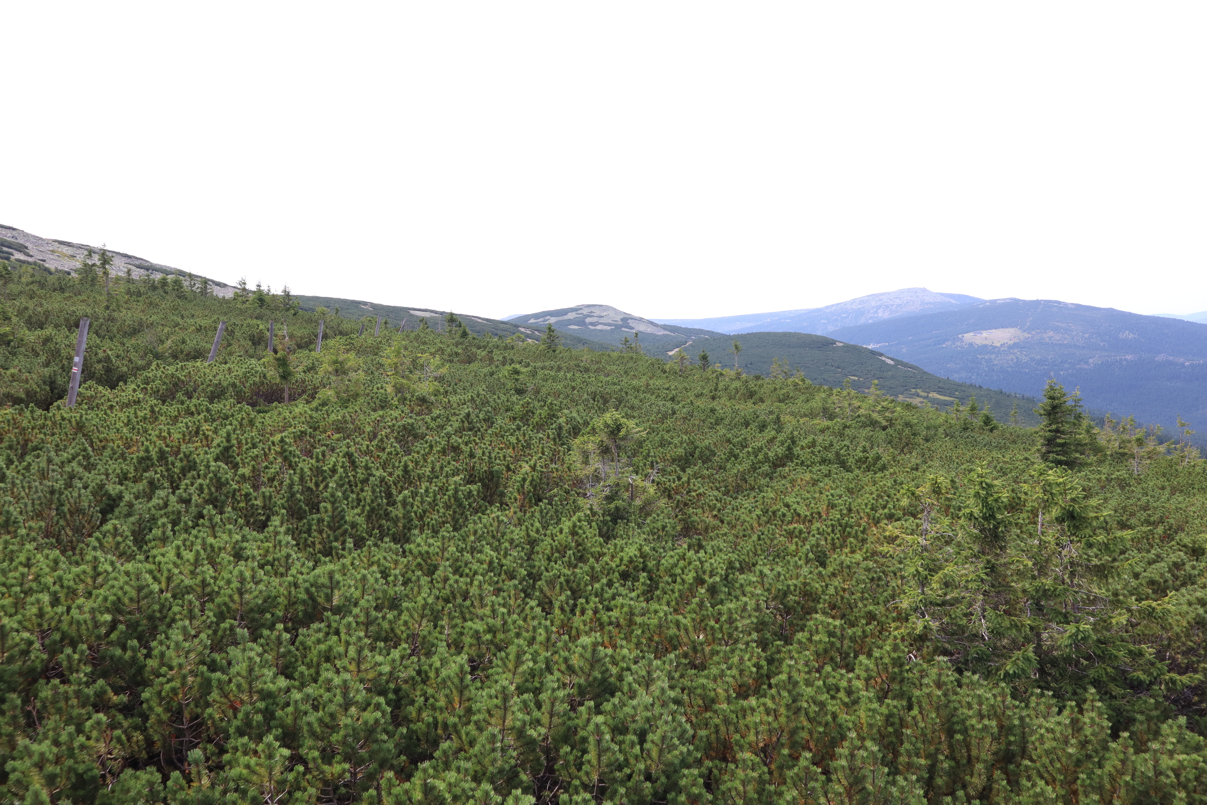
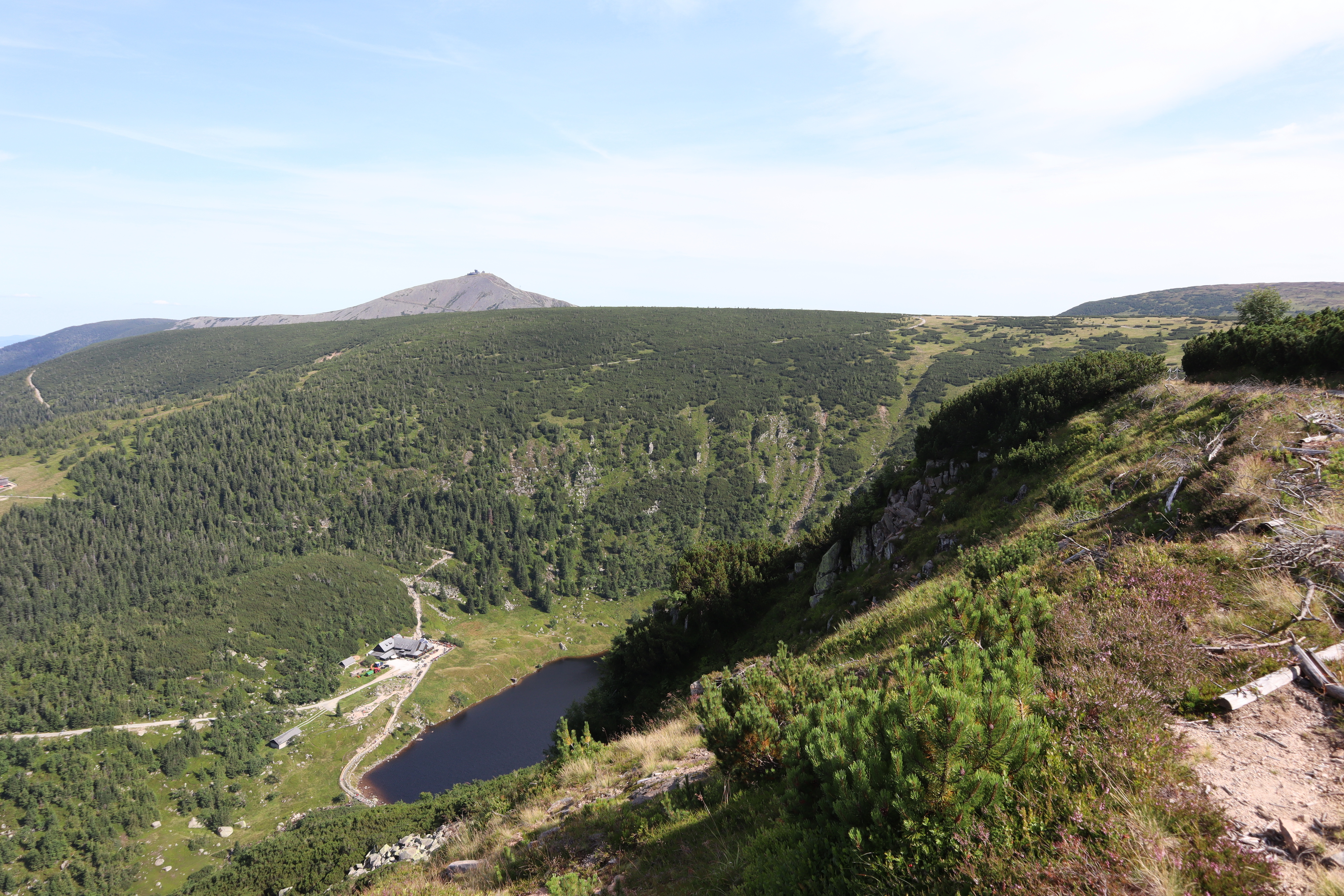
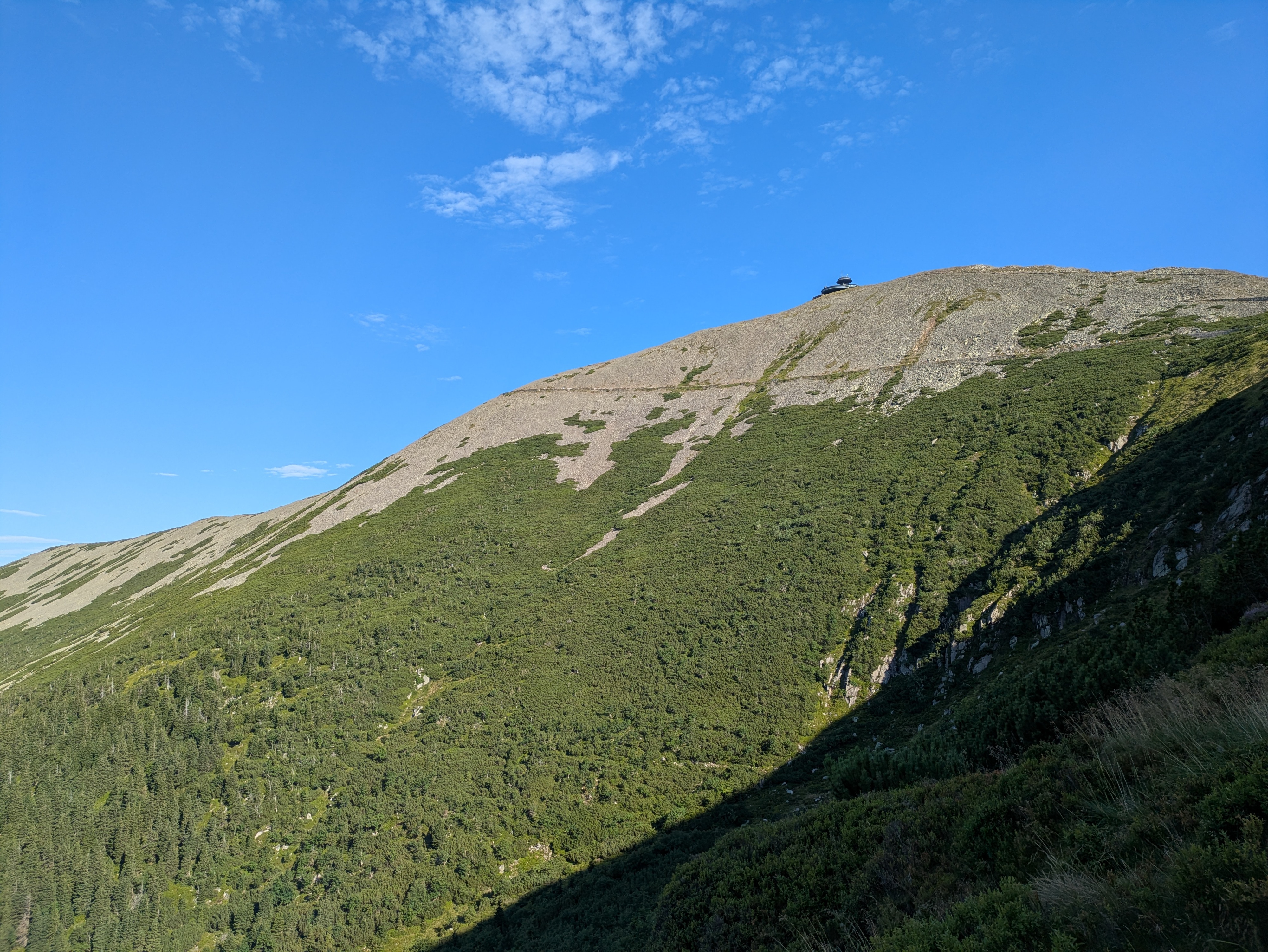
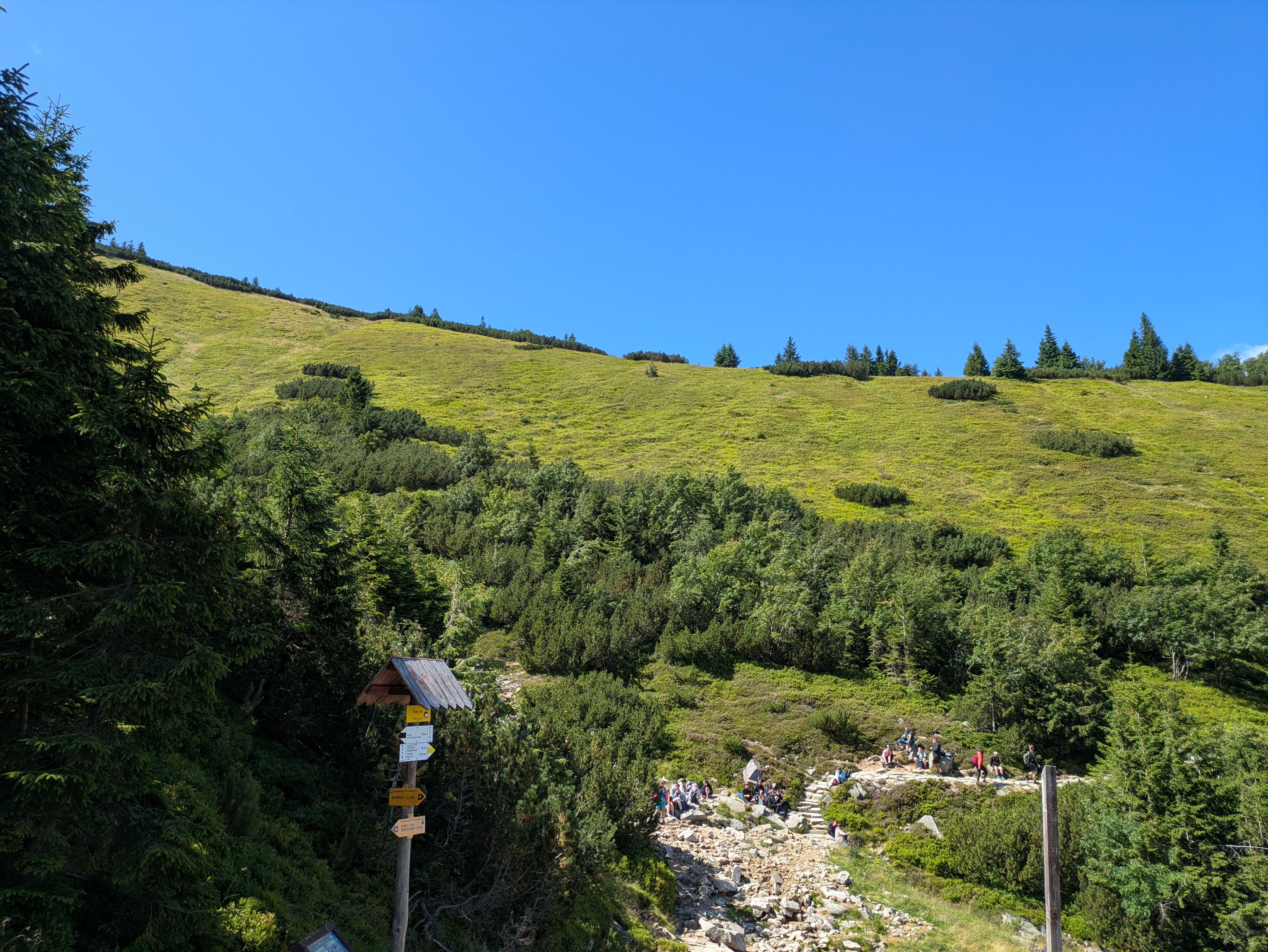
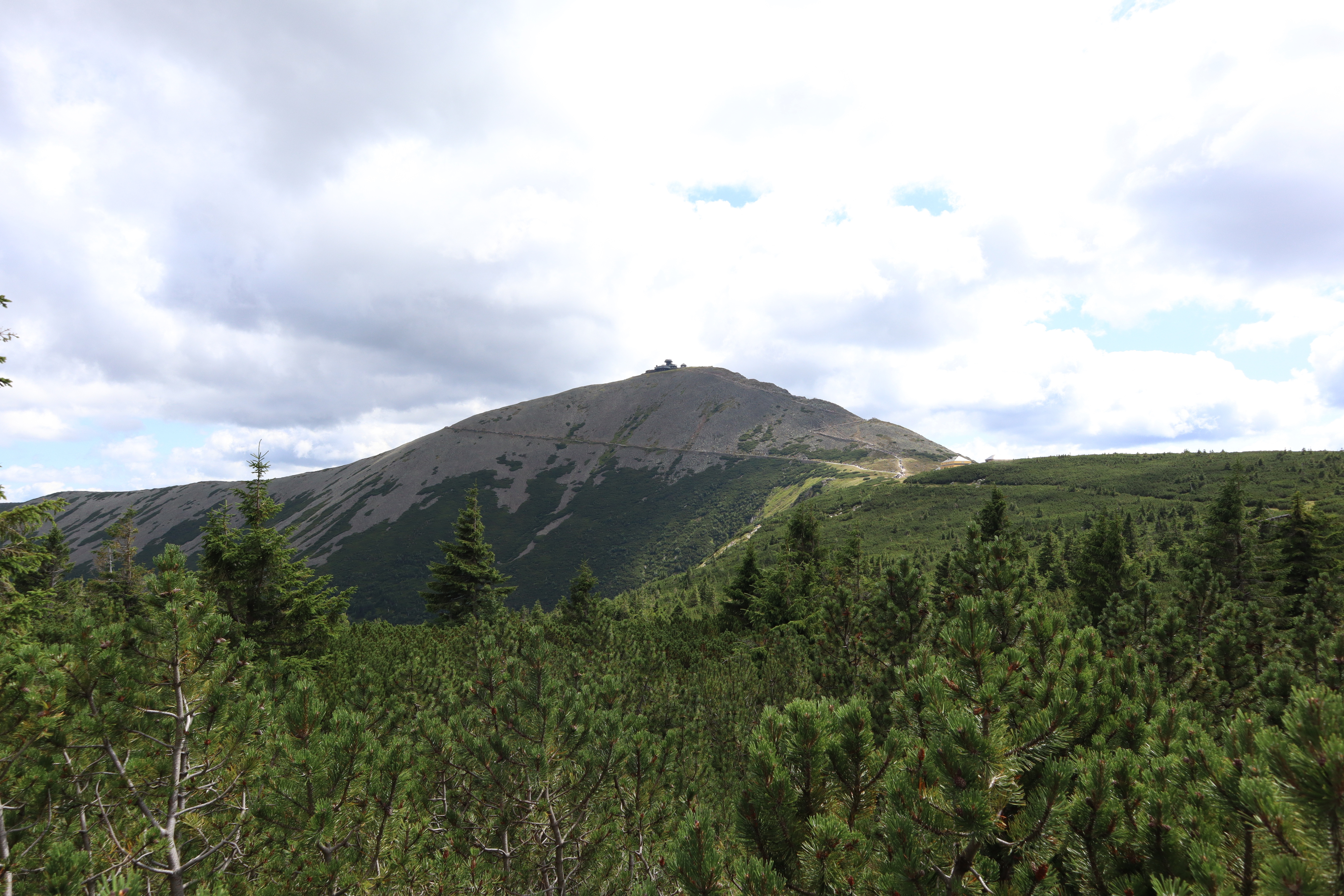
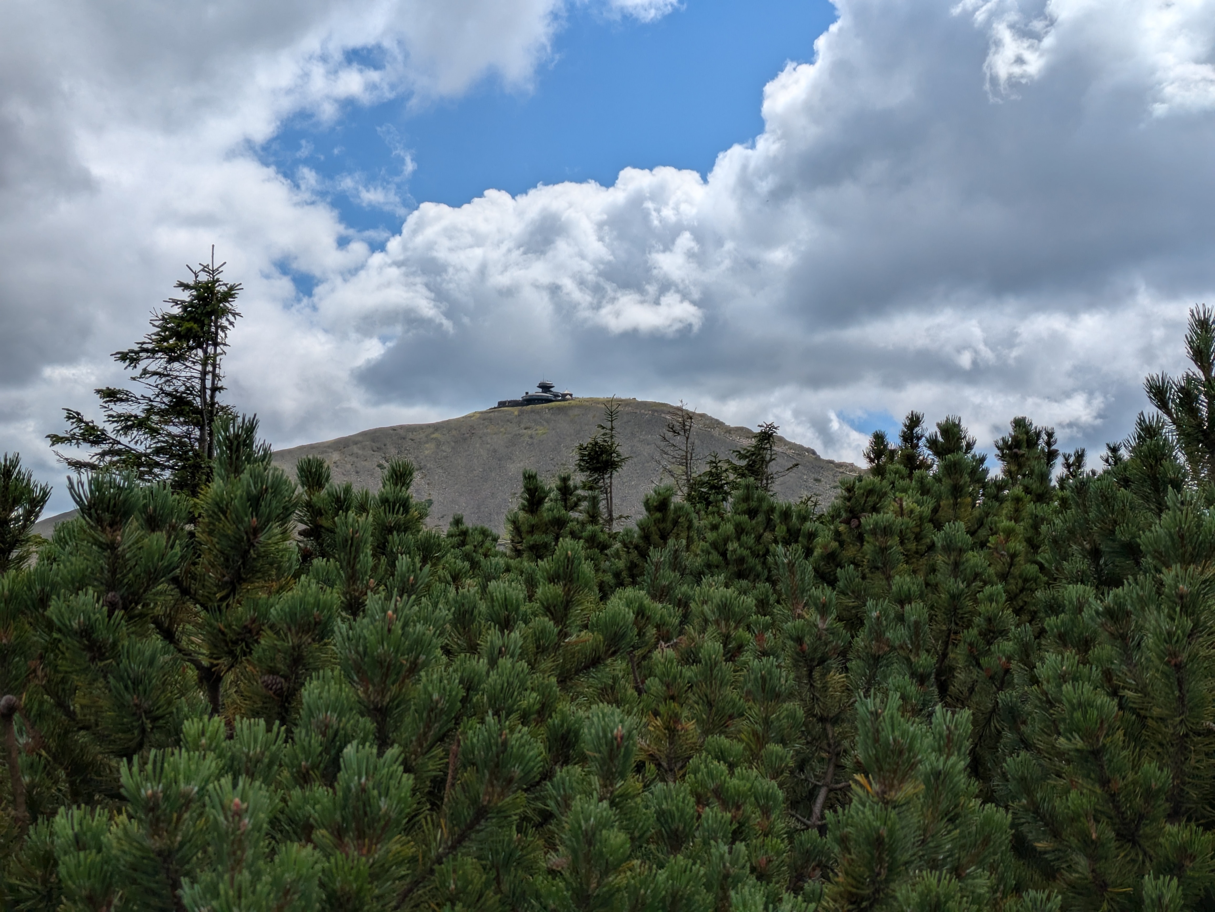
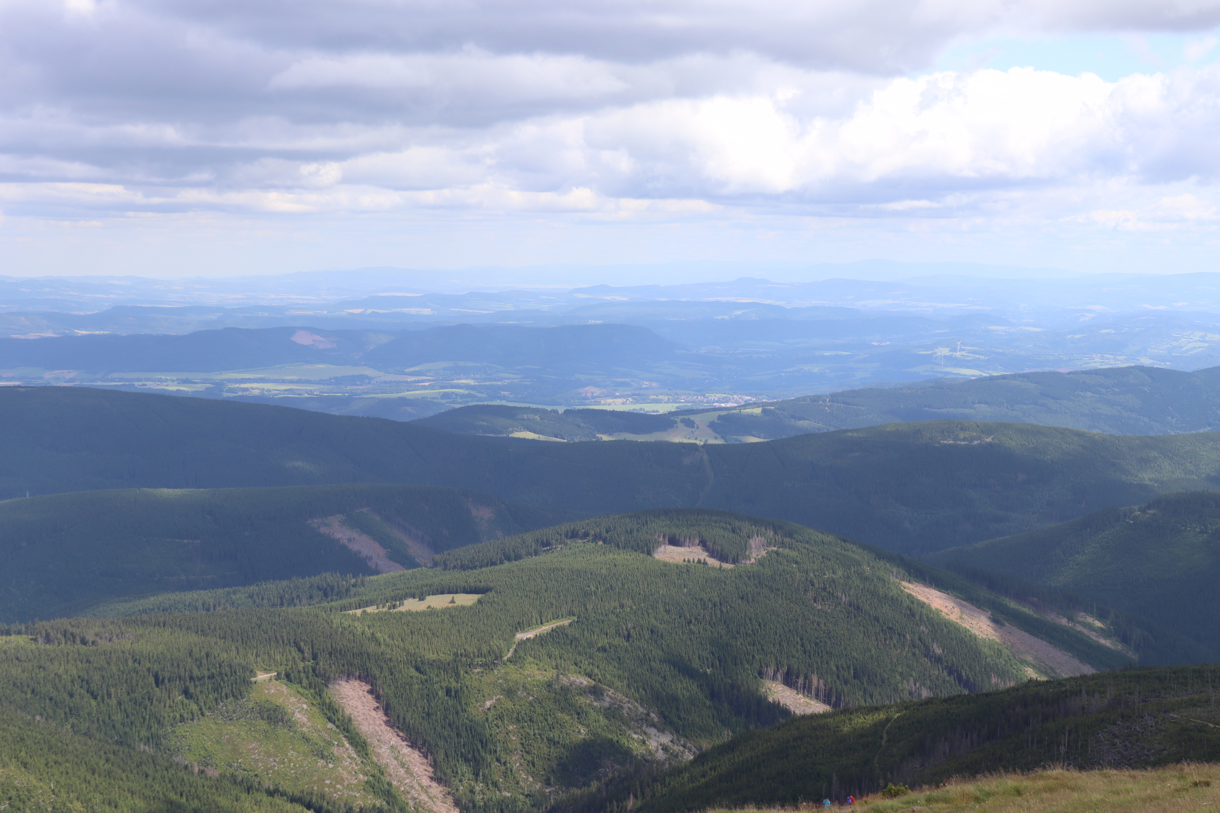
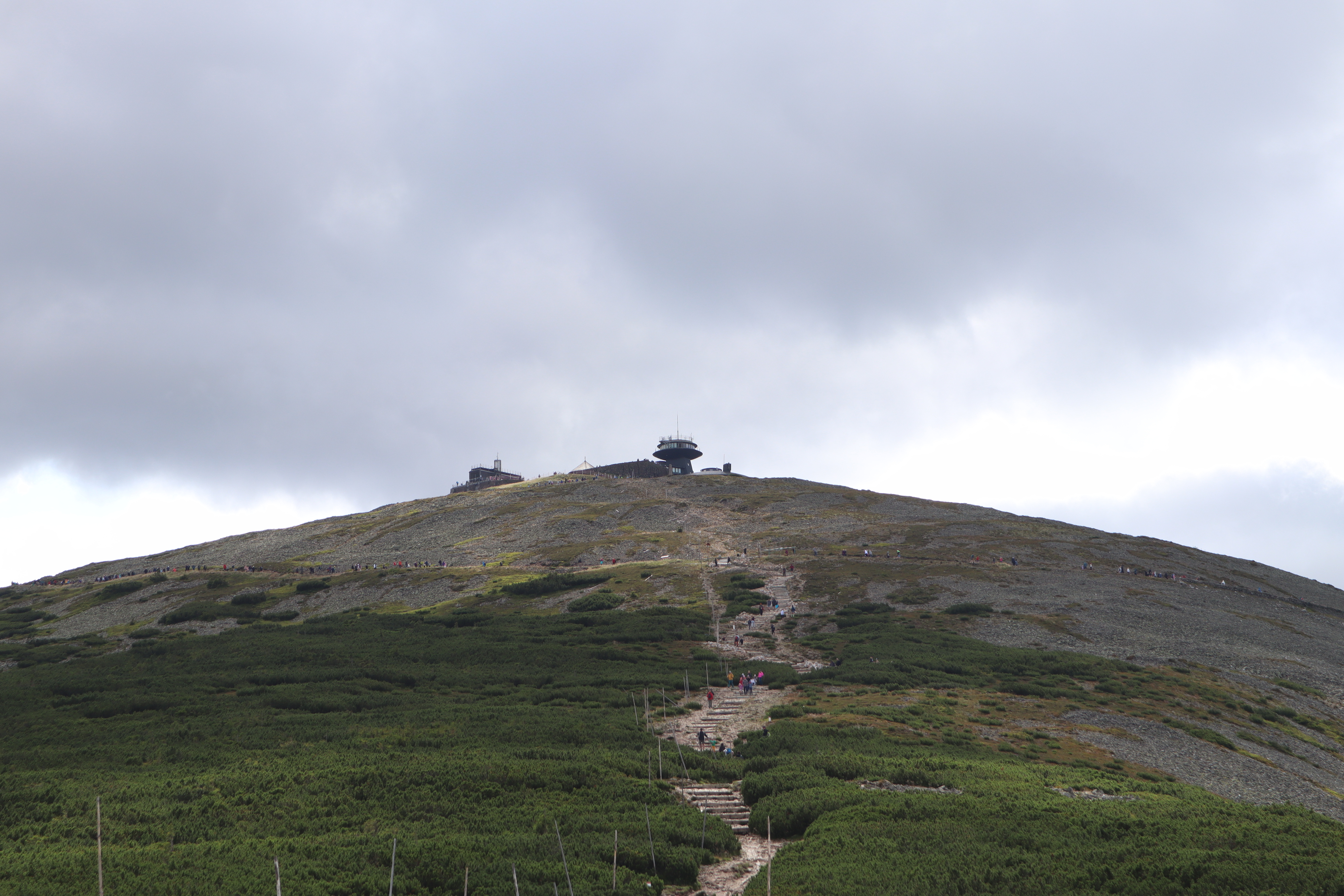
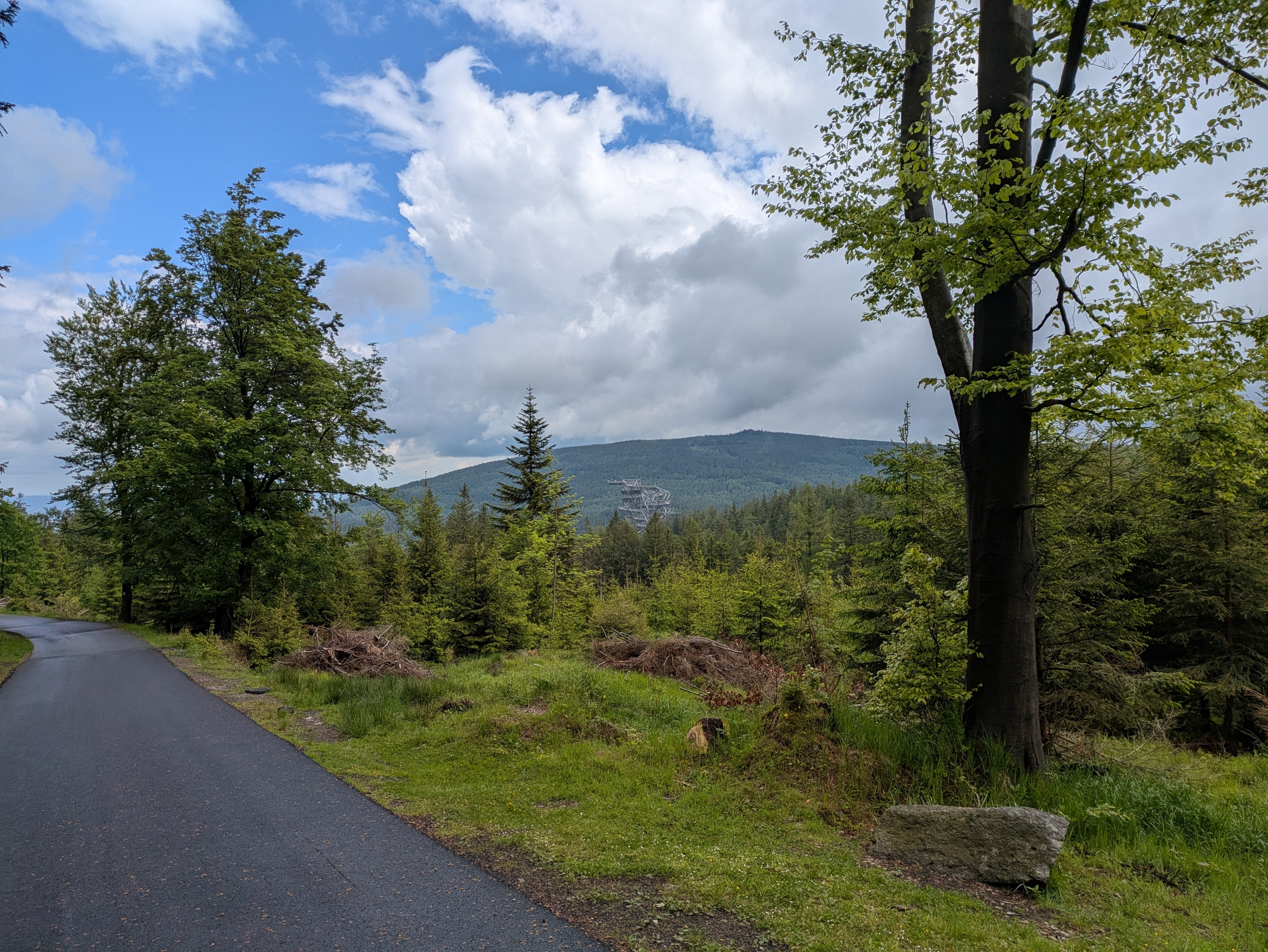
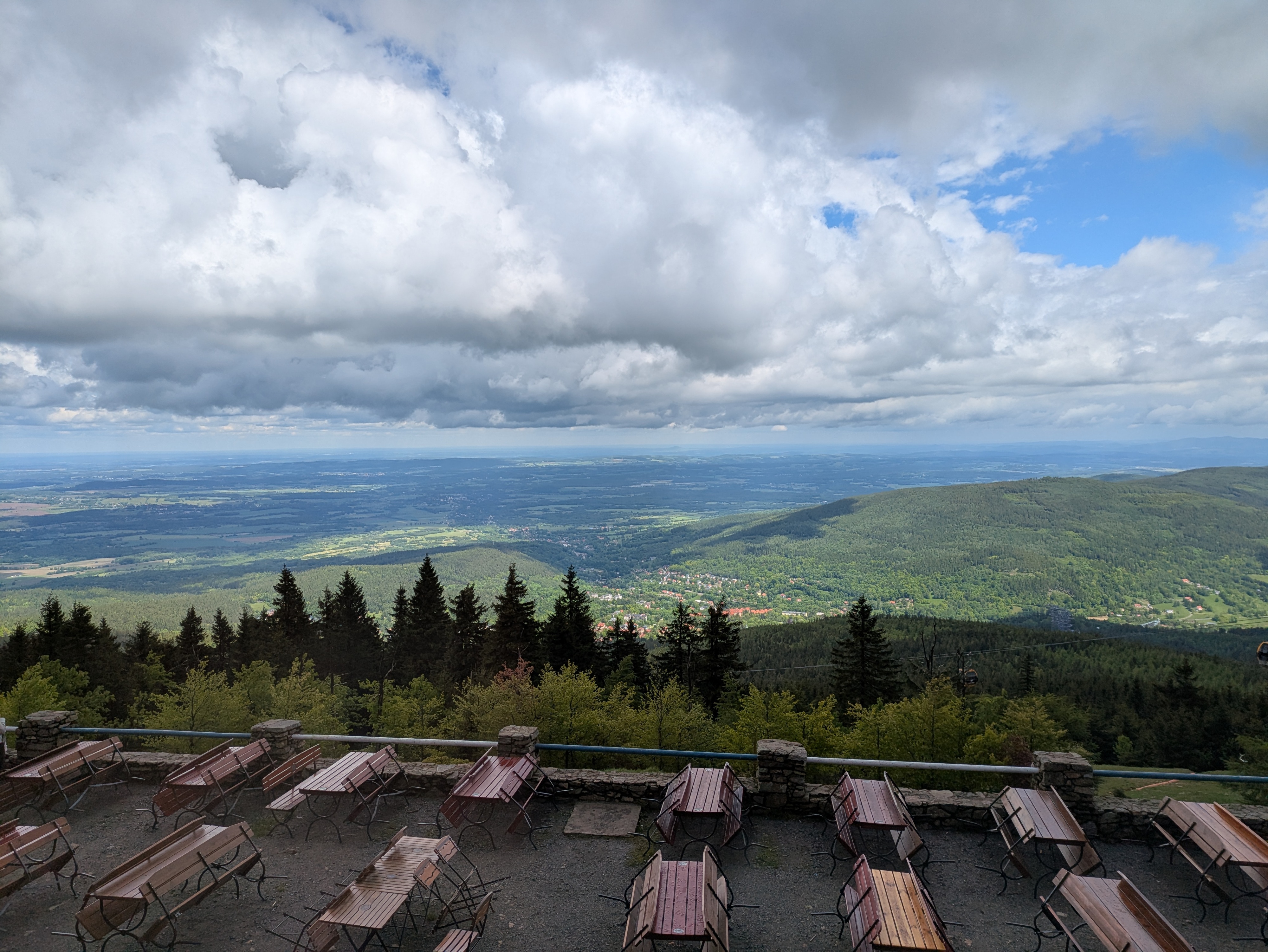
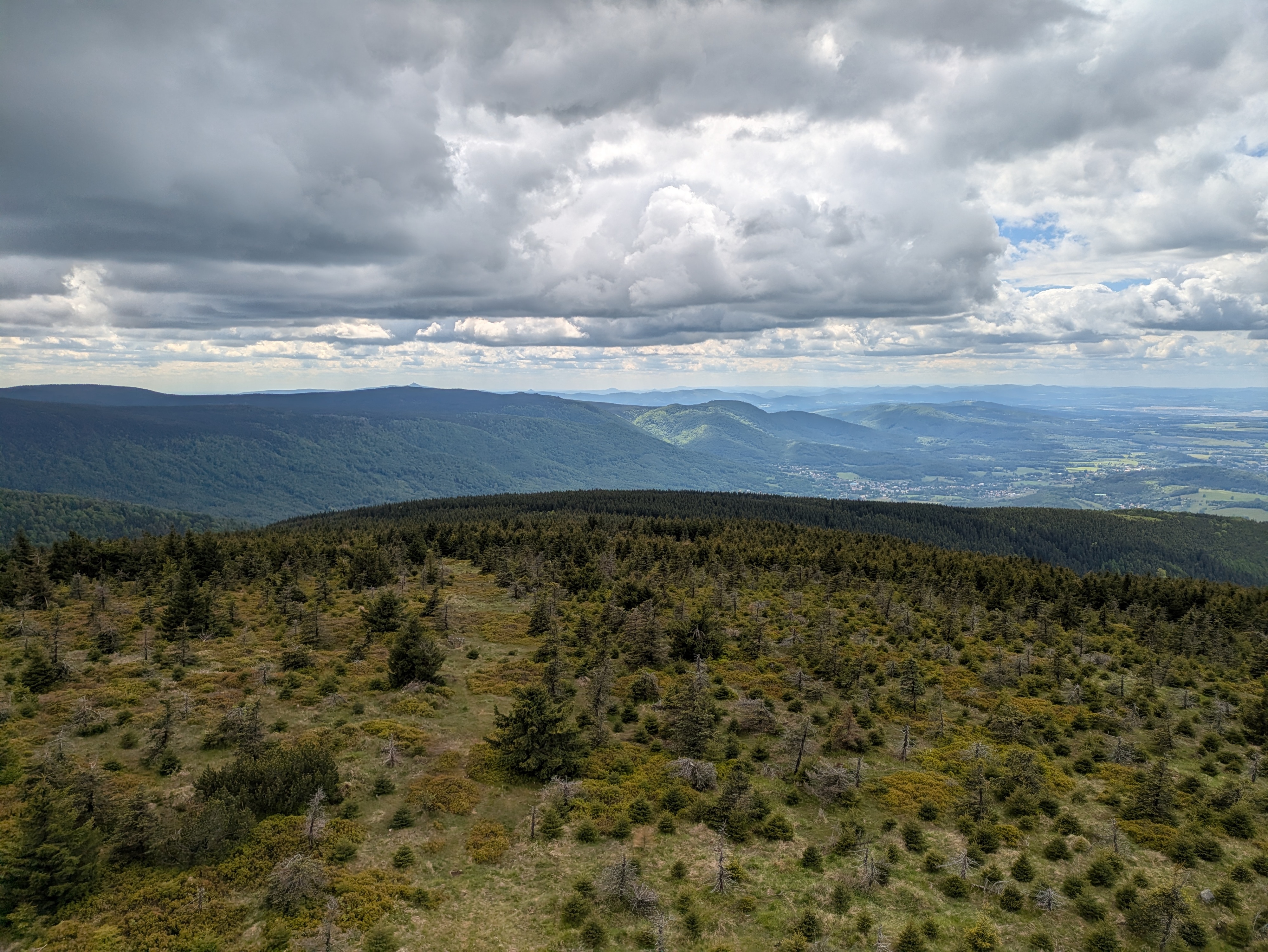
Up next were Vysoká pláň (high plain), a small peak located on a wide plateau that sits at about 1,400 metres above sea level, and the neighbouring Śnieżne Kotły (Schneegruben / snow pits). Vysoká pláň features the former Schronisko „Nad Śnieżnymi Kotłami” (Schneegrubenbaude / shelter “above the snow pits”), which used to offer rest to hikers and mountain climbers. These days, it is instead used as a radio tower: Radiowo-telewizyjny Ośrodek Nadawczy Śnieżne Kotły. Śnieżne Kotły tend to be a repository for not-yet-molten snow late into spring, but were absolutely devoid of it when we passed them in early August. In any case, the view from the upper side of the cliff was quite spectacular. We spent a few minutes admiring the views, and continued at about 15:00.

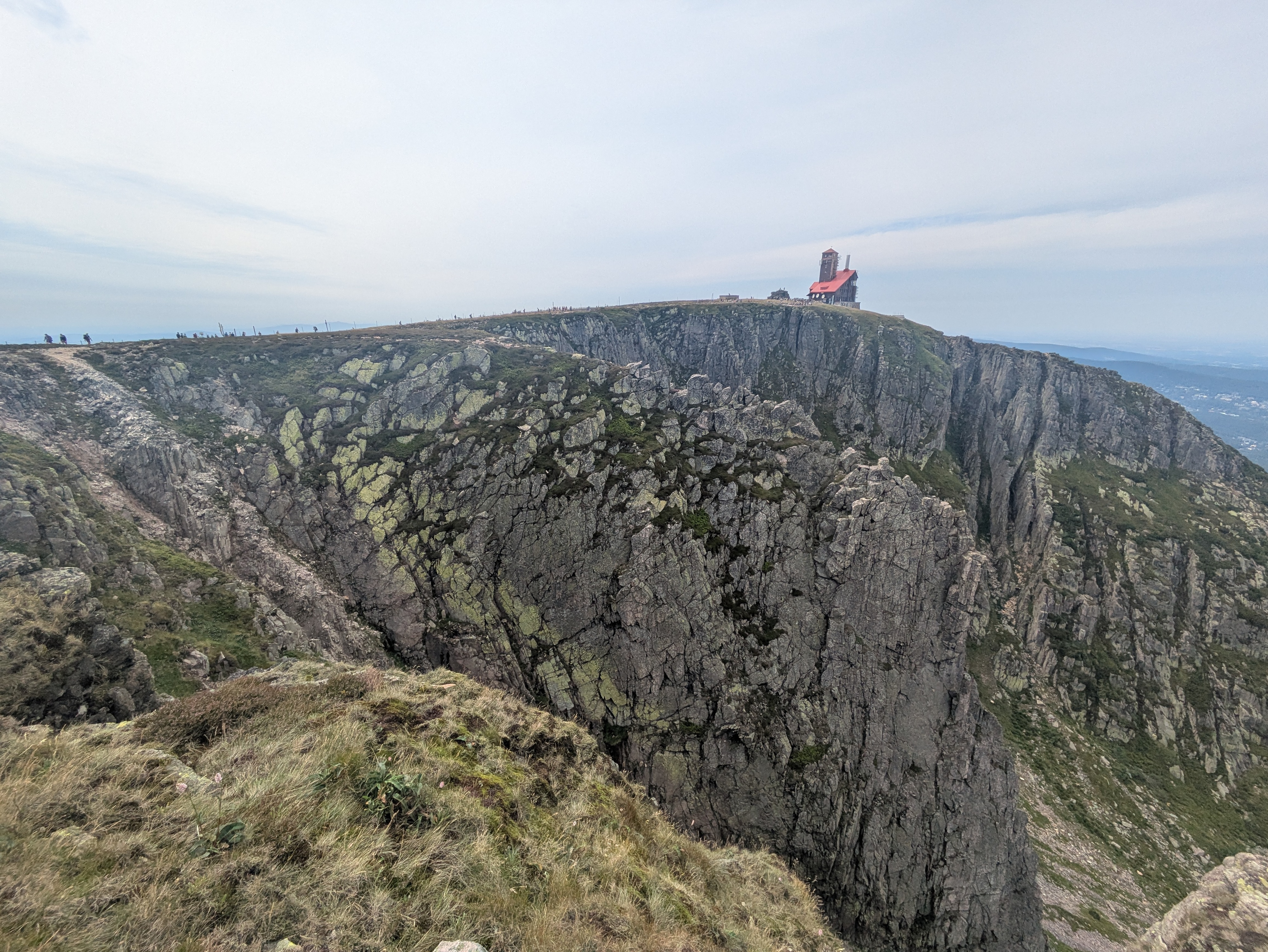
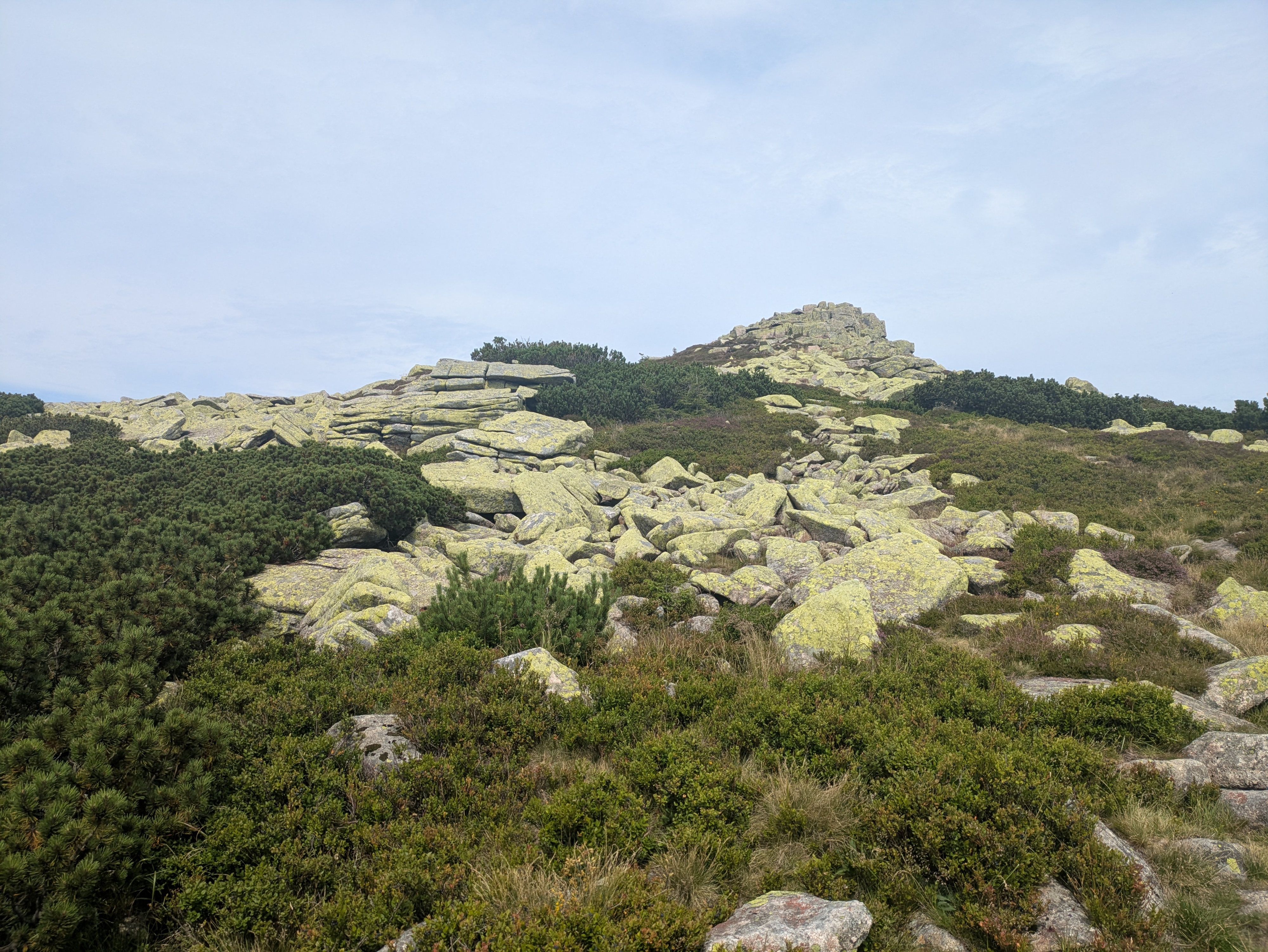
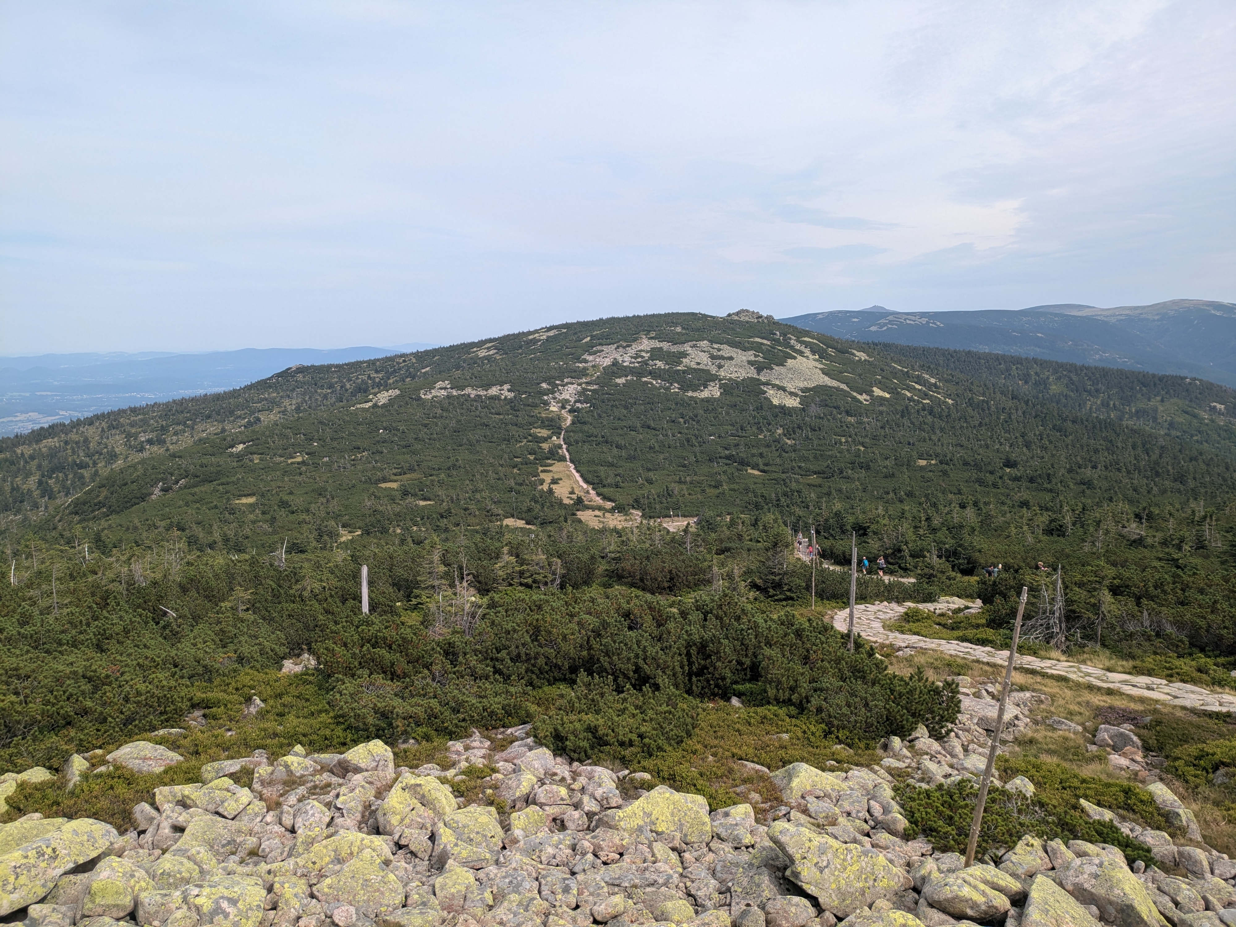
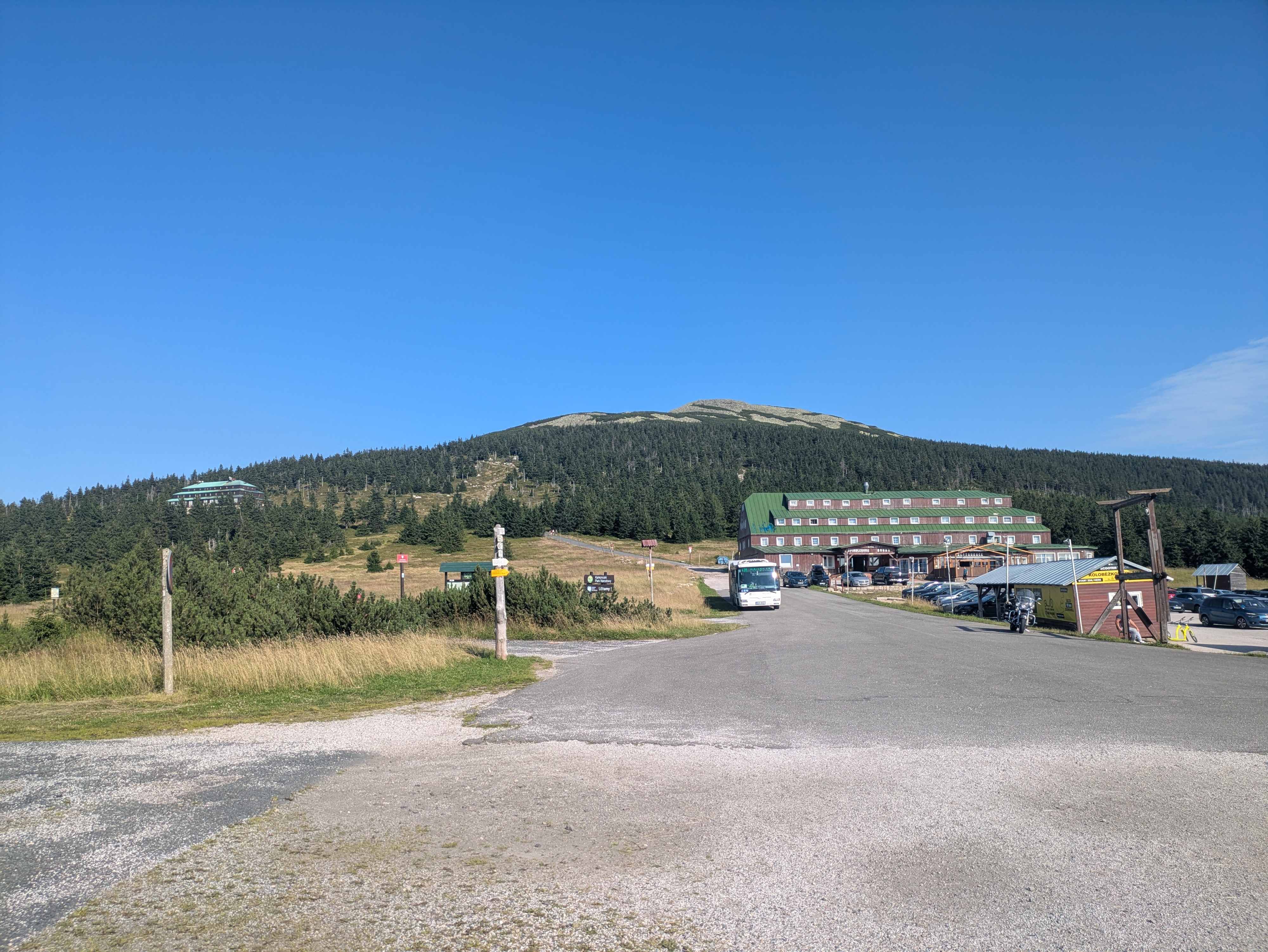
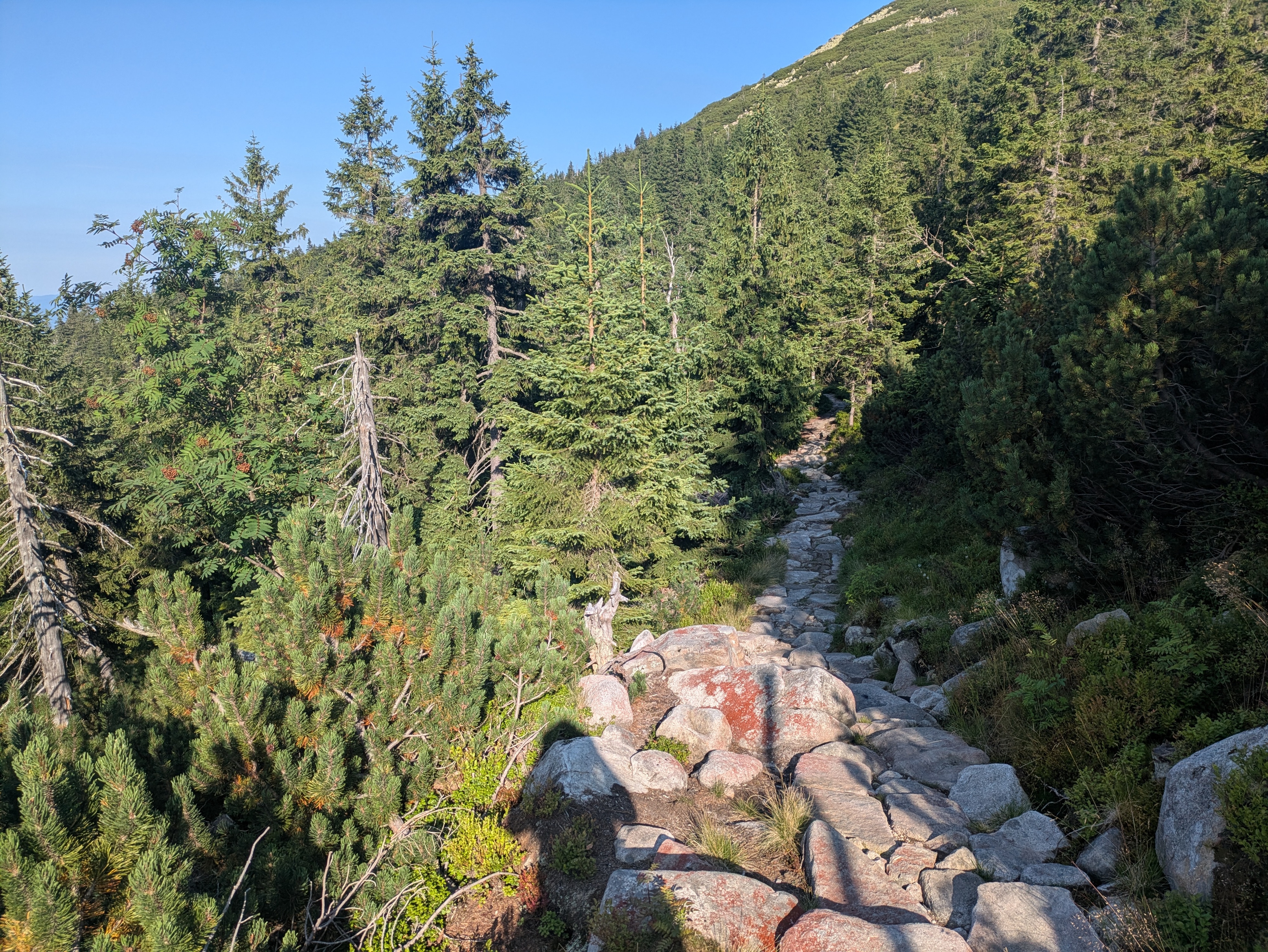
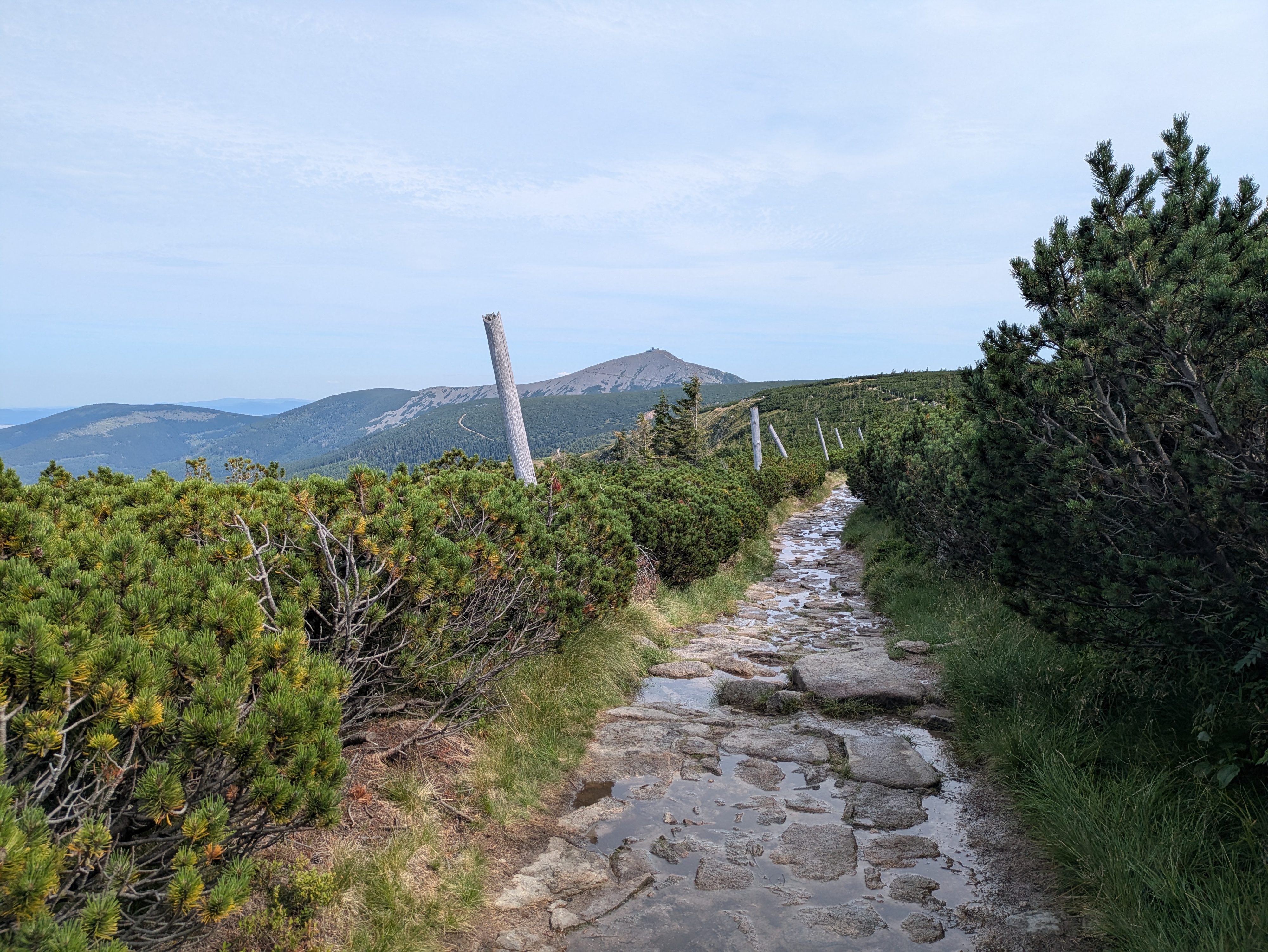
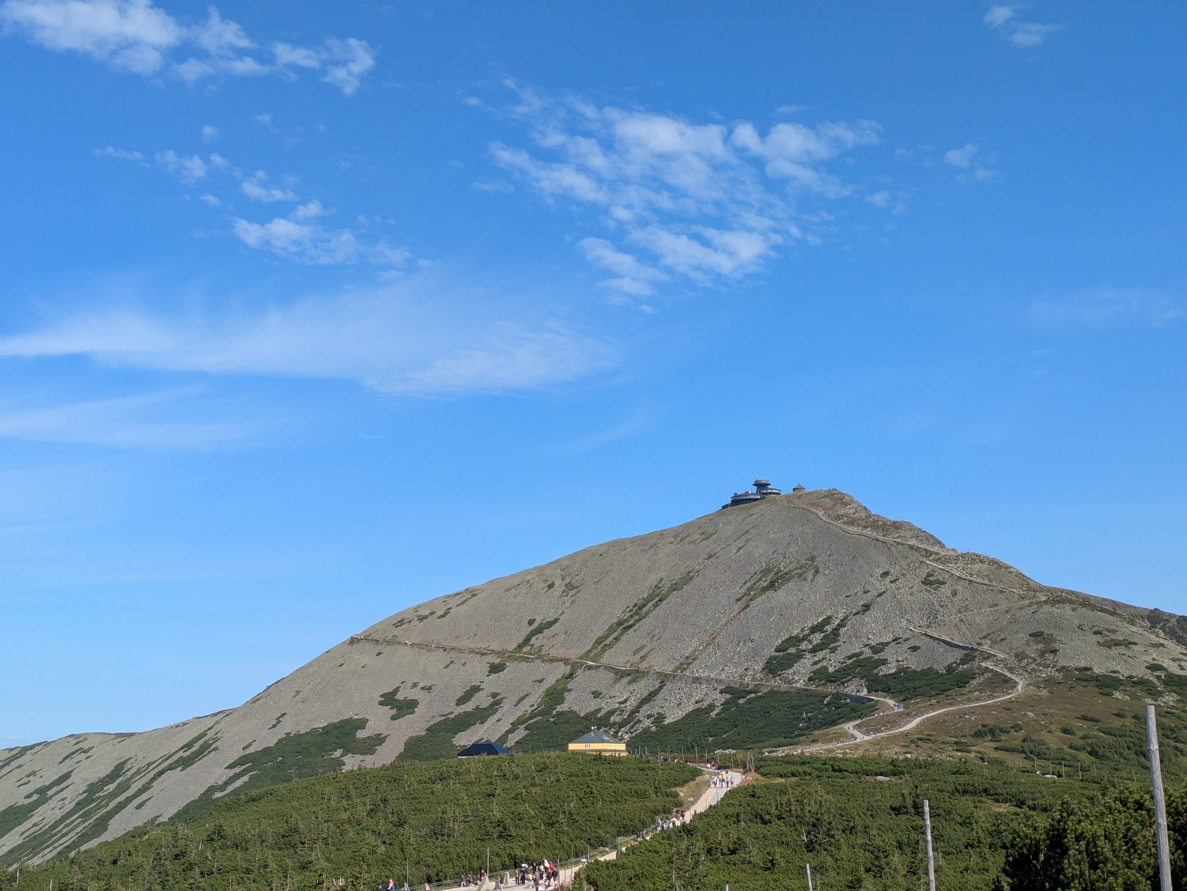
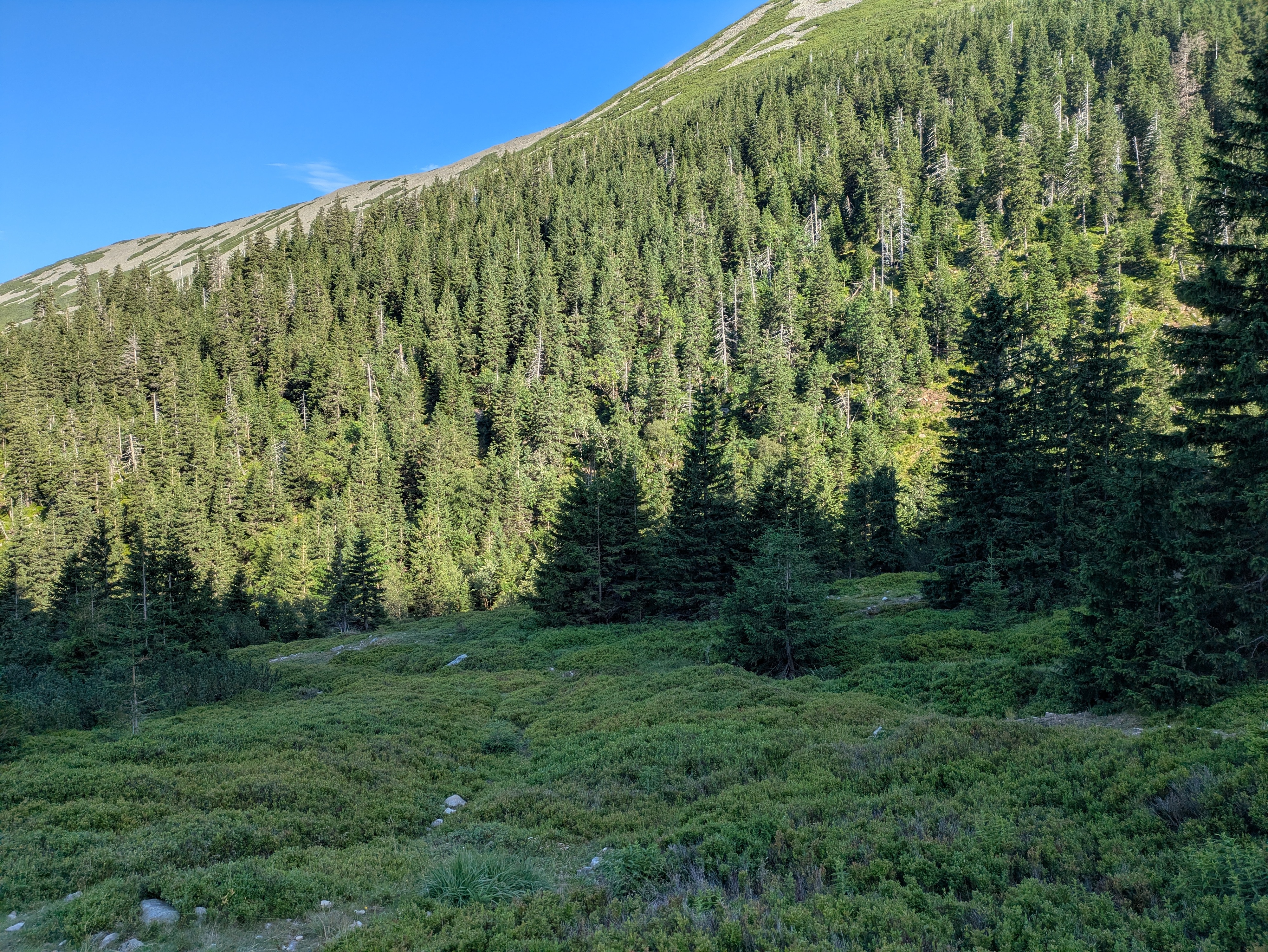
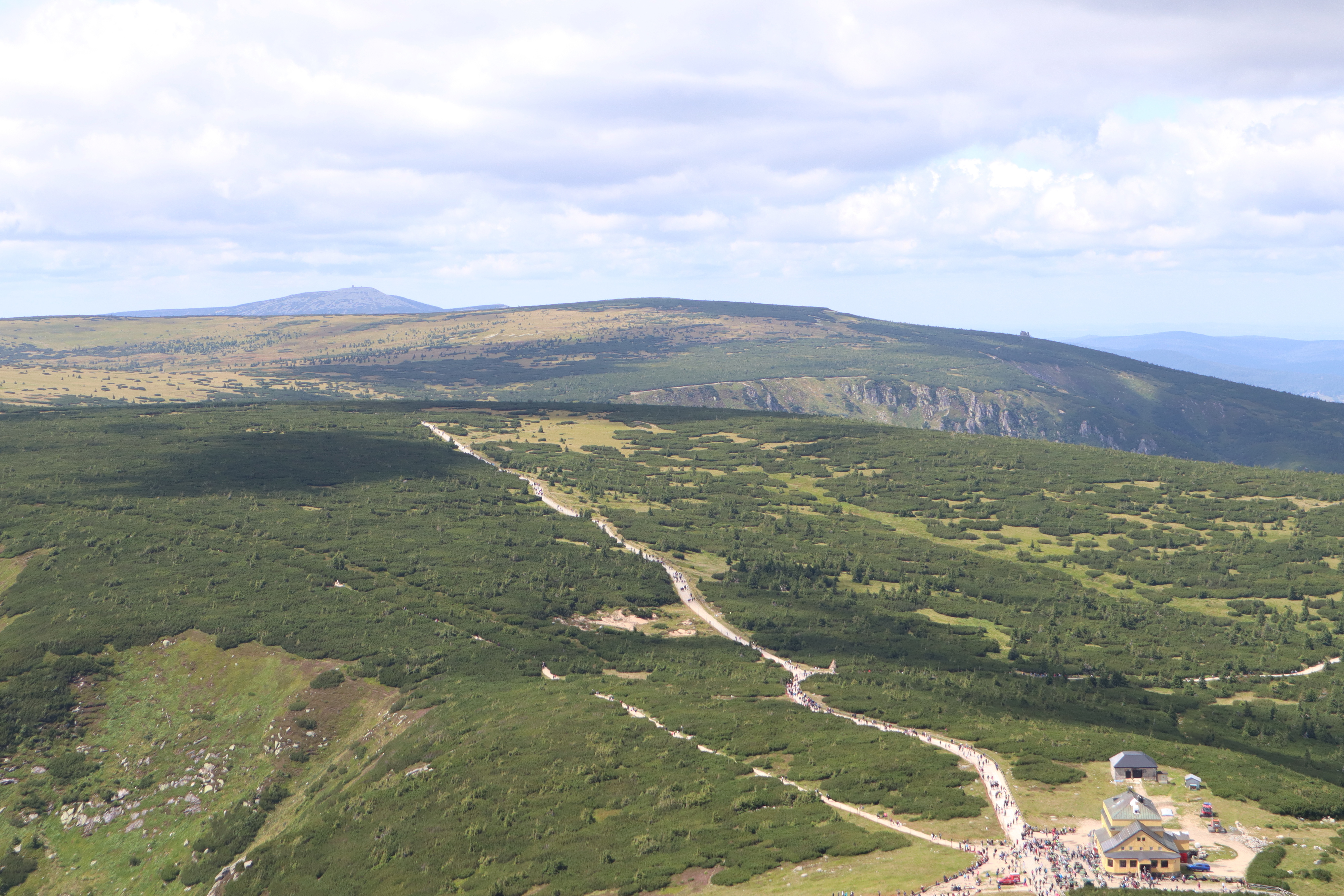
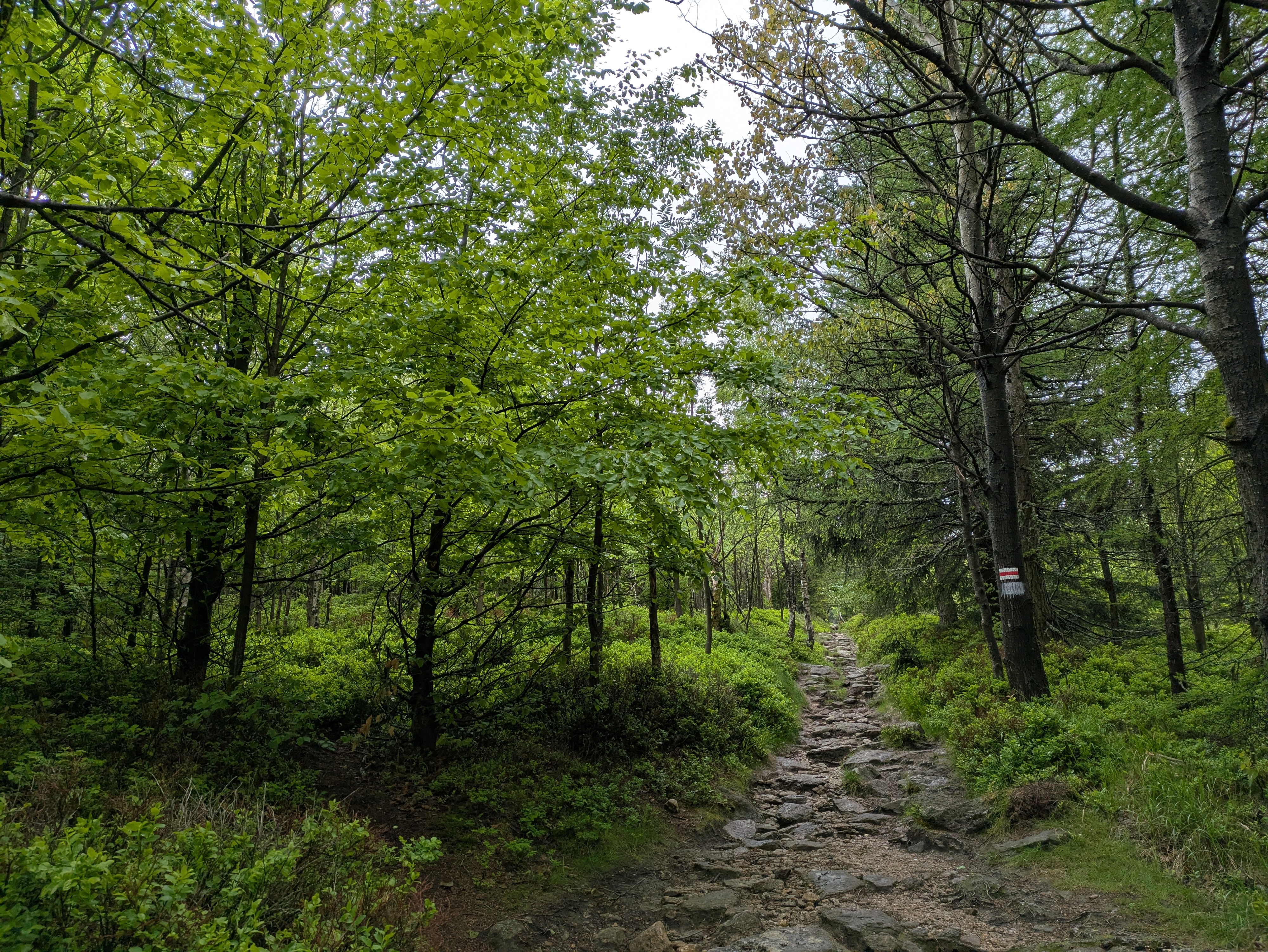
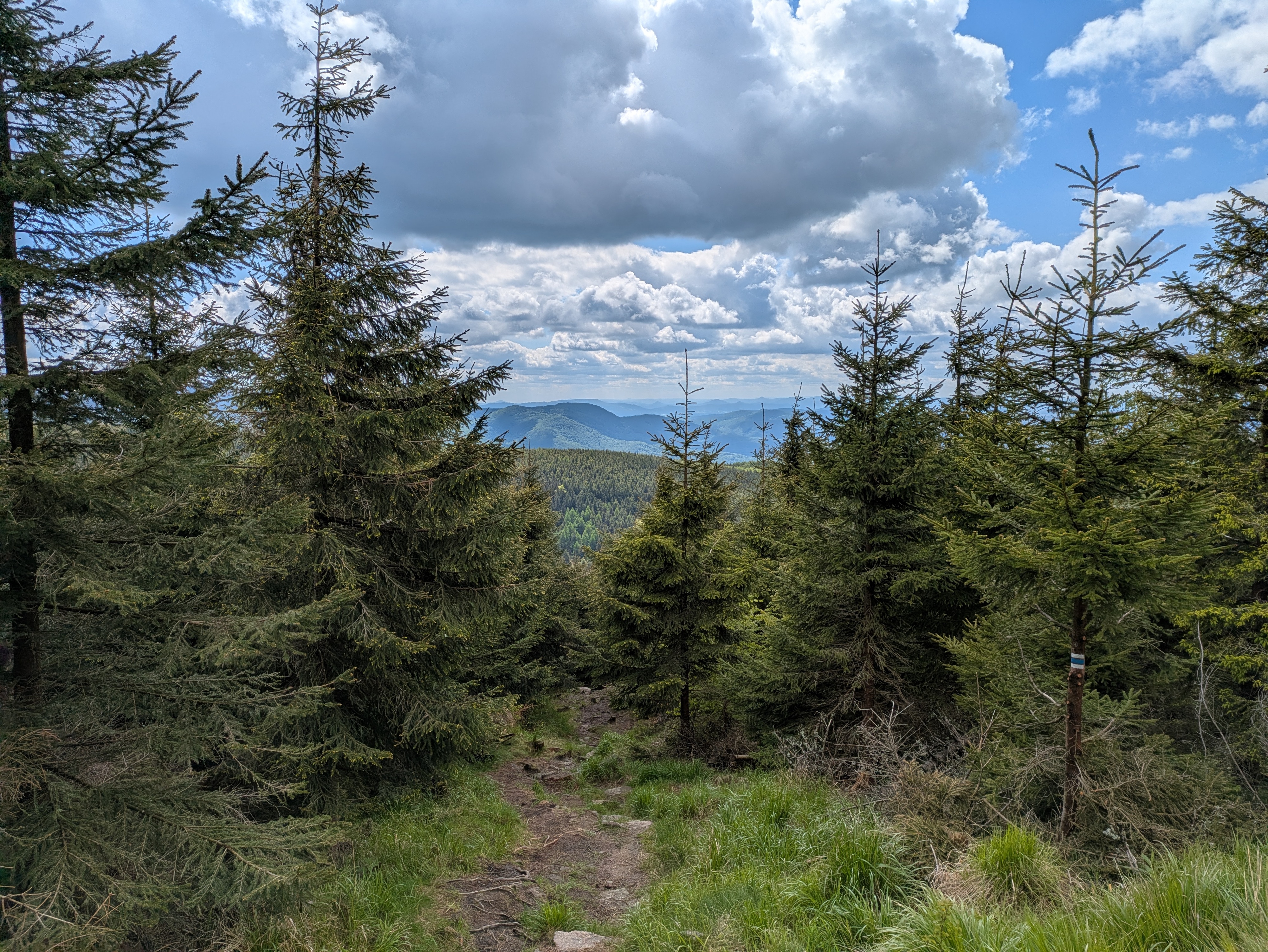
We continued around Vysoké kolo (Hohes Rad / high wheel), whose peak consists entirely of broken granite, towards Špindlerova bouda (Spindlerbaude / Špindler's hut), a former shelter that now serves as a hotel.
The peak of vysoké kolo really is quite impressive – I only have pictures of the hiking path around it; see the Wikipedia links for more. Some of the rocks on the path are loose and there are no handrails or anything – do be careful where you step.
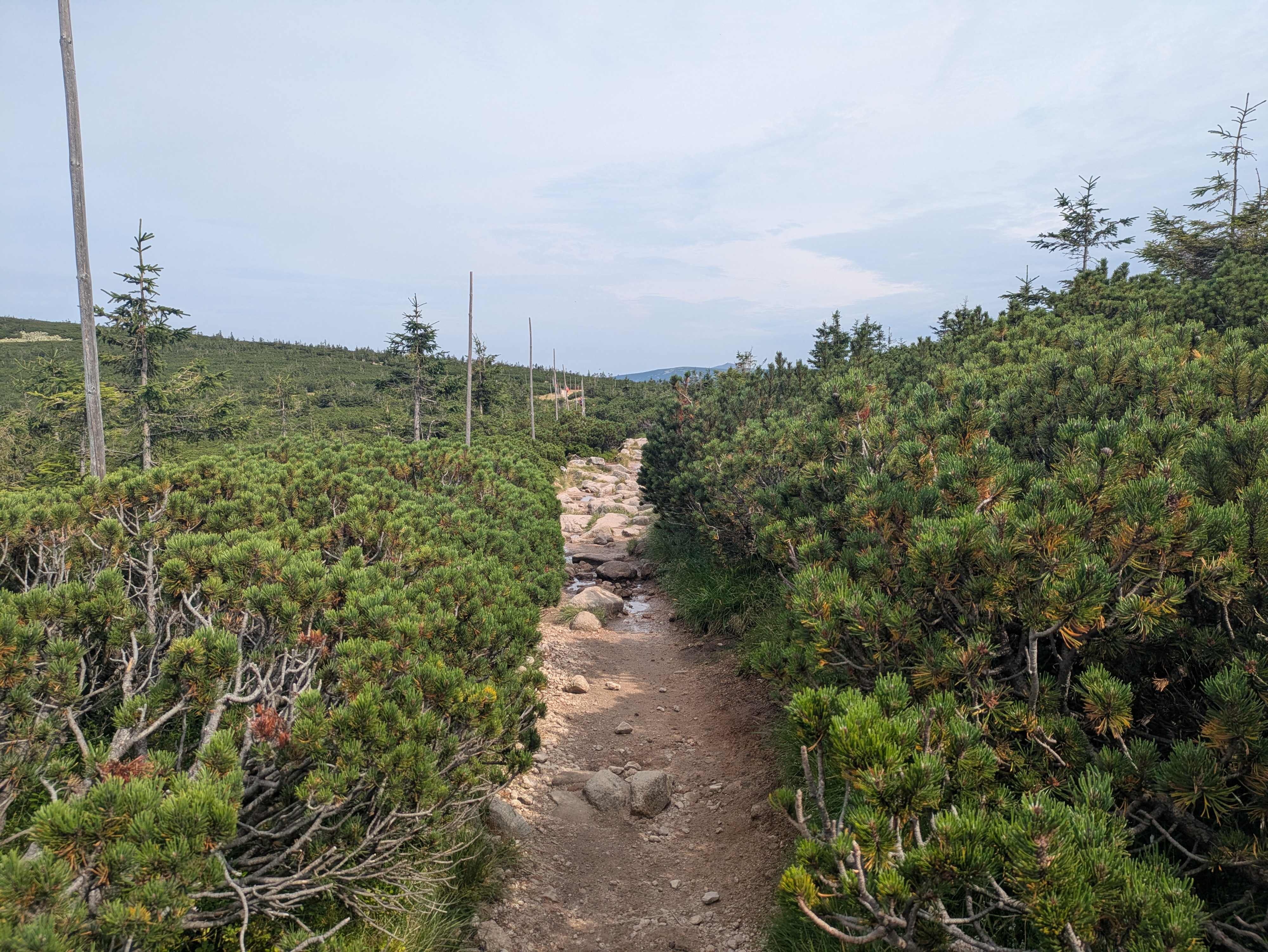
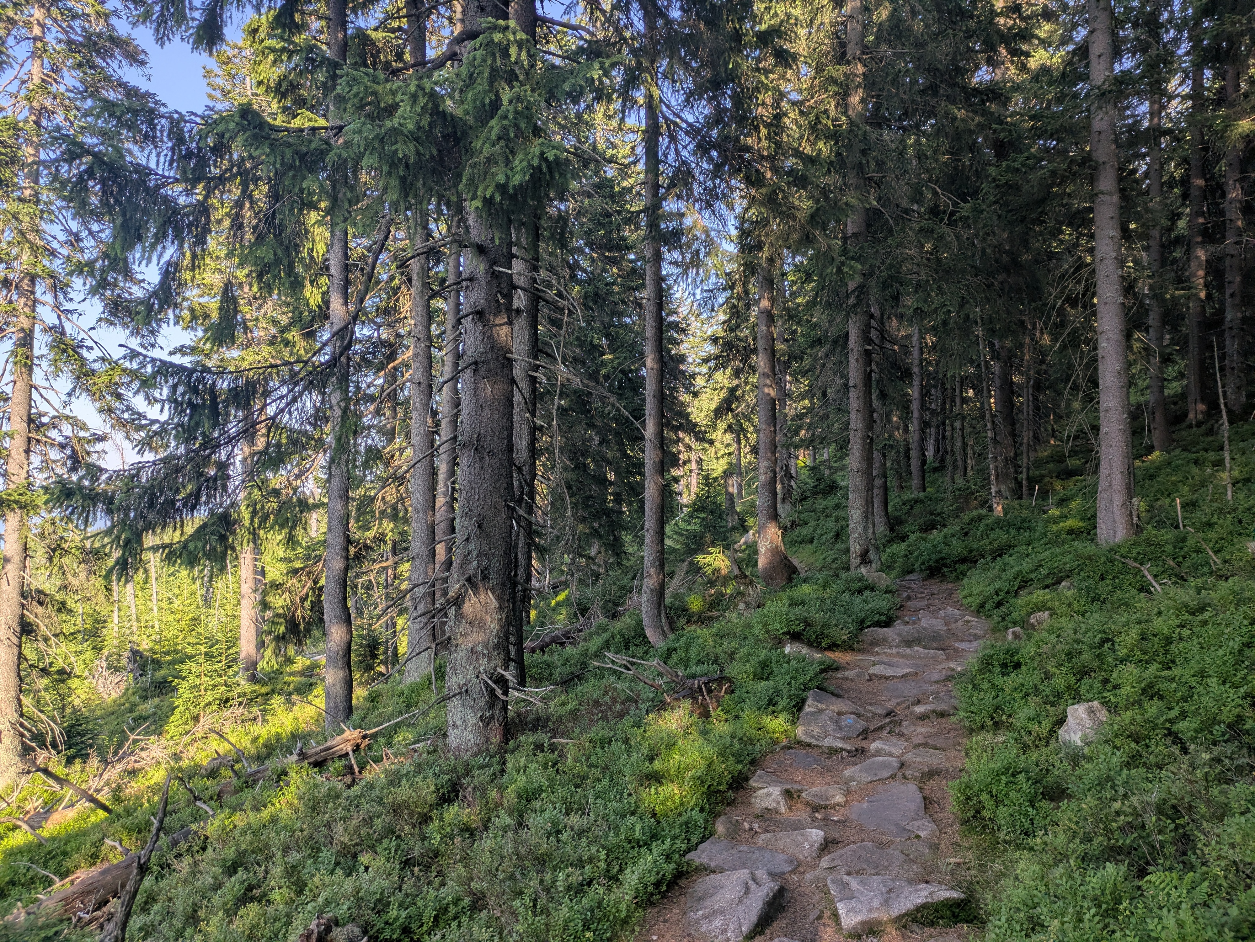
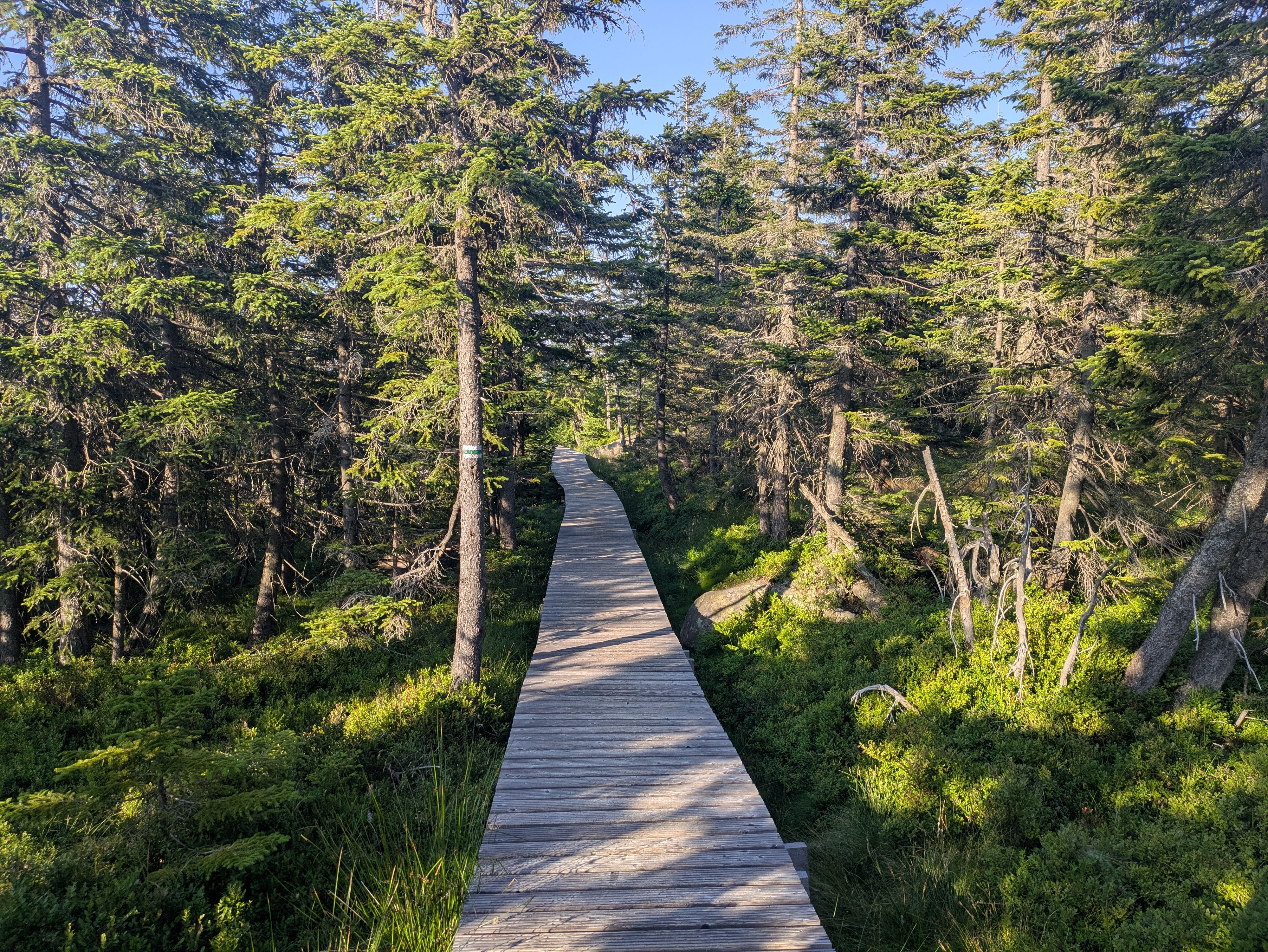
The remainder of the way towards Špindlerova bouda provided more granite heaps, mountain pines, and other kinds of rock formations. Also, Špindlerova bouda itself actually features a bus stop, located at convenient 1,198 metres above sea level.
Descent
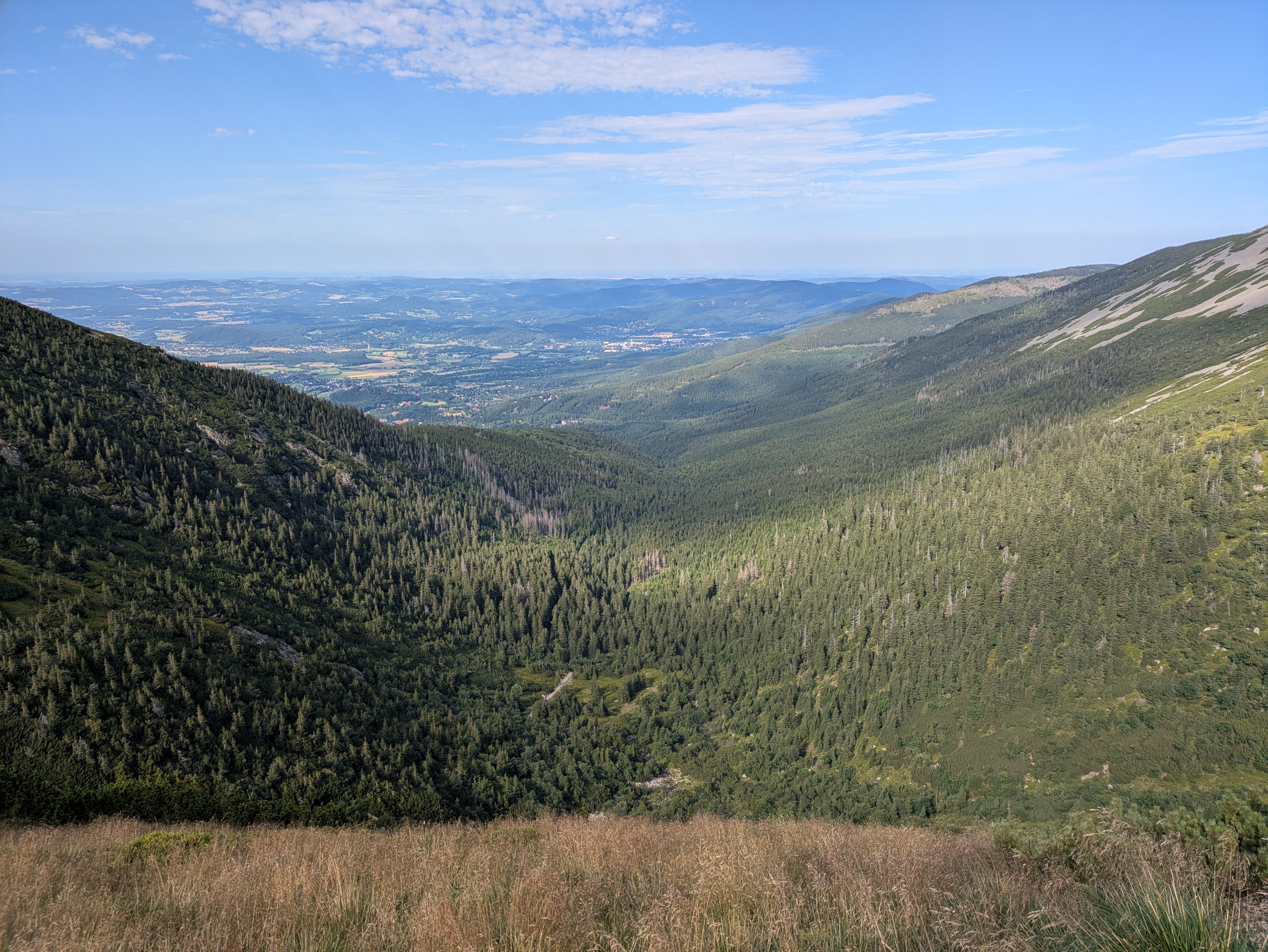
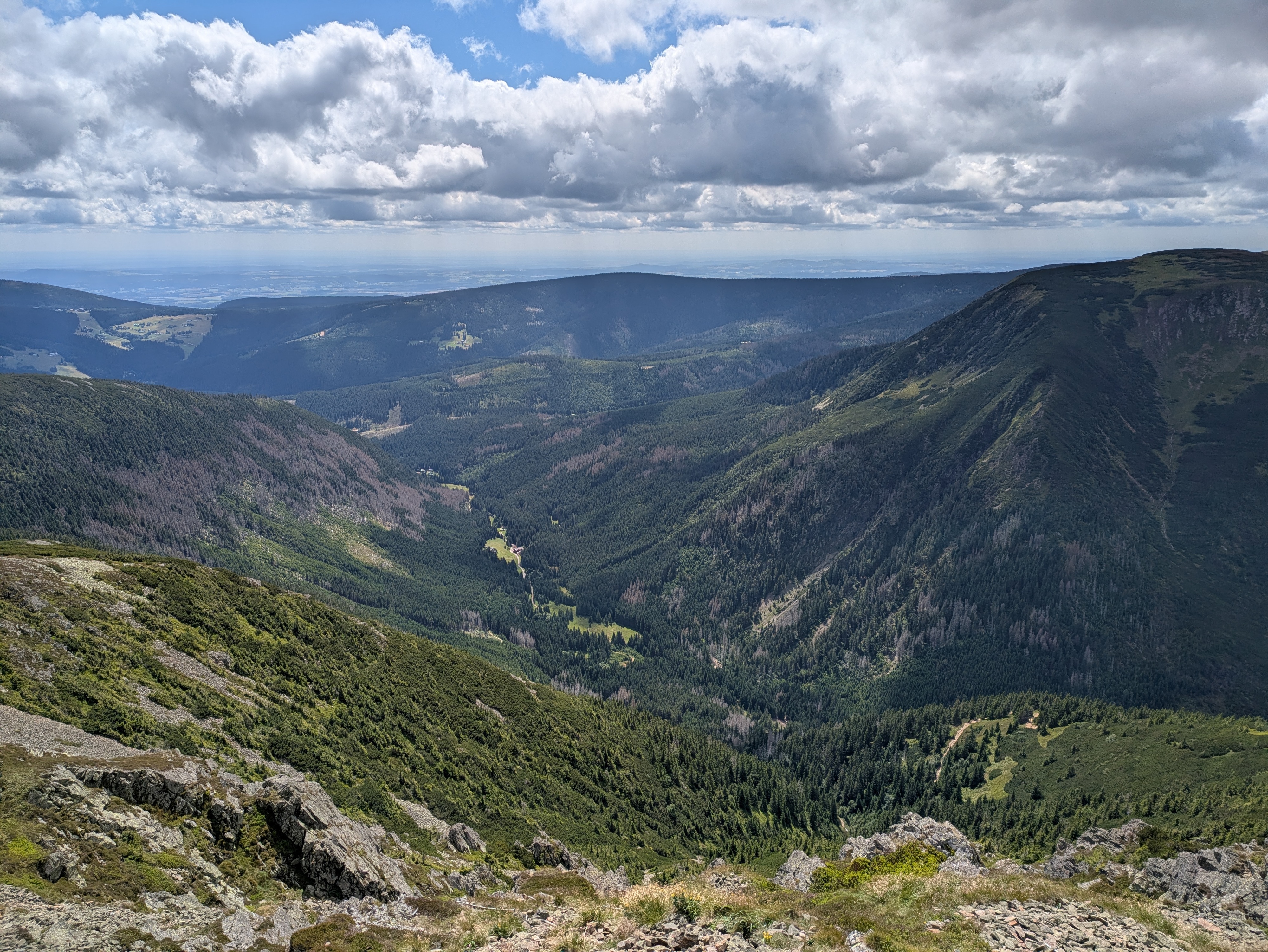
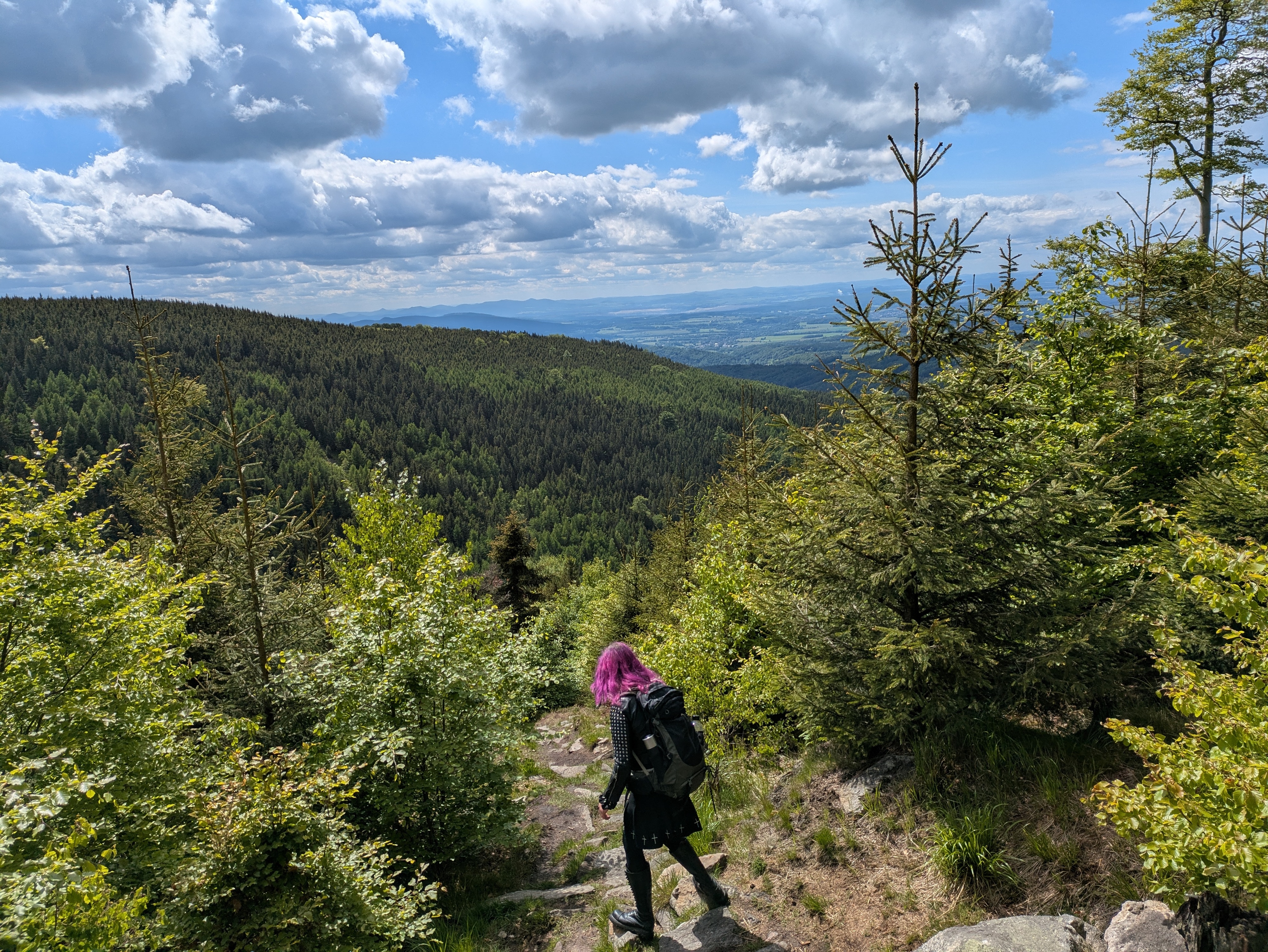
From here on, continuing the path along the peaks would have taken us to Słonecznik, which we had already visited two days ago. Instead, we descended to the north. We had actually planned to make our descent before Špindlerova bouda, however, it turned out that that path was closed to hikers.
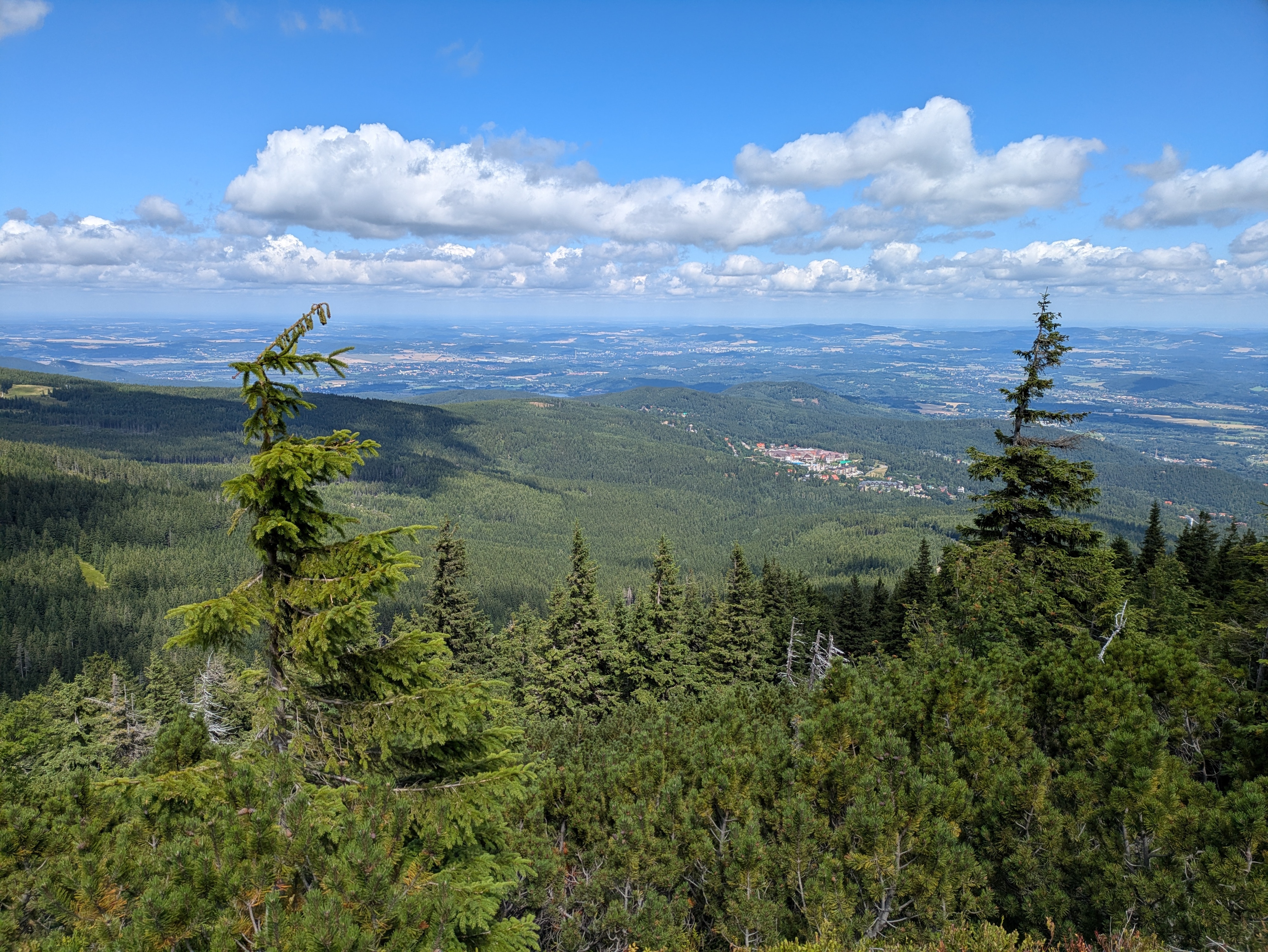
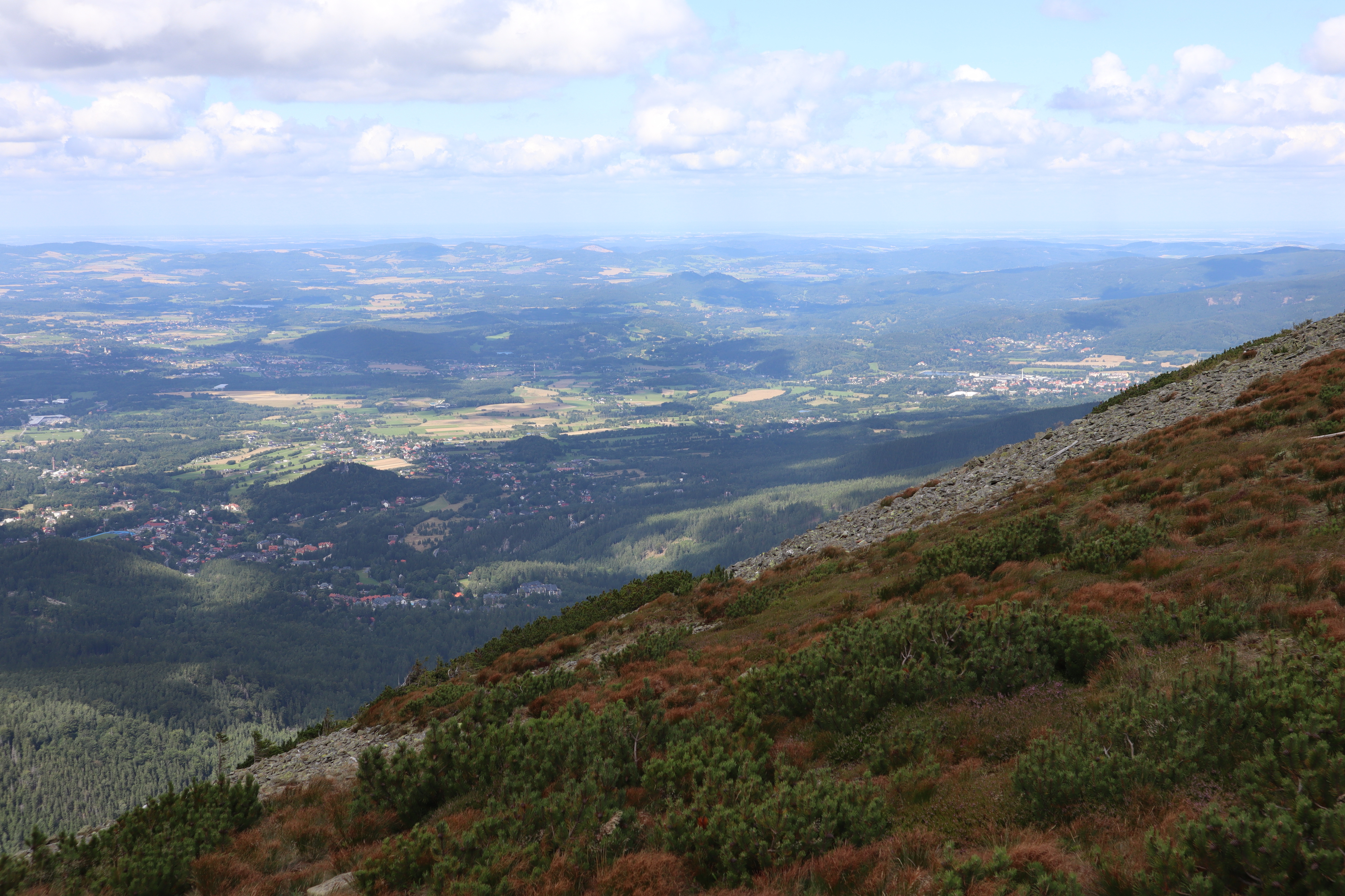
At this point, the clock was reading 17:00, we still had quite a few kilometres left to go, and the shadows were already growing longer. We had the sun at our backs and got some nice views across the Polish lowlands, plus the usual selection of rocks, more or less forested areas, and marsh lands. We reached Polana - Kotki (Katzenschlosslichtung / cat castle glade) at 18:45, and got back to Karpacz at around 20:15.
See lib.finalrewind.org/Pramen Labe for more pictures.
Krkonoše day 3: Malá Úpa and Tabule
This is the third of four posts about our 2025 vacation in the Giant Mountains (Krkonoše / Karkonosze), see Vacation in the Giant Mountaints for an introduction.
We wanted to have a change from the typical Polish food in the evening, and, thus, decided to climb up to Horní Malá Úpa on the Czech side of the Giant Mountains, have lunch there, walk a bit along the ridge, and return to Karpacz.
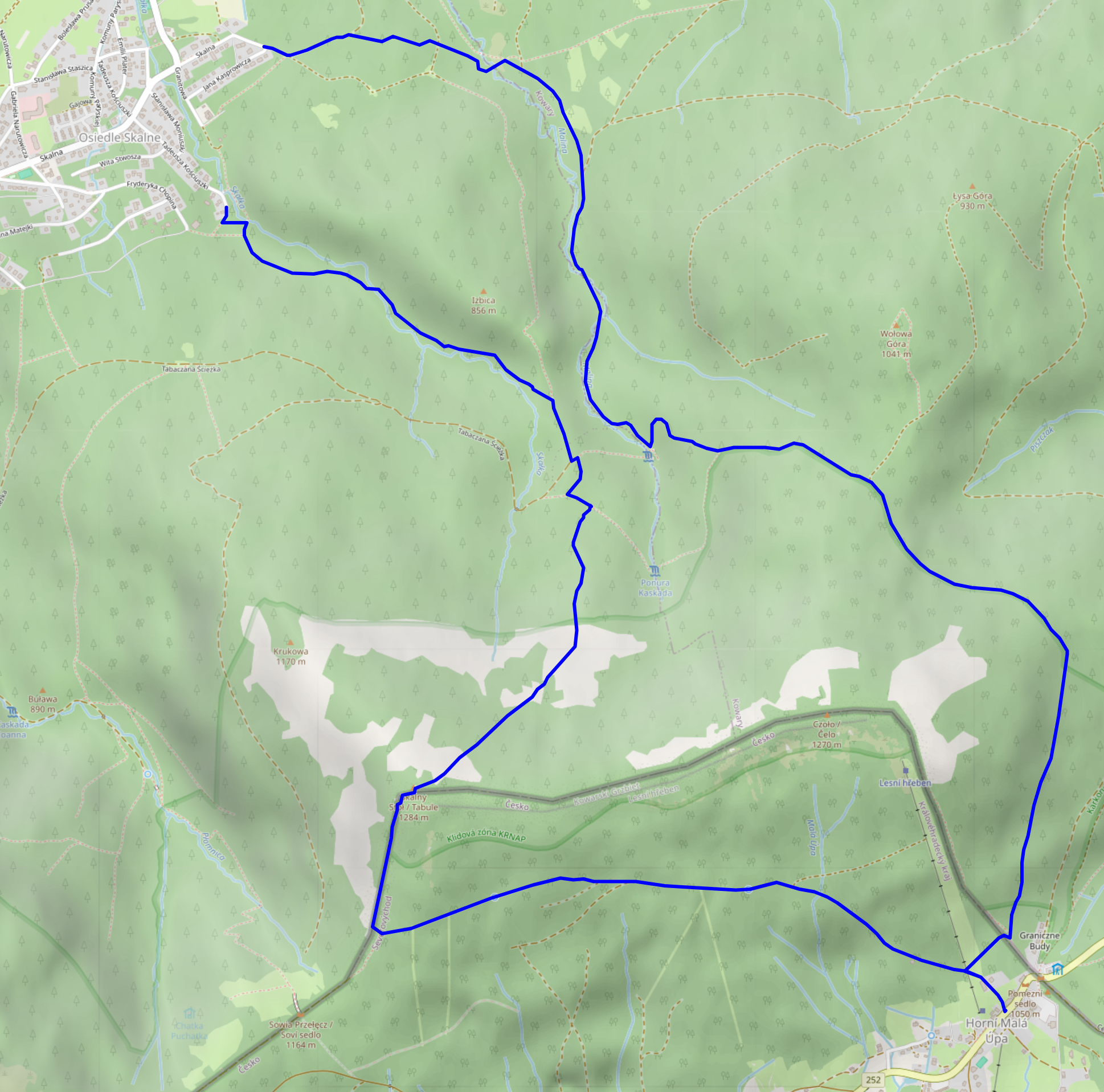
Ascent, Part 1
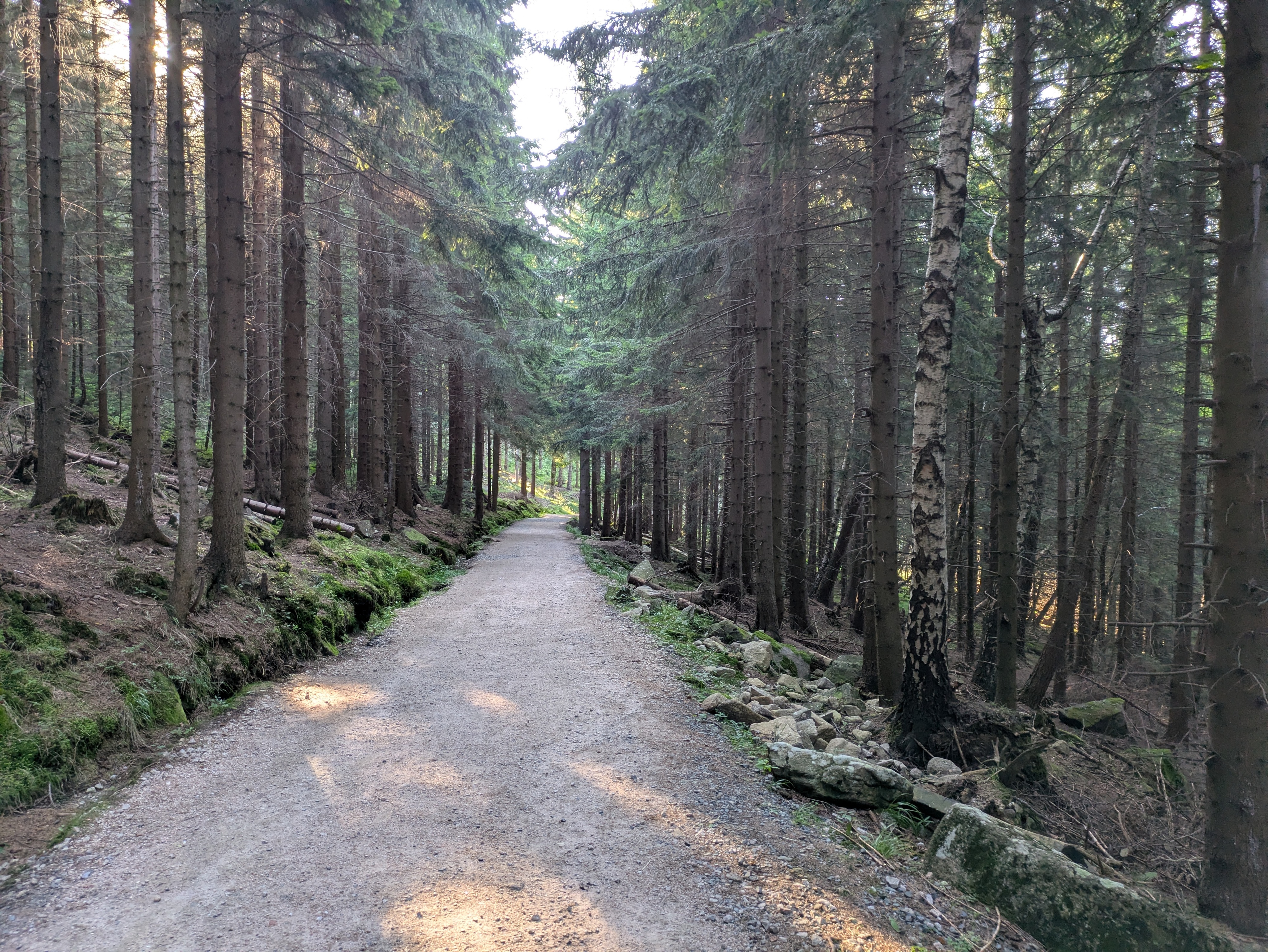
We started at around 10:30 from the very West of Karpacz, specifically its Osiedle Skalne suburb. From there, we took a path along (and, as often as not, across) the Malina stream (Langwasserbach). Some crossings came with bridges, others with broken bridges, and some with just a few strategically placed rocks. The latter parts of the path are helpfully marked with exclamation marks, likely indicating precisely these challenges. Anyhow, we enjoyed the quiet we had in this part of the forest, and made it through all fords without surprise baths.


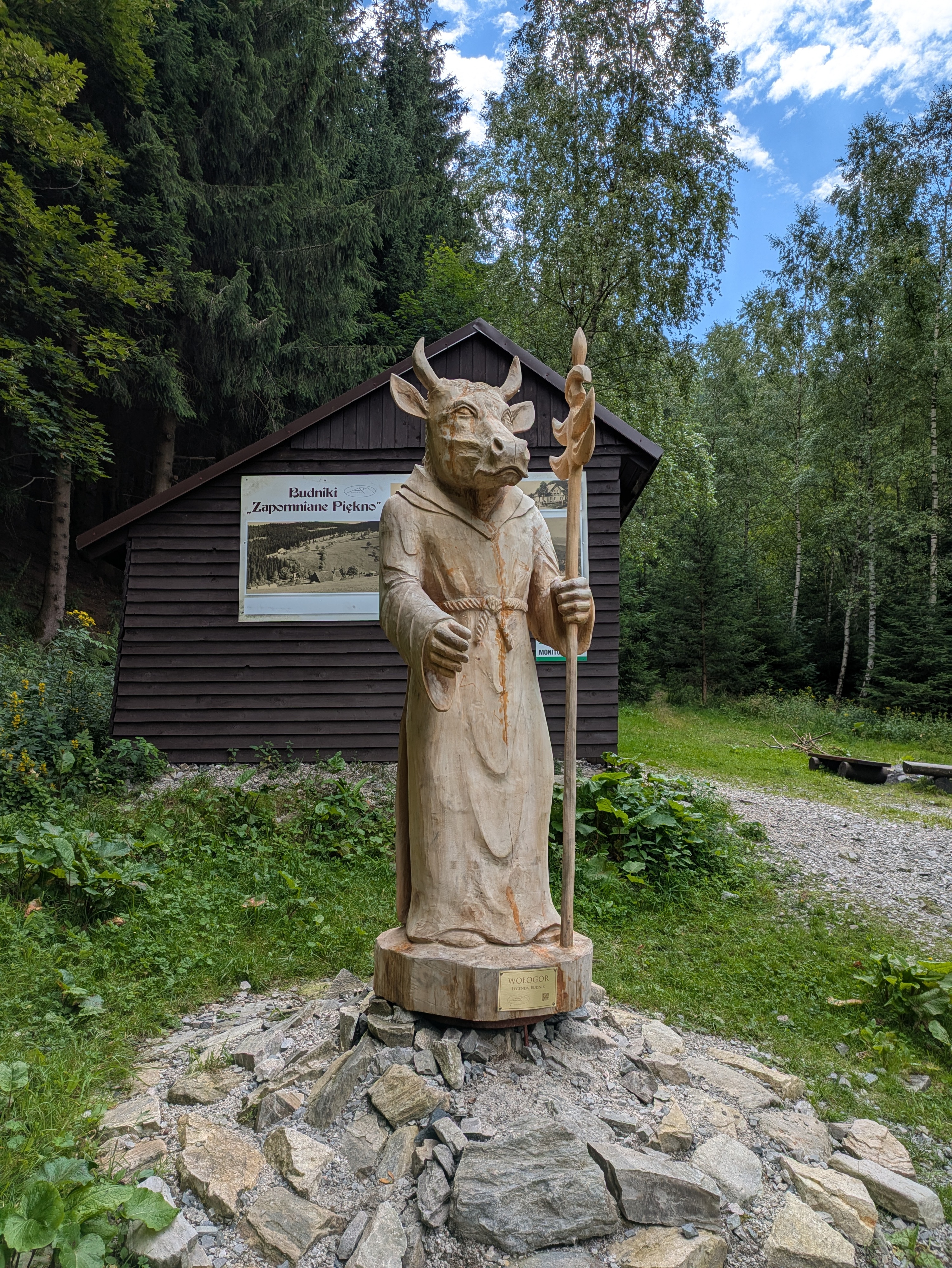
Budniki
At 12:00, about a third of the way up, we reached former Budniki (Forstbauden / Forstlangwasser). We weren't aware of this site when planning the trip, so that was a pleasant surprise. Essentially, Budniki is a former settlement that, due to its location very close to the peaks of the Giant Mountains, had the peculiarity of not receiving any direct sunlight for 110 days a year. Apparently, it was abandoned around 1950 due to preparations / explorations for uranium mining operations. We also learnt about Wołogór, which doesn't seem to have an English or German Wikipedia page that I can link. Furries, they're everywhere!


We also found out that the bread we had brought along was not a proper dark bread, but simply wheat with activated charcoal. That's the kind of surprises you can get when you aren't fluent in Polish.
Ascent, Part 2
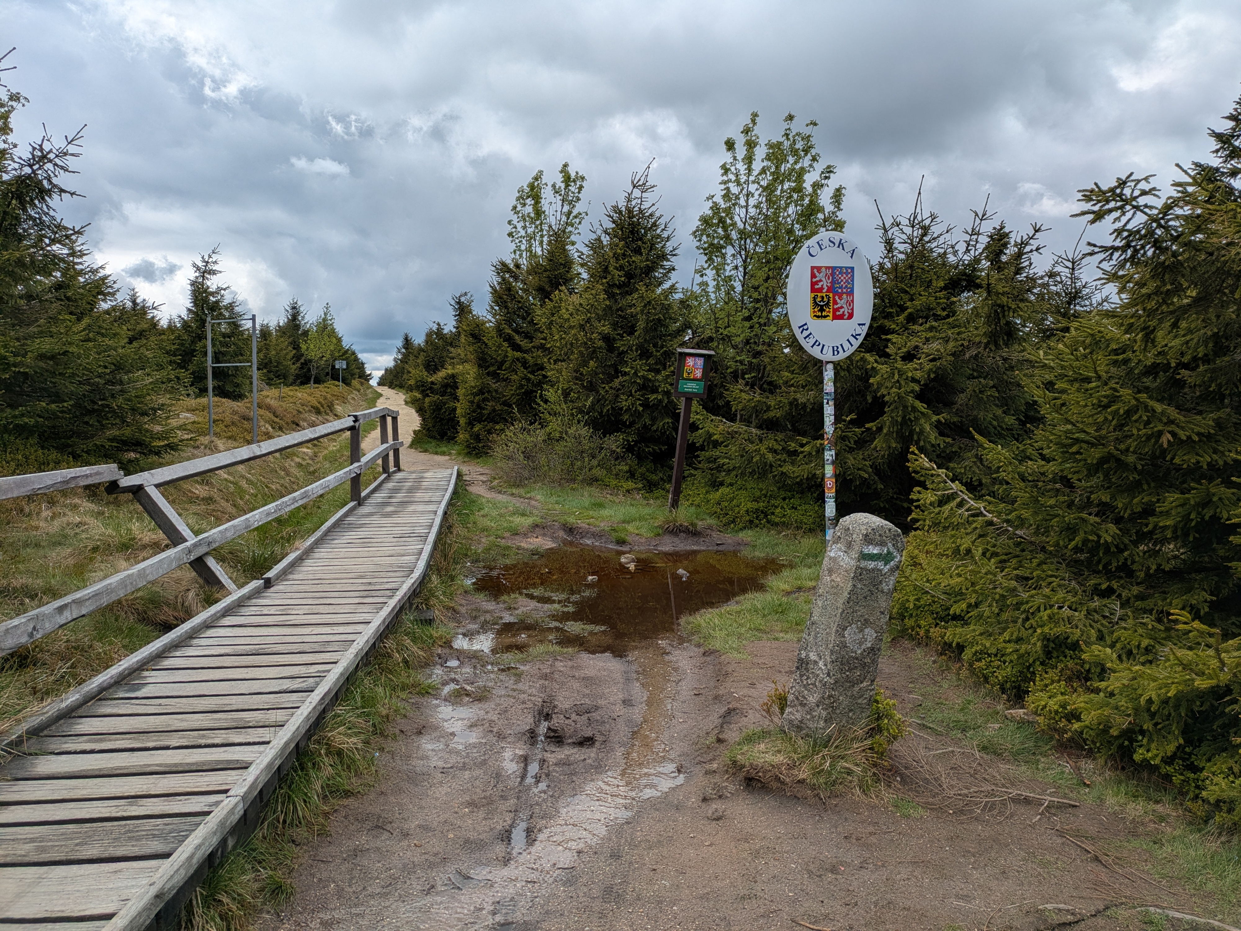
From Budniki on, the remaining 400-or-so metres of elevation got quite challenging, with uneven and pretty steep terrain that just kept going on and on. When we finally reached a more even path close to the ridge line, we were greeted with the usual occasional flooding, lush green, and (at about 14:00) a sign welcoming us to Česká Republika.


Horní Malá Úpa
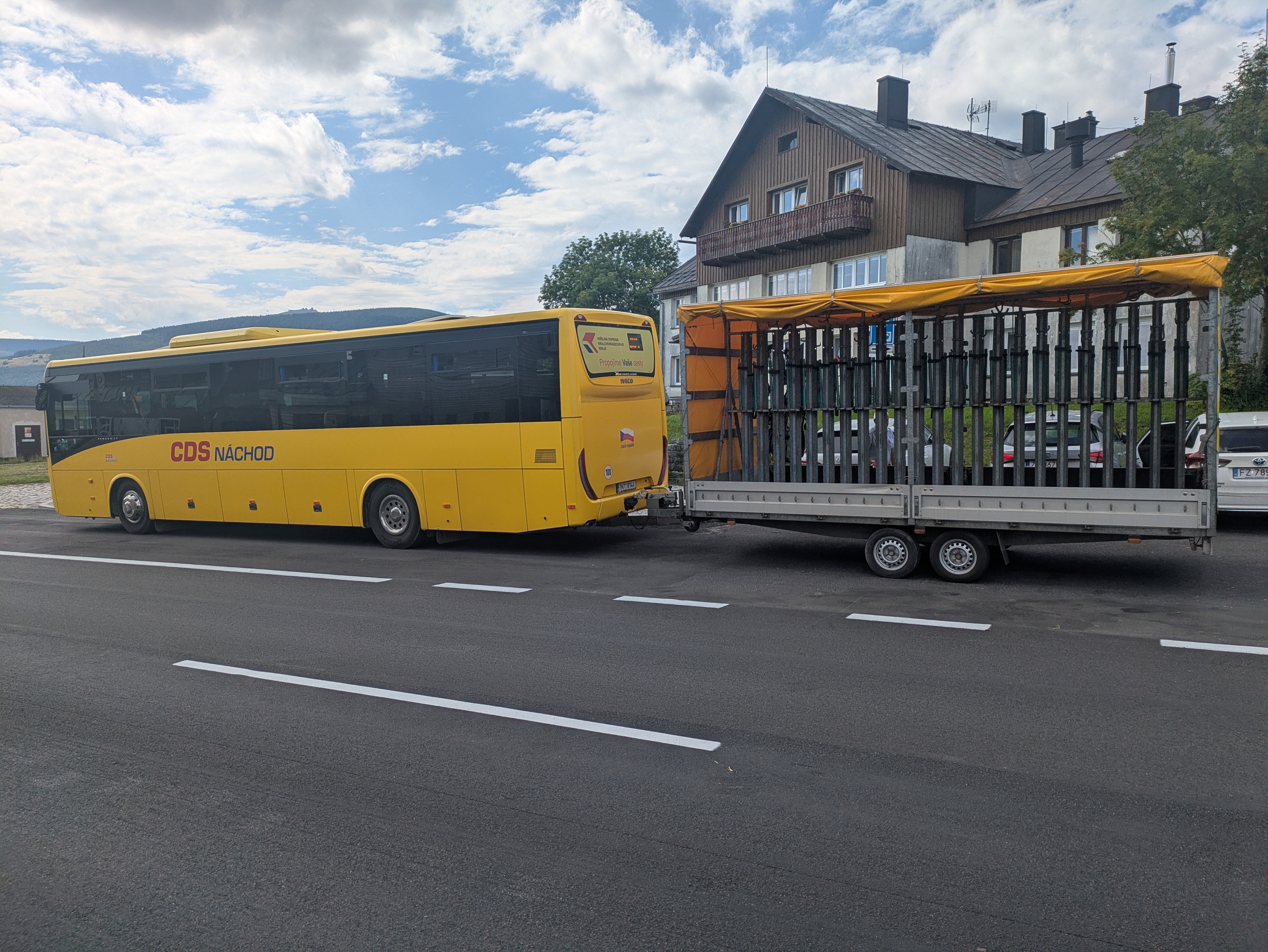
For English speakers, the jokes related to the name of Horní Malá Úpa (Ober-Kleinaupa / upper Malá Úpa) write themselves. So naturally, we had to pose for the obligatory photos near the entrance sign. Apart from that, the municipality is unspectacular. There's some border stones that still bear markings of the former ČSSR (Tschechoslowakei), some skiing infrastructure, and buses that are specifically outfitted for taking on bikes (or, possibly, skis). We had lunch at Pivovar Trautenberk, which I can recommend. Also, the nice part about Česká is that if you order lemonade, there's a high likelihood that you'll be served kofola 😋.


Tabule
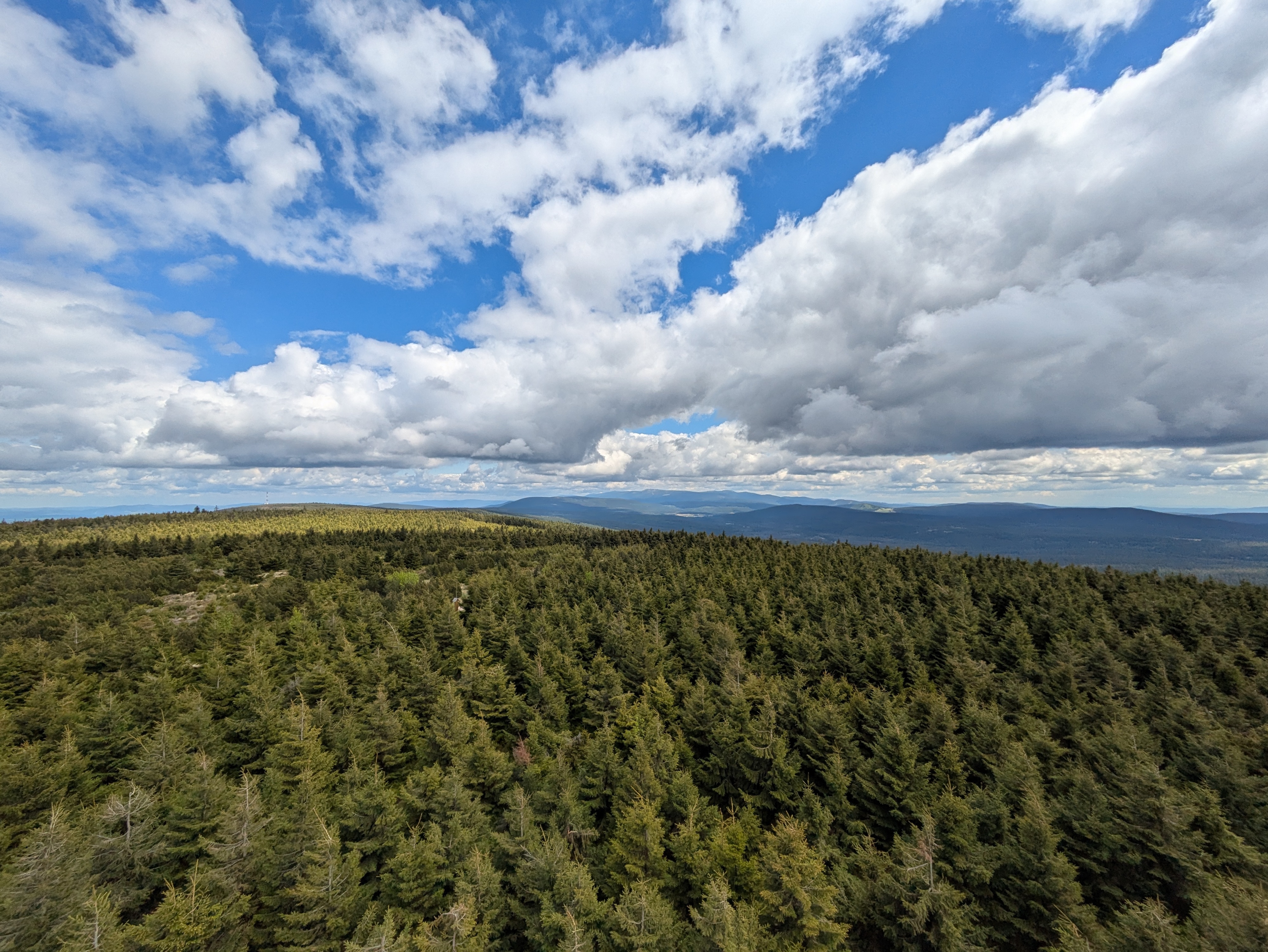
After some exploration and our lunch break, we left Horní Malá Úpa for the final climb up the nearest peak at around 15:30. We started out in a dense forest, and then, as the vegetation grew thinner, got some views towards other parts of the Giant Mountains.

We reached Tabule (Tafelstein / table peak) at about 17:00, and took in some more scenery. Once again, we could spot Sněžka in the distance, and also a little bit of Karpacz and the Polish lowlands.

Descent
The descent took us slightly west of the path we used for the ascent, and was just as steep. It also really drove home just how much its height (and, likely, other factors) affect the vegetation – we got everything from low bushes to coniferous and birch forests.


We passed Budniki once more, and then followed the Skałka stream for a bit. Here, we were faced with another surprise: a (possibly carbonated) spring that not even OpenStreetMap knew about.


We got back to Karpacz at about 19:00. As usual, more photos are available at lib.finalrewind.org/Tabule 2025.
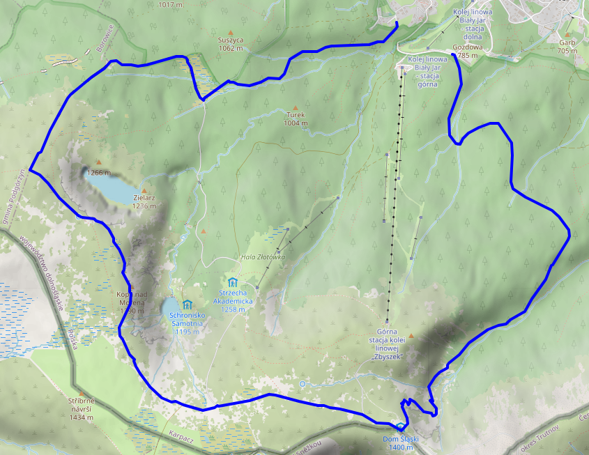
Krkonoše day 2: Słonecznik: Wetlands, Stones, and Ponds
This is the second of four posts about our 2025 vacation in the Giant Mountains (Krkonoše / Karkonosze), see Vacation in the Giant Mountaints for an introduction.
On this day, we decided to make our ascent more to the east, take a look at the wetland we'd find there, and then see where our intuition took us.
Ascent
We started at around 11:00 from Karpacz Górny (“upper Karpacz”) and followed a path along the Pląsawa stream towards the wetland near Polana - Kotki (Katzenschlosslichtung / cat castle glade). The path along the stream is steep, but relatively even, and the stream provides a nice background soundtrack to the ascent. Right before Polana - Kotki, we merged with the (decidedly more crowded) main track towards Sněžka, and passed a KPN employee who glanced at my smartphone to verify that we did indeed have KPN tickets. Luckily, most of the crowd continued to Sněžka, whereas we left the track to the east, right into a small patch of wetland.
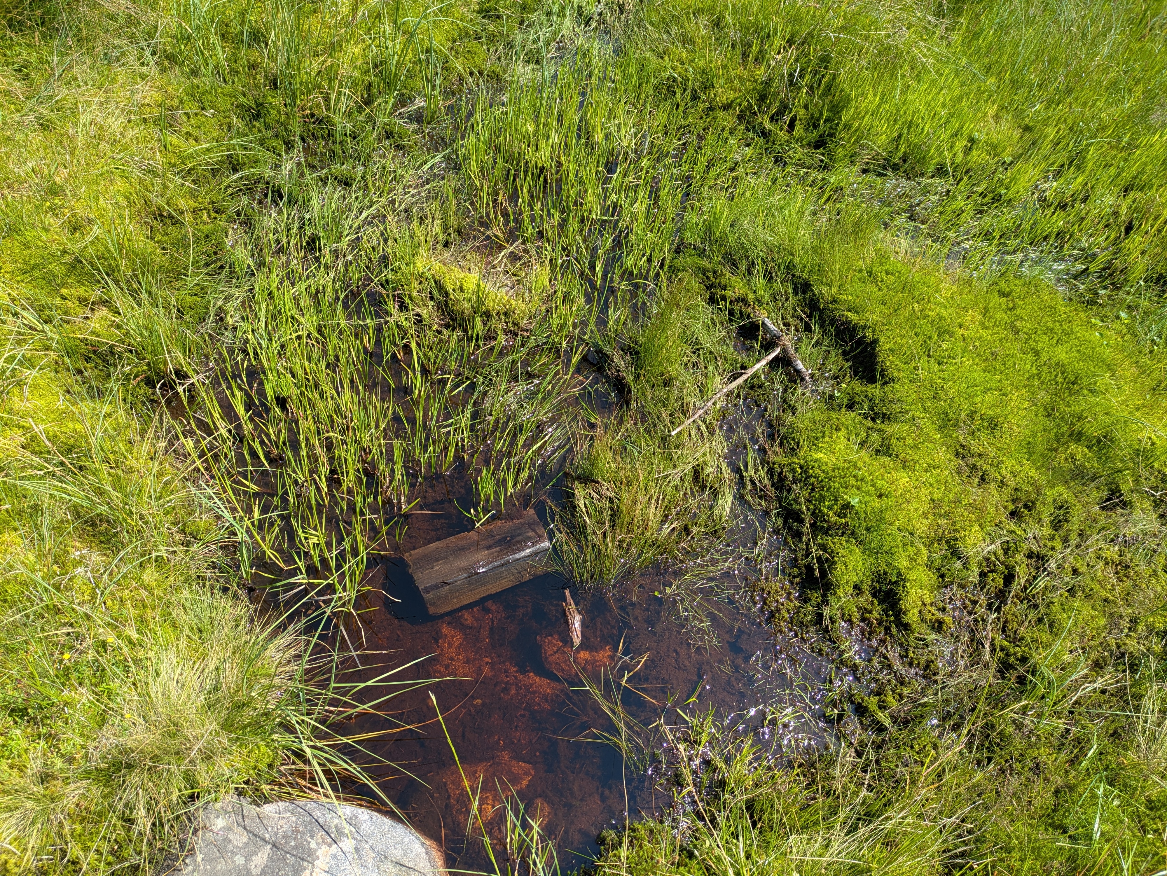
Wetlands
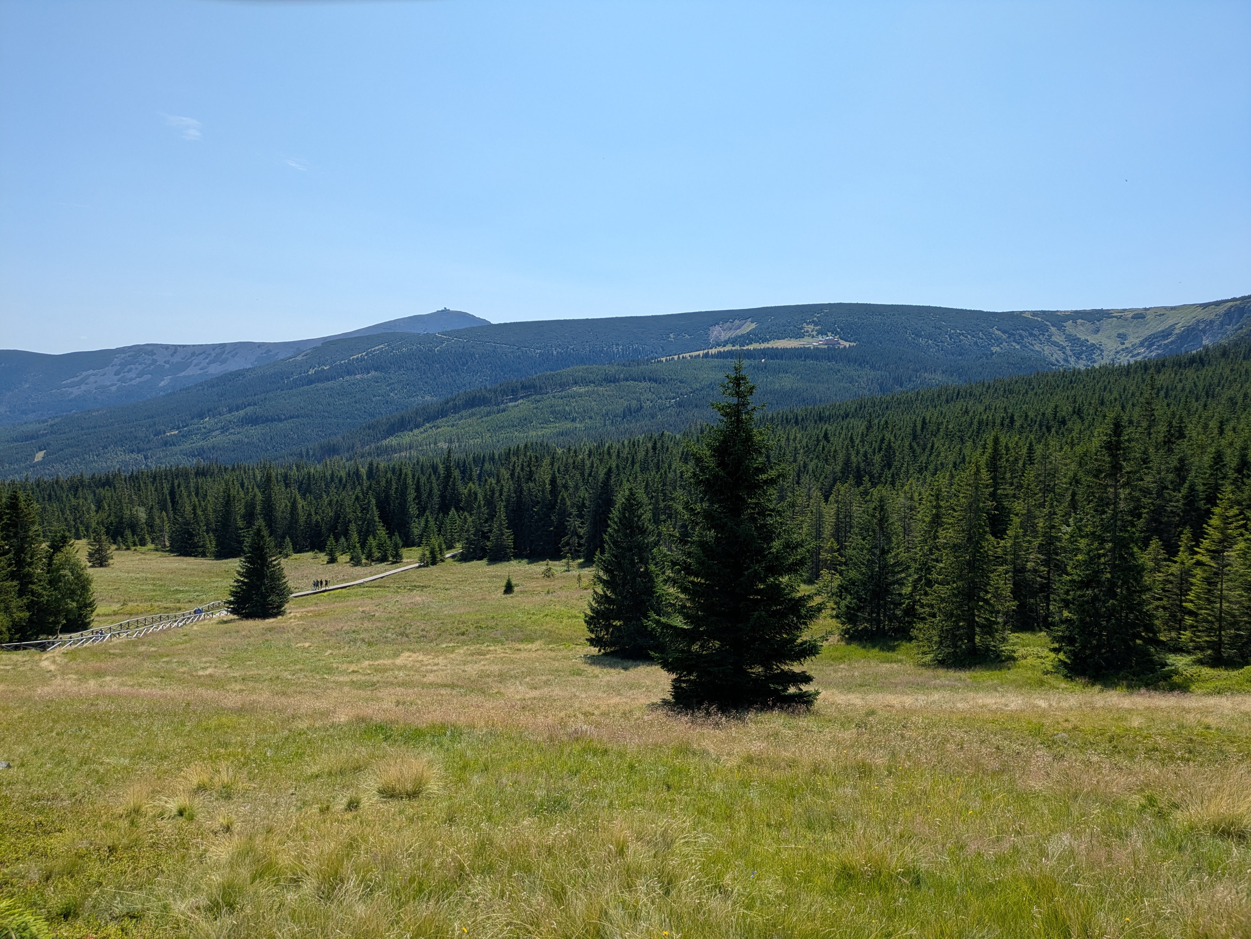
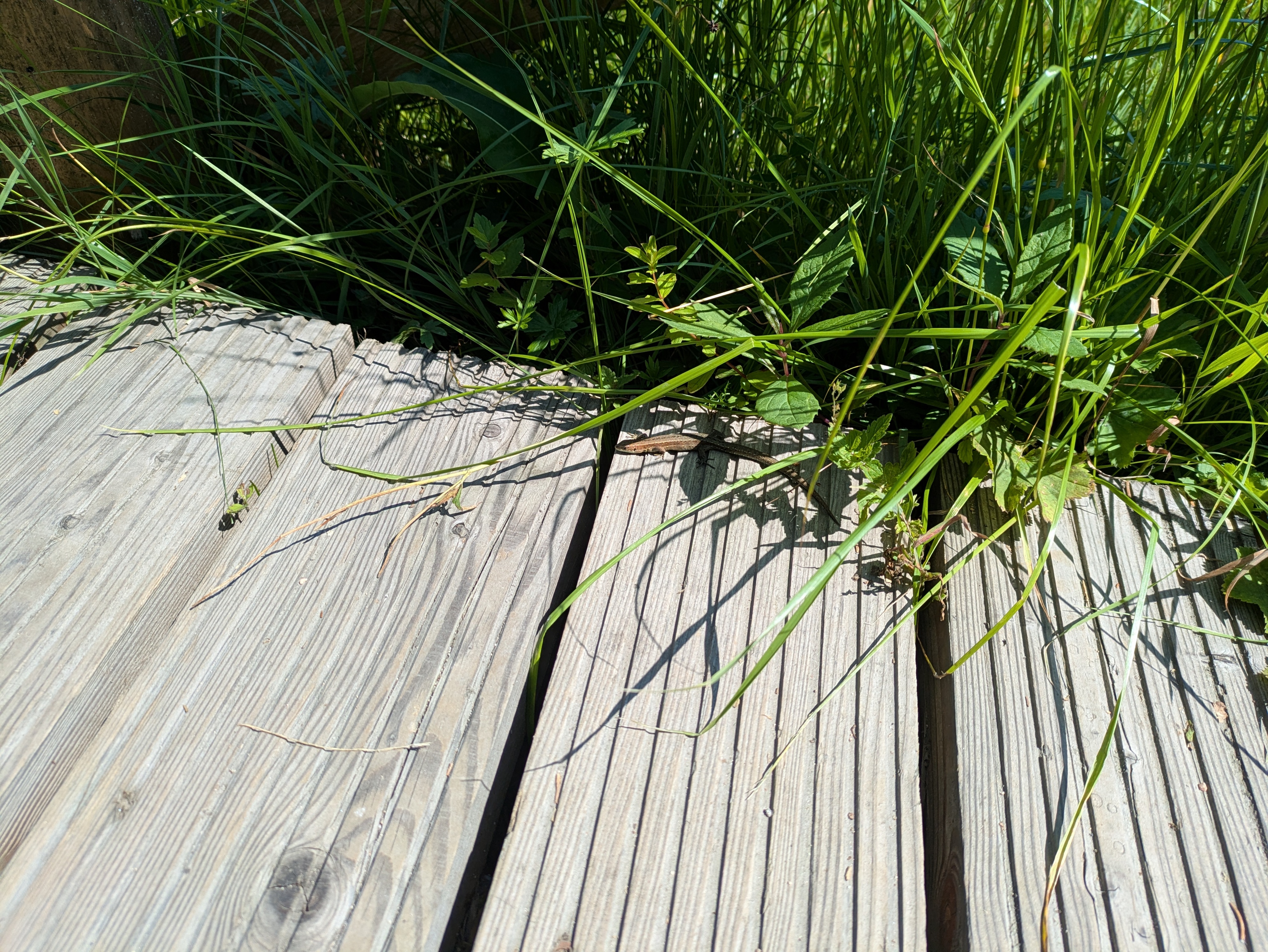
It's a wet, grassy and relatively plain area that seems to be fed exclusively by ground water. I don't quite know whether it's a fen, bog, or marsh, but probably something along those lines. There's the usual elevated wooden walkways to help you traverse it, and already some nice views across the mountainside. We also found a lizard who was enjoying the sun :)
Stones
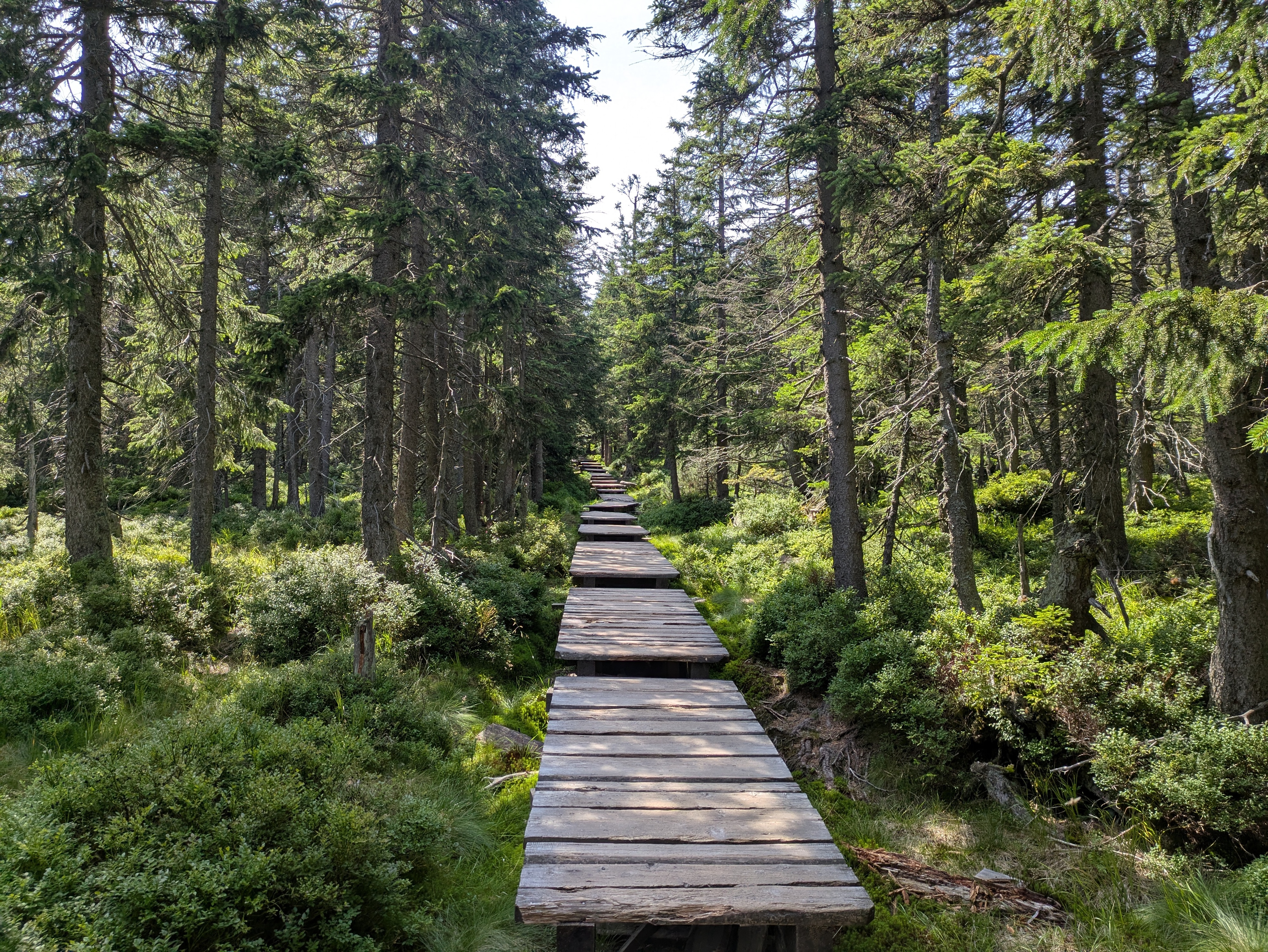
We followed the path towards the ridge of the mountain range, and passed quite a few notable granite structures. The path itself also grew more rocky and uneven, interleaved with wooden walkways that were decidedly in disrepair, featuring frequent occurences of broken or missing planks. It's a good idea to look where you're going, and not just take in the (gorgeous as usual) nature around you.
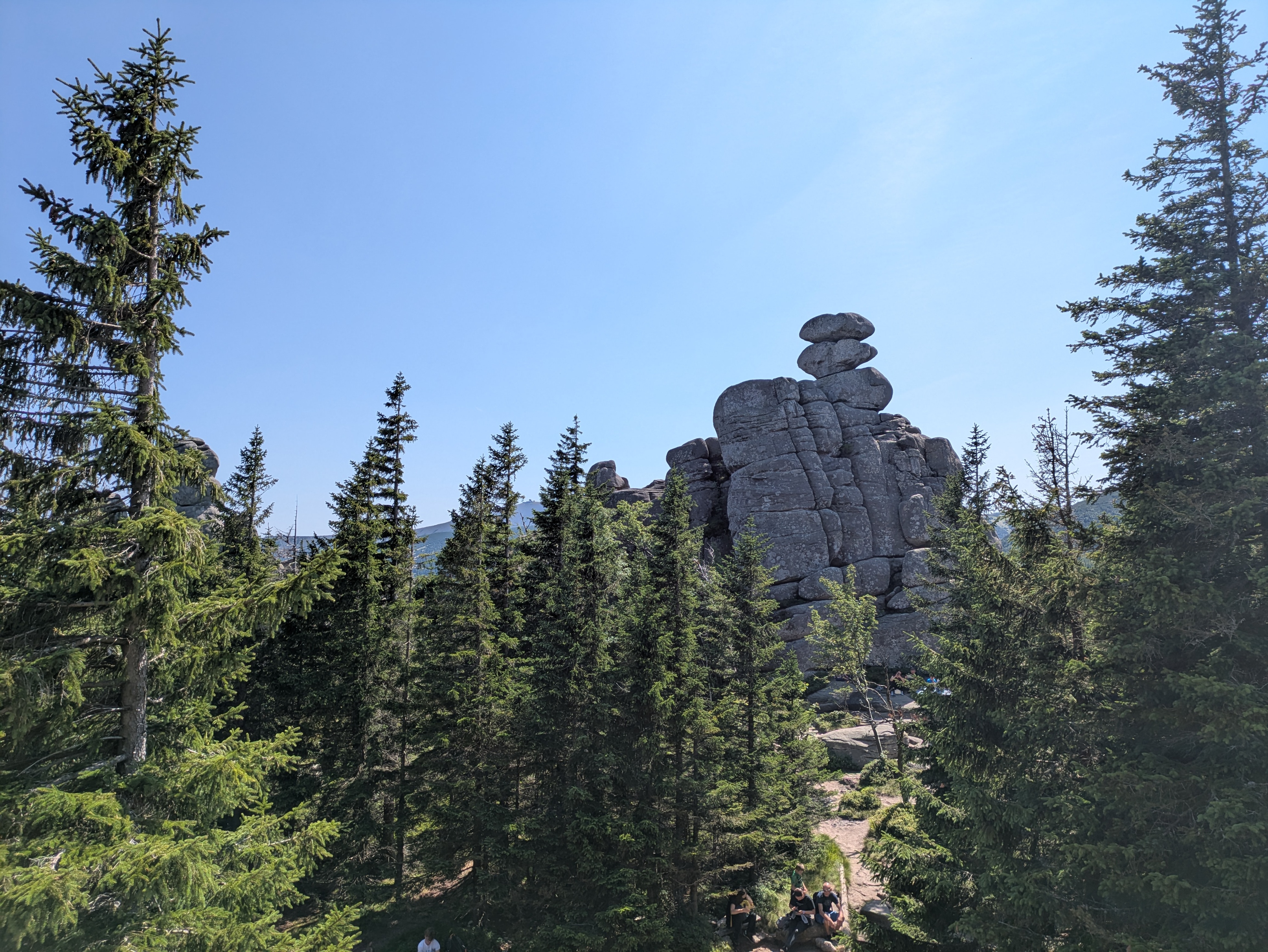
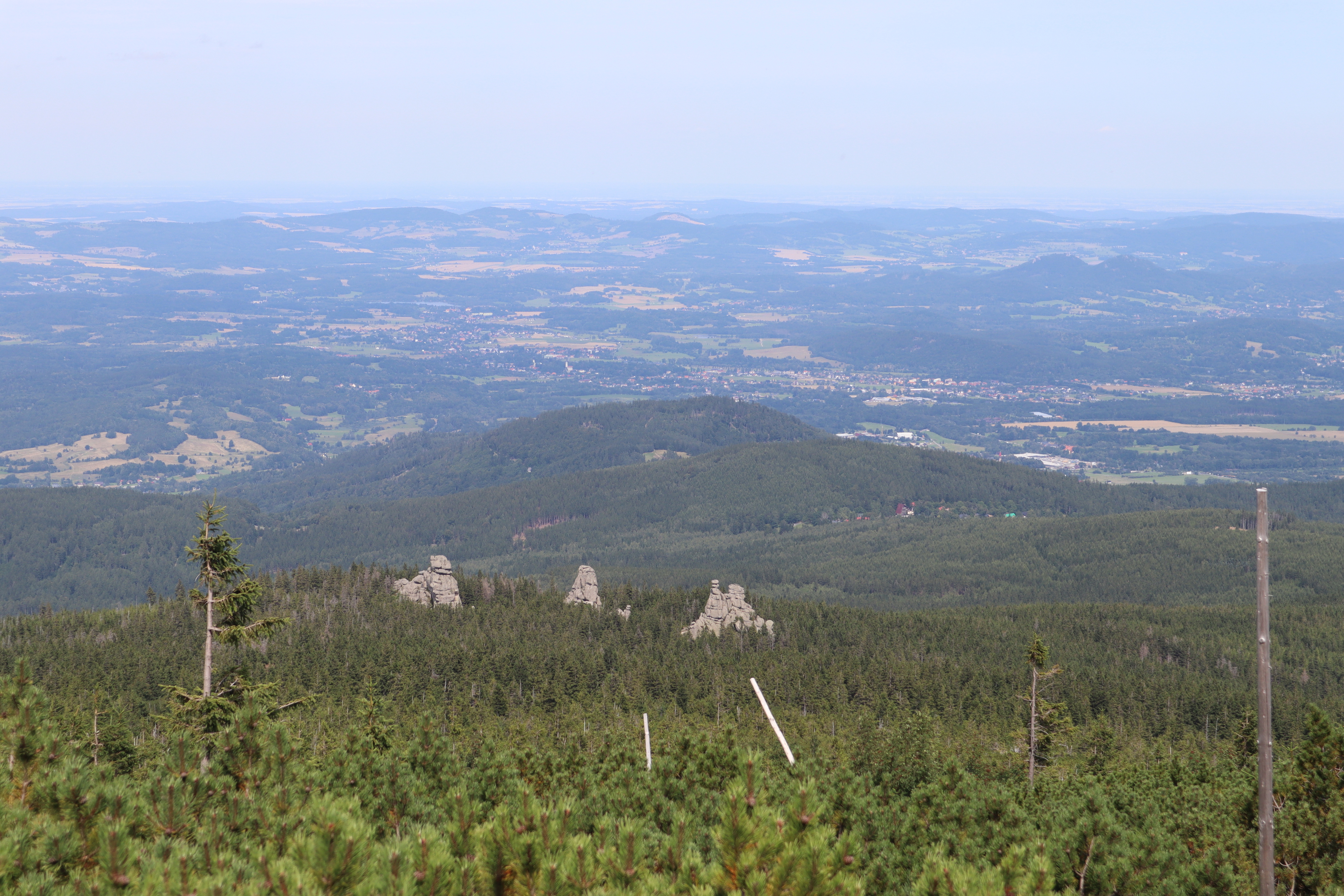
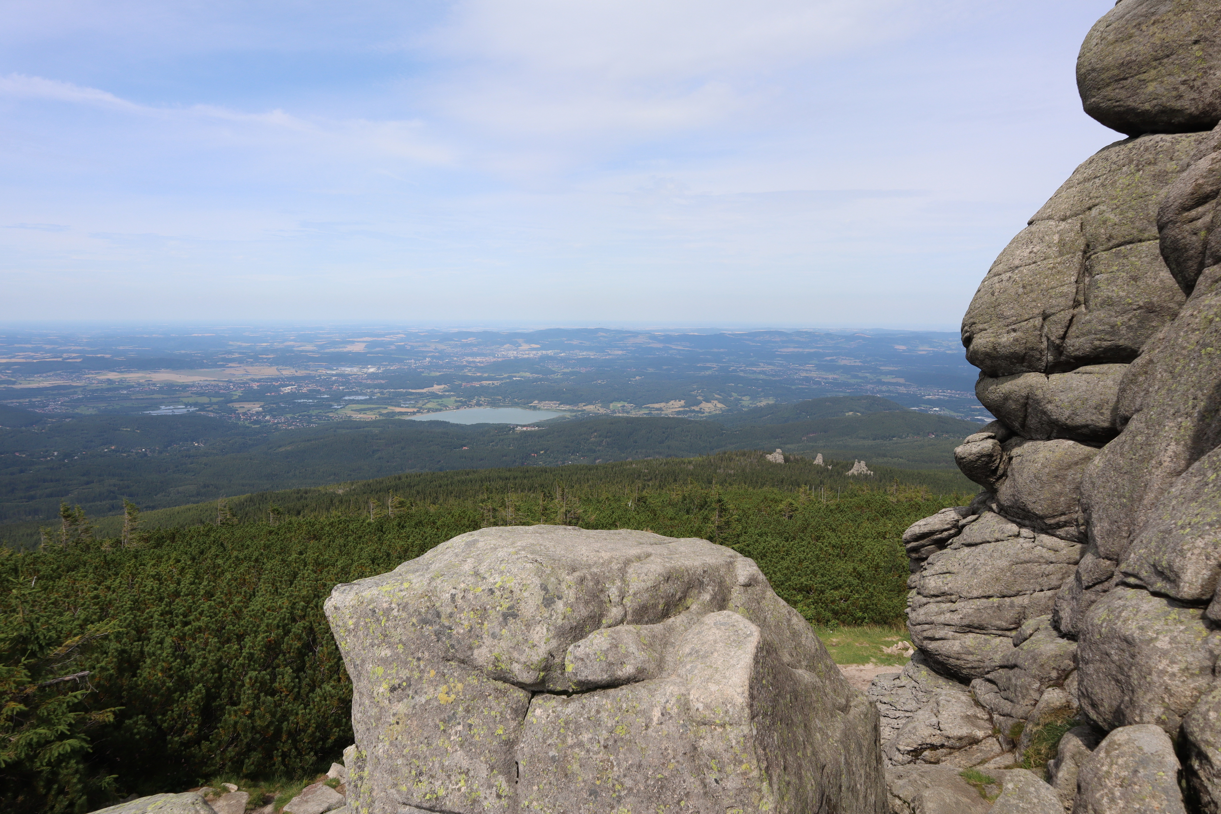
The first stone formation we passed were the Pielgrzymy (Pilgersteine / pilgrim's stones), with views towards Koci Zamek (Katzenstein / cat rock) below and Słonecznik (Mittagsstein / sunflower or noon rock, depending on whether you translate from Polish or German) above. One of them is apparently open for climbing, and if you do find a reasonably safe path up one of its plateaus, you are rewarded with a pretty nice view.
Going up further, we reached Słonecznik at around 15:00, but not before enjoying some more views down towards the valley. As Słonecznik itself was a bit crowded (though far less than Sněžka on the day before), I don't have any photos of it – see the Wikipedia link above for two samples. Just like Sněžka peak, it's also a good spot for some radio range tests, so we stayed for a bit.
Ponds
Słonecznik is also where the path up the ridge terminates, and you get to decide whether you want to take on the summits to the east or to the west. We opted for the east, which would lead us back towards Sněžka and Karpacz. As on the day before, the local groundwater frequently found its way onto the path. Apart from that, the path was relatively even, relatively easy terrain, and not too crowded. This seems to be a rather tame segment of the Krkonoše ridge line.
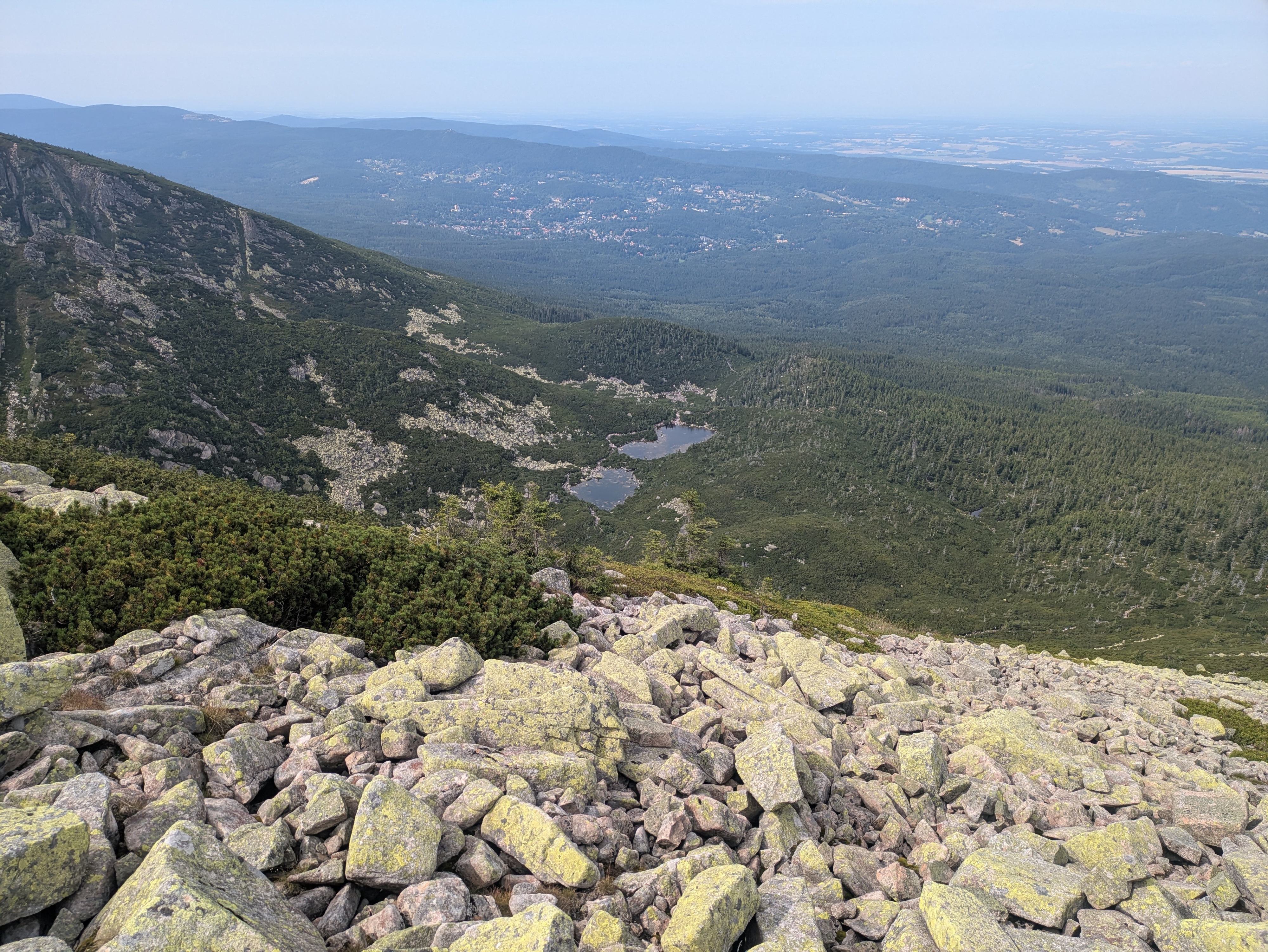
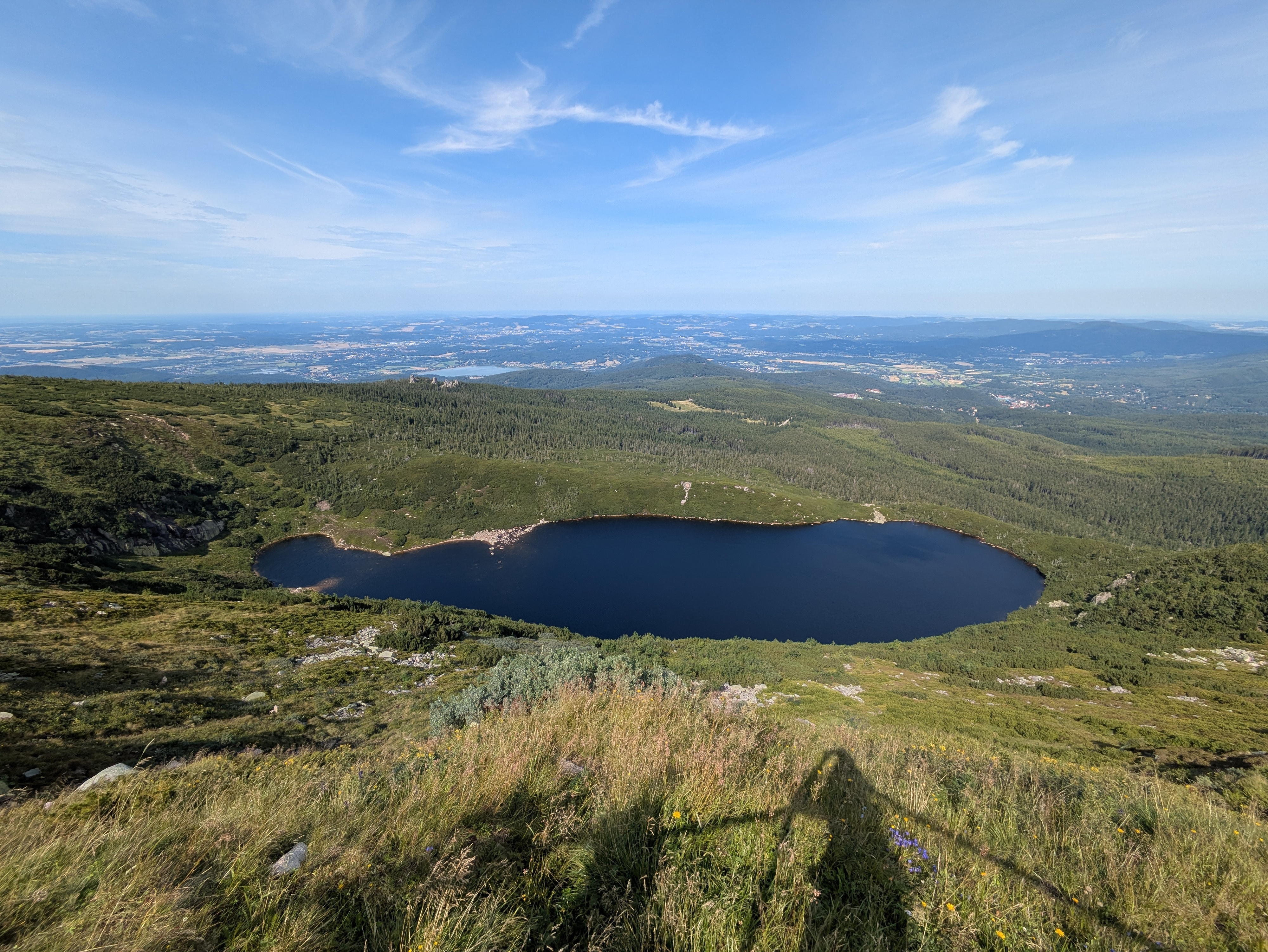
Before too long, we ended up above Wielki Staw (Großer Teich / large pond) and, a bit later, Mały Staw (Kleiner Teich / small pond). The water was quite calm, clear, and full of rocks that had fallen into it over time.
Descent
We decided to make our descent at Dom Śląski (Silesian house), a tad eastwards of the path we used for our ascent on the day before, hoping that it'd be less crowded. But before that, we got yet another view of Sněžka, which also seemed slightly less crowded than the day before – possibly because it was already quite late in the day (around 16:30), and the shadows were already growing longer by the minute.
Our descent took us from Dom Śląski down into the Kocioł Łomniczki (Melzergrund) valley, right along the Główny Szlak Sudecki (Sudeten-Hauptwanderweg / Main Sudetes Trail). Kocioł Łomniczki valley is a former glacier site, and as such the path starts out very steep and rocky.
It also features a memorial / symbolic graveyard for all those who passed away on the mountain. You may decide to hum the tune of the Celeste – Resurrections soundtrack at this point.
In any case, once you've made it past the steep part, you're rewarded with a chance to cool off your feet in the Łomniczka stream, and easy walking for the remaining hour or so to Karpacz.
As usual, our trip ended at around 19:00, and more photos are available at lib.finalrewind.org/Słonecznik 2025.
Krkonoše day 1: Sněžka (snow top) to Soví sedlo (owl pass)
This is the first of four posts about our 2025 vacation in the Giant Mountains (Krkonoše / Karkonosze), see Vacation in the Giant Mountaints for an introduction.
On our first full day, we decided to start with the most obvious target: Sněžka (snow top / Schneekoppe), the highest summit of the Giant Mountains (and also of the Sudetes mountain range and of the Czech Republic).
Starting near Karpacz train station (600m) at about 09:00, we took the Śląska Droga path from the outskirts of Karpacz (800m) to Biały Jar (1225m), which we reached at about 11:00. It's steep, but easy terrain, and seems to be the main tourist trail from Karpacz up to Sněžka: it wasn't exactly packed, but definitely crowded. As neither of us hike up mountains every day, we made frequent breaks along the way – there aren't too many (free) seats or benches, but plenty of stones that can serve as seats when needed.
Up next is a relatively even segment via the Zbyszek's upper aerial way station and Dom Śląski (Silesian house); we got there at about 12:15. The path already offers some nice views down into the Polish lowlands and towards Sněžka, and also seems to be quite popular. It's close to the timber line, and you can already see the vegetation getting smaller and more compact.
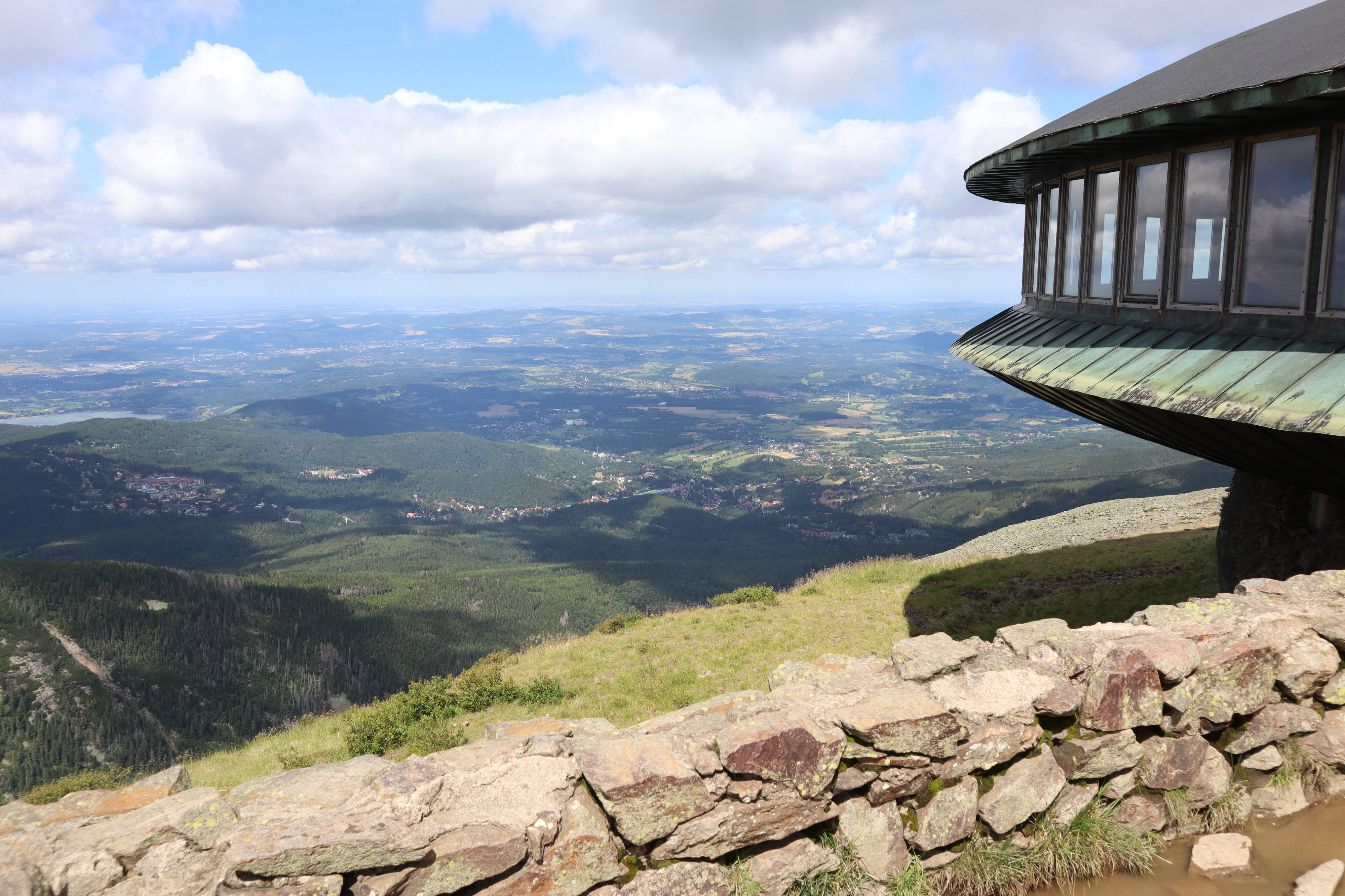
Finally, we took a segment of Droga Przyjaźni Polsko-Czeskiej (the Polish-Czech friendship trail) for the final serpentine climb up Sněžka (1603m). This is a pretty steep and stony one-way path; alternatively, Droga Jubileuszowa (Jubilee road) offers a less steep way up through better terrain. Droga Przyjaźni Polsko-Czeskiej definitely has the better views – you get to look into an unnamed and unpopulated Czech valley and can also see the next range of the Giant Mountains and the Czech lowlands behind it, as well as a plateau of the Giant Mountains to the west.
Sněžka itself was pretty crowded, but a good spot for radio experiments, so we stayed there from about 13:00 to 13:50. The views are nice, but the paths around it are more interesting. The Sněžka peak sits comfortably above the timber line, so there is hardly anything growing there at all.
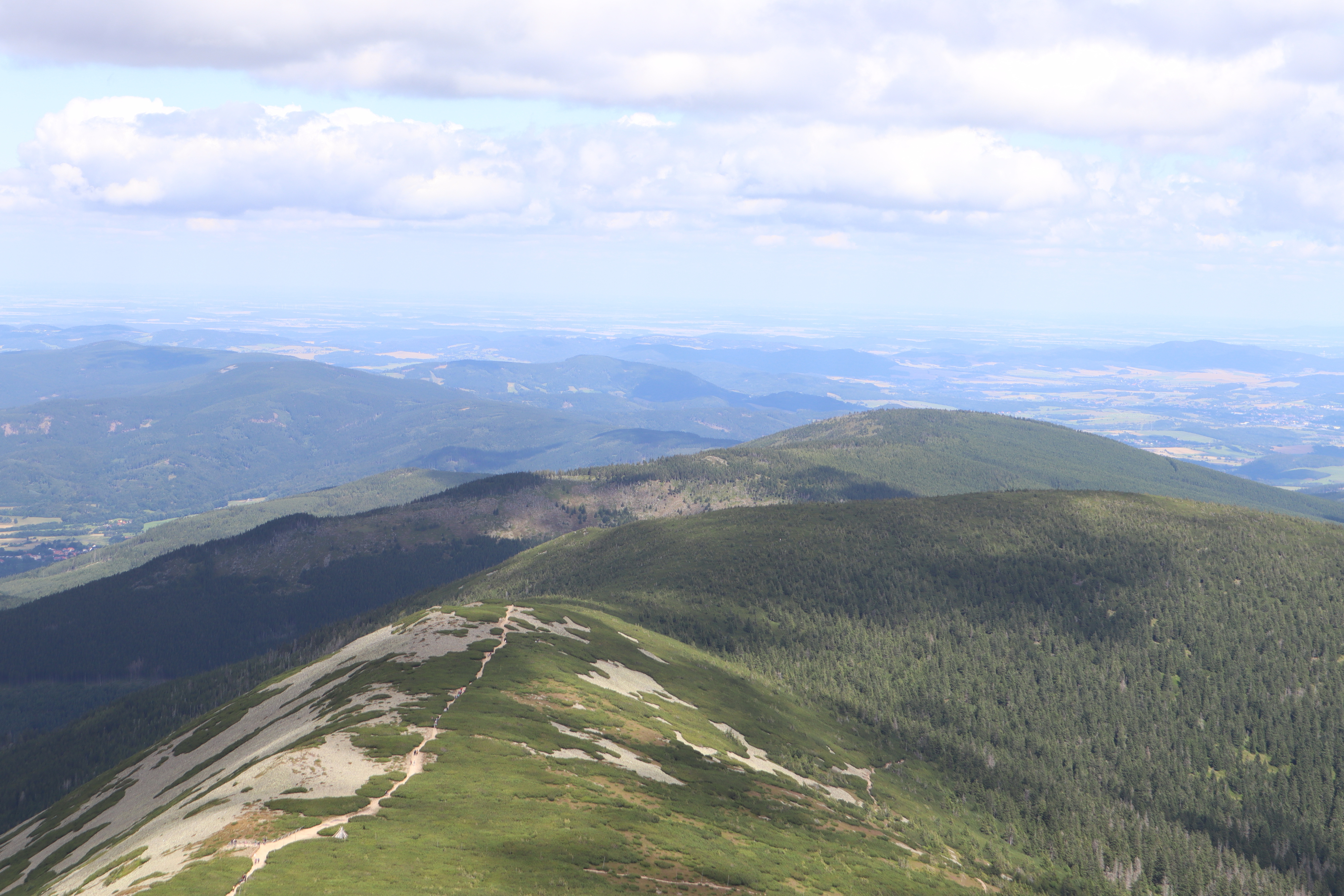
We quickly scrapped our original plan of returning via Śląska Droga, and instead chose to follow Droga Przyjaźni Polsko-Czeskiej to the east until we'd find the next path down to Karpacz at Soví sedlo / Sowia Przełęcz (owl pass / Eulenpass). This turned out to be an excellent idea – the path was far less busy, and really drove home just how much a few dozen metres of ascent or descent affect the height of the vegetation next to the path. As the trail largely follows the Czech–Polish border, you'll frequently pass border stones.
Also, the views back to Sněžka and to either side are, unsurprisingly, very good.
We reached Soví sedlo / Sowia Przełęcz (owl pass / Eulenpass) at about 15:20. The way back to Karpacz took us through a valley next to the Płomnica (Plagnitz) stream and was easily as steep as the ascent towards Biały Jar and Sněžka, just with a bit more serpentine segments and less even surfaces. There's lots of fruit growing in the upper parts of the path, and plenty of water (including on the trail itself) further down.

We returned to our room near Karpacz train station at about 18:30. More photos are available at lib.finalrewind.org/Sněžka 2025.
In early August 2025, dm2lct and I spent a few days in the Giant Mountains (Krkonoše / Karkonosze) at the Czech/Polish border. Specifically, we booked a room in Karpacz, a town at the foot of the Sněžka, which happens to be the highest summit of the Giant Mountains (and also of the Sudetes mountain range and of the Czech Republic).
The Giant Mountains are absolutely worth a visit – we've been there for four days and I feel like we've seen quite a lot, but certainly not all of the diverse landscapes and views they have to offer. Just note that, unless you want to take one of the few lifts scattered throughout the mountain range, you'll have to climb 700 to 1,000 metres each day depending on where you are staying and where you are going.
I'll write separate blog post for each of the four days (i.e., for each of the four summits / parts of the mountain range that we visited during our stay). This one just serves as a documentation of arrival, departure, and some notes on Karpacz and the Karkonosze National Park (Karkonoski Park Narodowy / KPN) in general.
Arrival
There is a connection from Dresden to Karpacz every other hour, and the entire trip takes about four hours when everything goes well. In our case, we started with a delayed bus to Bautzen, thus leading to a far longer layover in Görlitz than anticipated. Görlitz is absolutely worth a visit though, so no harm done.
- Trilex RE1 Bautzen (11:16) → Görlitz (11:50)
- KD D19 Görlitz (13:39) → Jelenia Góra (15:15)
- KD D62 Jelenia Góra (15:32) → Karpacz (15:56)
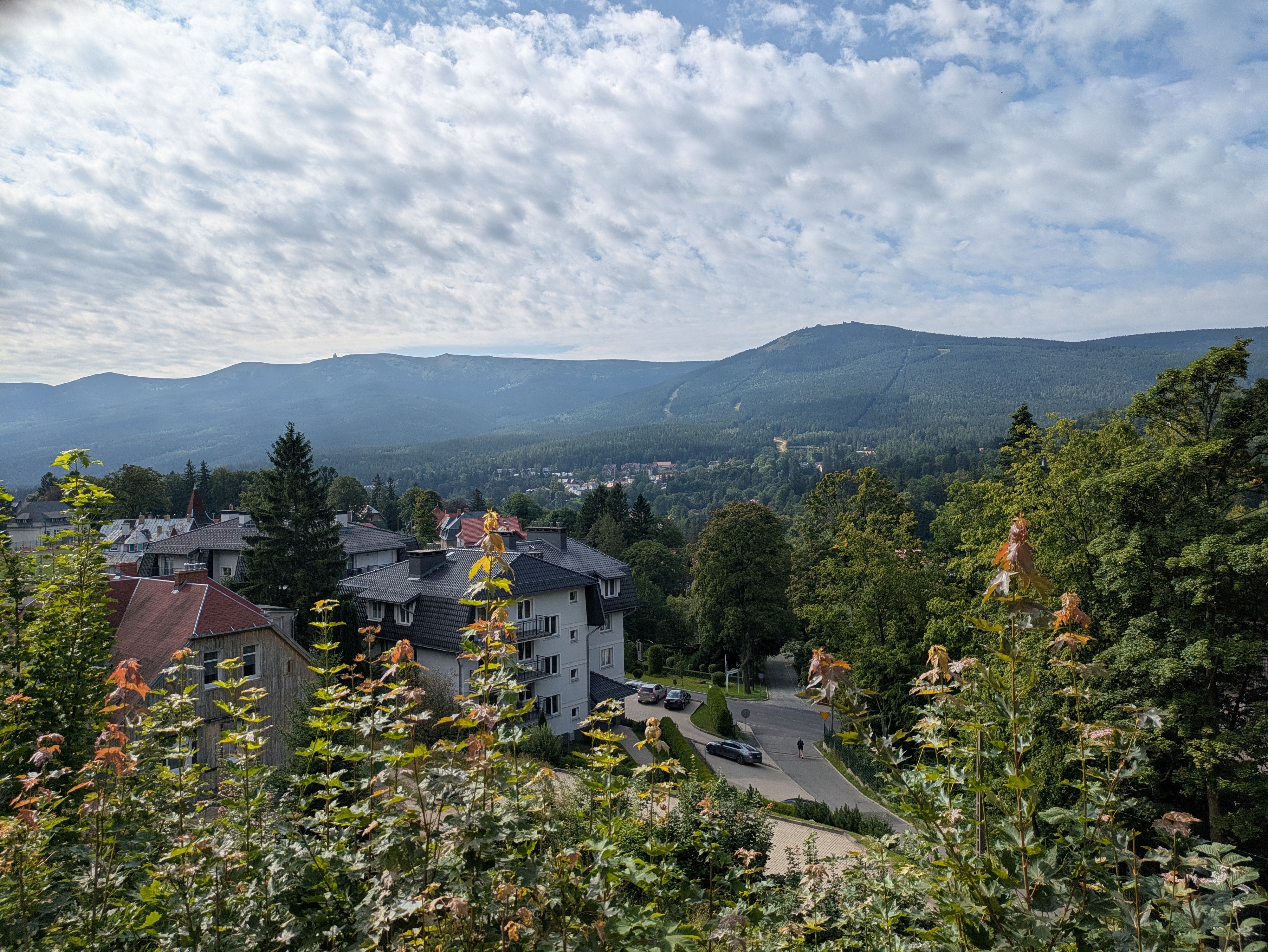
Karpacz
Karpacz looks like a pretty typical Polish tourist town. It offers plenty of hotels, pensions, and more simplistic renting options, and also plenty of restaurants and kitsch. There are two supermarkets close to the train station, and a few more scattered throughout the remainder of the city. Note that most restaurants close between 20:00 and 22:00, so you should not wait too long in case you still want to have a warm meal after a day of hiking up and down the mountains.
On the language side, learning some Polish beforehand is a good idea. In our case, some remnants of school Polish and a dictionary on the smartphone were sufficient most of the time. At least a few people also speak at least a little bit of English; we didn't try German.
Karkonoski Park Narodowy (KPN)
The entire Polish side of the giant mountains is covered by a national park, entry to which costs 8 to 11 Złoty (about 2 €) per day and person, depending on whether you buy a single-, two-, or three-day pass. Especially on the popular tourist trails, you will find staff selling tickets at one of the entrances to the park – of course, you can pay by card, even at 1,000m above sea level. You also have the option of buying day passes online and then presenting those on your smartphone or as a print-out. The trails inside the park are mostly well-kept and seem like the upkeep isn't that cheap, so overall, I'd say the fee is justified.
We did not encounter any ticket checks inside the park or on the way out, and there were also no ticket checks (or sales) on the ridges and peaks, which frequently criss-cross between Poland and the Czech Republic. So, if you're entering the Giant Mountains from the Czech side, you probably don't need a ticket even if you enter KPN area every now and then.
Departure
Due to several Nazi demos in Bautzen, we were not too keen on taking Trilex RE1 on the way back. As the line to Tanvald / Liberec was closed as well, we instead opted for the long way round: Karpacz → Sędzisław → Trutnov → Praha → Děčin → Bad Schandau → Dresden. This took the better part of the day and was absolutely worth it.
- KD D62 Karpacz (06:52) → Jelenia Góra (07:15)
- KD D6 Jelenia Góra (07:22) → Sędzisław (07:49)
- KD D26 / Os 25425 Sędzisław (07:58) → Trutnov střed (08:45)
- ČD R10 “Krkonoše” Trutnov střed (08:47) → Praha hlavní nádraží (11:42)
- ČD R20 “Labe” Praha hlavní nádraží (14:45) → Děčin (16:33)
- RB U28 Děčin (16:41) → Bad Schandau (17:11)
- S1 Bad Schandau (17:14) → Dresden Hbf (17:58)
The whole endeavour cost us about 60 € (about 30€ per person):
- Karpacz → Jelenia Góra: – (vending machine was broken and the conductor didn't know how to sell cross-country tickets, so we got to travel for free)
- Jelenia Góra → Královec: 40 PLN (about 10€)
- Královec → Trutnov: 102 CZK (4.20 €)
- Trutnov → Děčin: 999 CZK (41.13 €)
- Děčin → Schöna: 80 CZK (about 4 €)
- Schöna → Dresden: Deutschlandticket
Also, I'd like to note that the official České Dráhy app (Můj vlak) is easily the best official railway app I've ever used. It has detailed and up-to-date information about trains, free/reserved seats, delays / disruptions / construction sites, and anything else you need. Also, despite booking a conventional day ticket for two adults that was not even bound to specific trains, we were able to reserve seats on R10 and R20 free of charge. Rail travel in Poland doesn't even come close.
Sędzisław → Trutnov
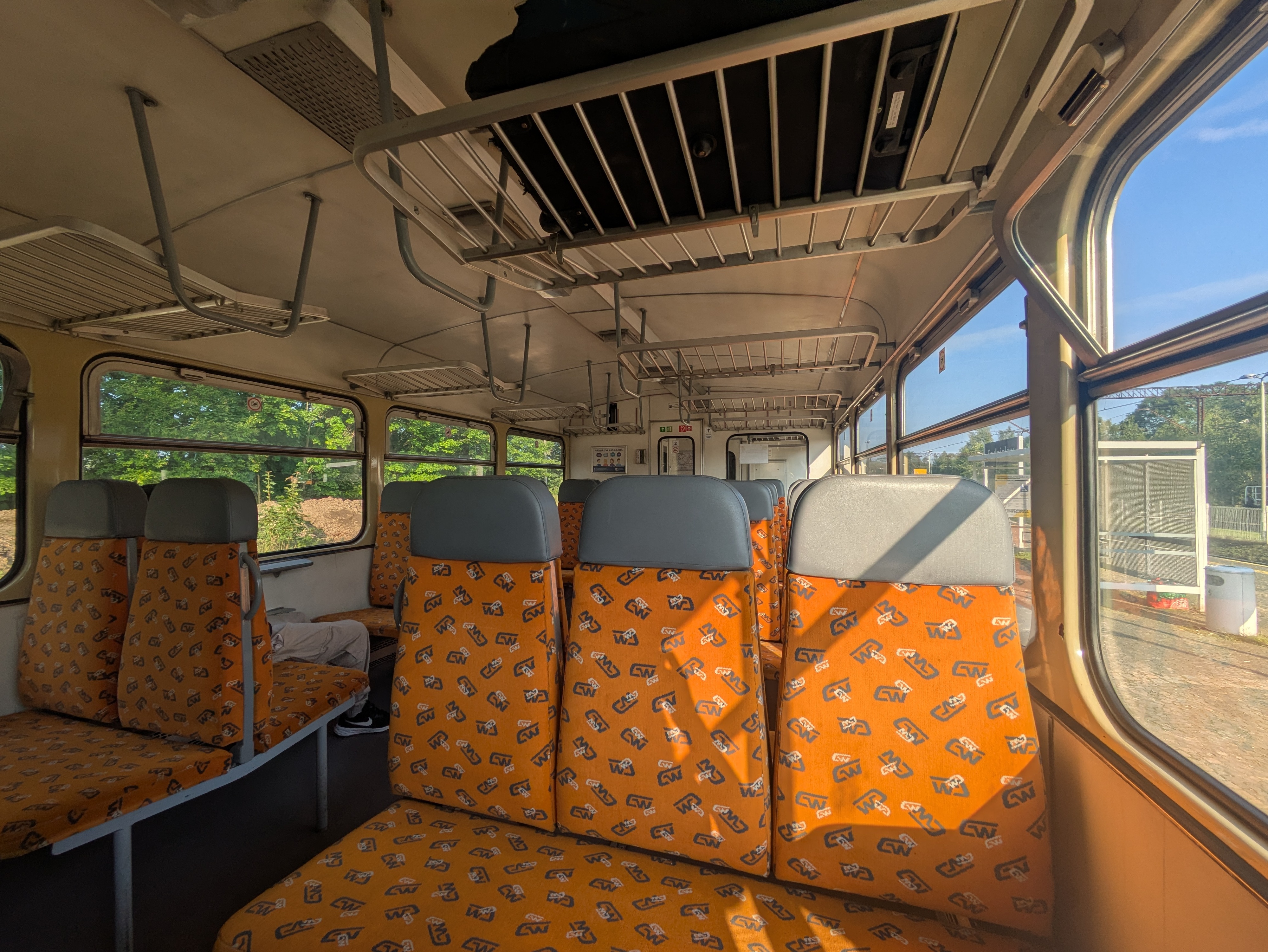
We did not look up the rolling stock beforehand, and were positively surprised when we encountered a ČSD M 152.0 (“Brotbüchse”) on the cross-border line from Poland to the Czech Republic. It's a single-carriage Diesel train, using a conventional omnibus motor, and was pretty empty – at least on the early Sunday morning at which we were travelling. It's not exactly modern or fast, but does its job and got us to Trutnov almost in time. From a nostalgia point of view, this was quite the jackpot.
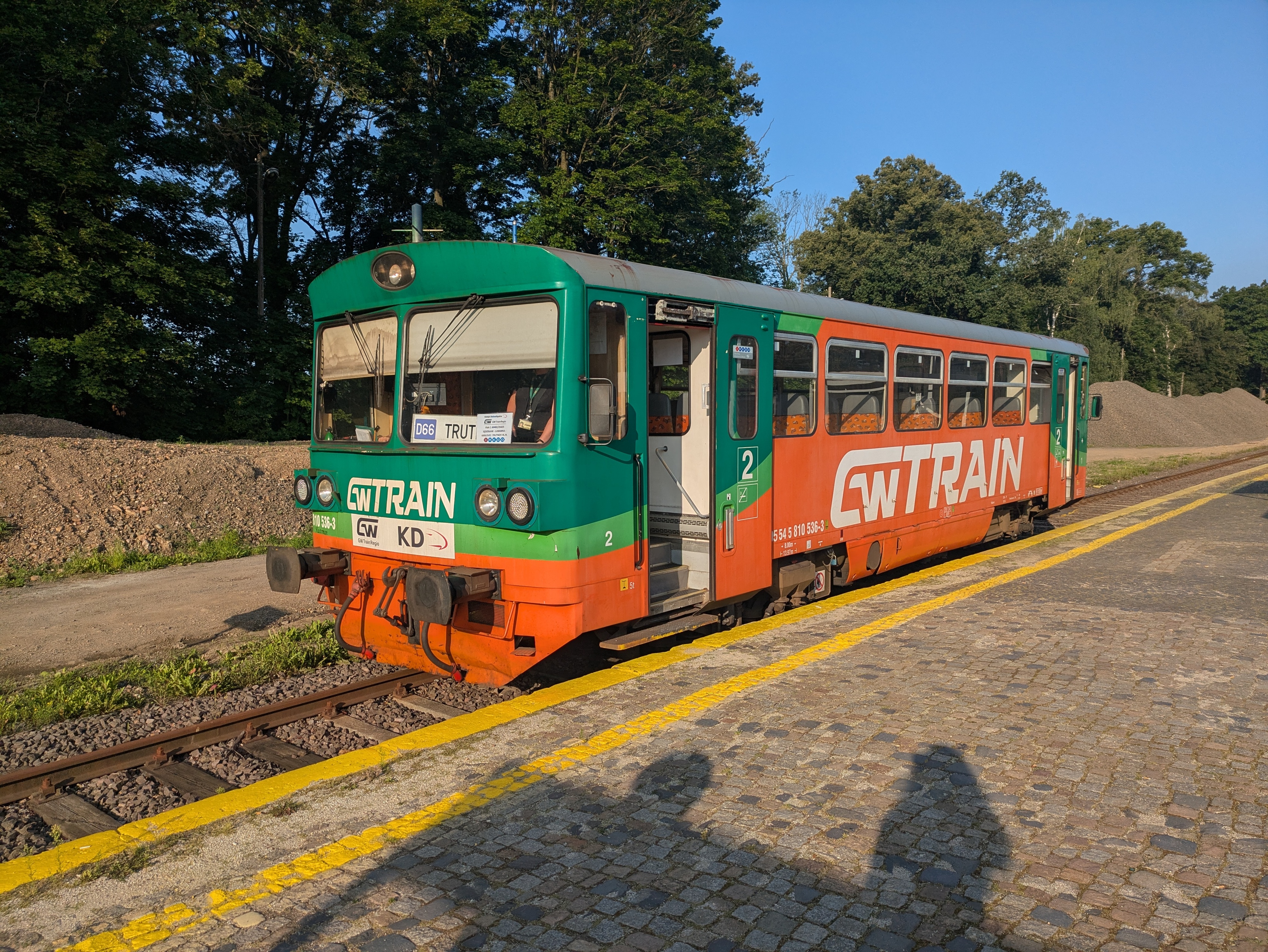
Luckily, the layover in Trutnov střed happens before a single-track segment, with the train from Sędzisław coming from the segment that the R10 to Praha has to pass after departure. hence, although our train from Poland had two minutes of delay, the R10 was waiting for us on the same platform and we could still board it. I have no idea whether this connection always works that well.
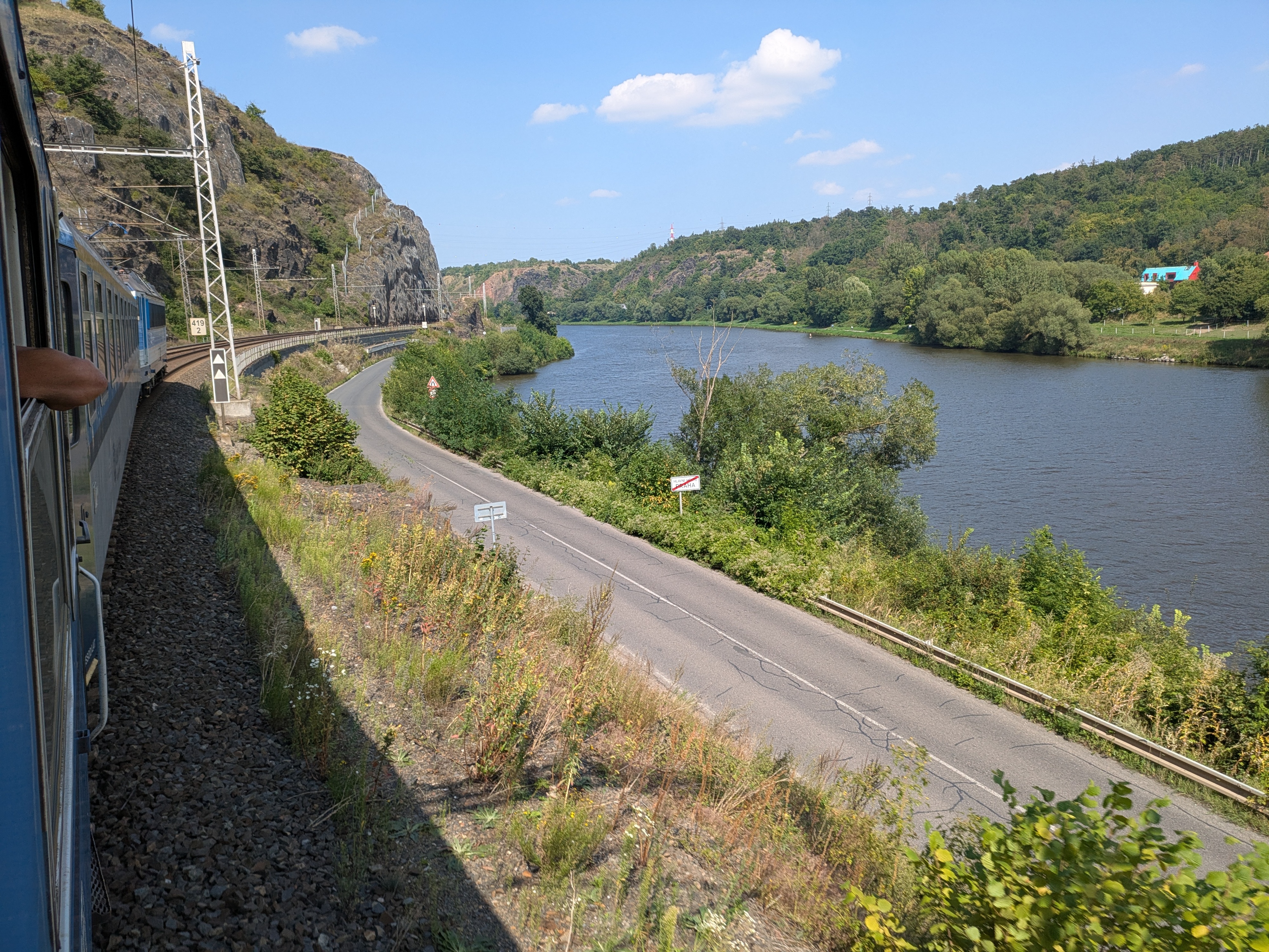
Praha → Děčin
Our ticket would have allowed us to take a EuroCity, but dm2lct specifically suggested the R10 line. As of 2025, its rolling stock still includes a luggage wagon that contians four 8-person compartments – and features windows that you can actually open. You hardly ever see that anymore these days, so taking this train on the way back also was quite a treat. The noise at an open window can be deafening at times, though – both the wheels and the brakes are anything but quiet, especially when walls or rocks next to the tracks reflect their noise back towards the train.
Enabling Filesystem Quotas on Debian
Because I keep forgetting how I do it, here's how to enable filesystem quotas on a reasonably recent Debian server.
For simplicity, let's say the mountpoint is /home and the device /dev/storage/home.
sudo apt install quota
- Add
usrquotaas a mount option to the/etc/fstabfor/home
sudo systemctl daemon-reload
sudo umount /home
sudo tune2fs -O quota /dev/storage/home
sudo mount /home
For usrquota alone, a remount should be sufficient, but tune2fs needs to run offline in this case.
Now, all that's left is setting quotas.
This only needs to be run once for each new account, preferable automatically as part of some kind of account management system.
setquota -u account block-soft block-hard inode-soft inode-hard /home
You can check quota settings and usage with repquota -as.
Installing Debian on a ThinkPad T14s Gen 6 with Intel CPU
When setting up my new work laptop (replacing the more than eight years old X270 that I used before), I found that the freshly installed Debian unstable was unable to produce any kind of graphics output. X11 complained about not finding any screens, and the text console also broke as soon as the kernel tried configuring it. Long story short: Turns out that Linux 6.12, as shipped with Debian unstable, is simply too old for Intel Arc 130V/140V graphics and/or Intel Lunar Lake / Core 258V CPUs. With Linux 6.14, everything works right out of the box.
Luckily, you can just install Ubuntu kernels on Debian. So, solving this issue was as simple as issuing the following commands:
wget \
  https://kernel.ubuntu.com/mainline/v6.14/amd64/linux-headers-6.14.0-061400-generic_6.14.0-061400.202503241442_amd64.deb \
  https://kernel.ubuntu.com/mainline/v6.14/amd64/linux-headers-6.14.0-061400_6.14.0-061400.202503241442_all.deb \
  https://kernel.ubuntu.com/mainline/v6.14/amd64/linux-image-unsigned-6.14.0-061400-generic_6.14.0-061400.202503241442_amd64.deb \
  https://kernel.ubuntu.com/mainline/v6.14/amd64/linux-modules-6.14.0-061400-generic_6.14.0-061400.202503241442_amd64.deb
sudo apt install \
  ./linux-headers-6.14.0-061400_6.14.0-061400.202503241442_all.deb \
  ./linux-headers-6.14.0-061400-generic_6.14.0-061400.202503241442_amd64.deb \
  ./linux-modules-6.14.0-061400-generic_6.14.0-061400.202503241442_amd64.deb \
  ./linux-image-unsigned-6.14.0-061400-generic_6.14.0-061400.202503241442_amd64.deb
The new kernel version is automatically picked up by GRUB, so one reboot later everything worked as intended.
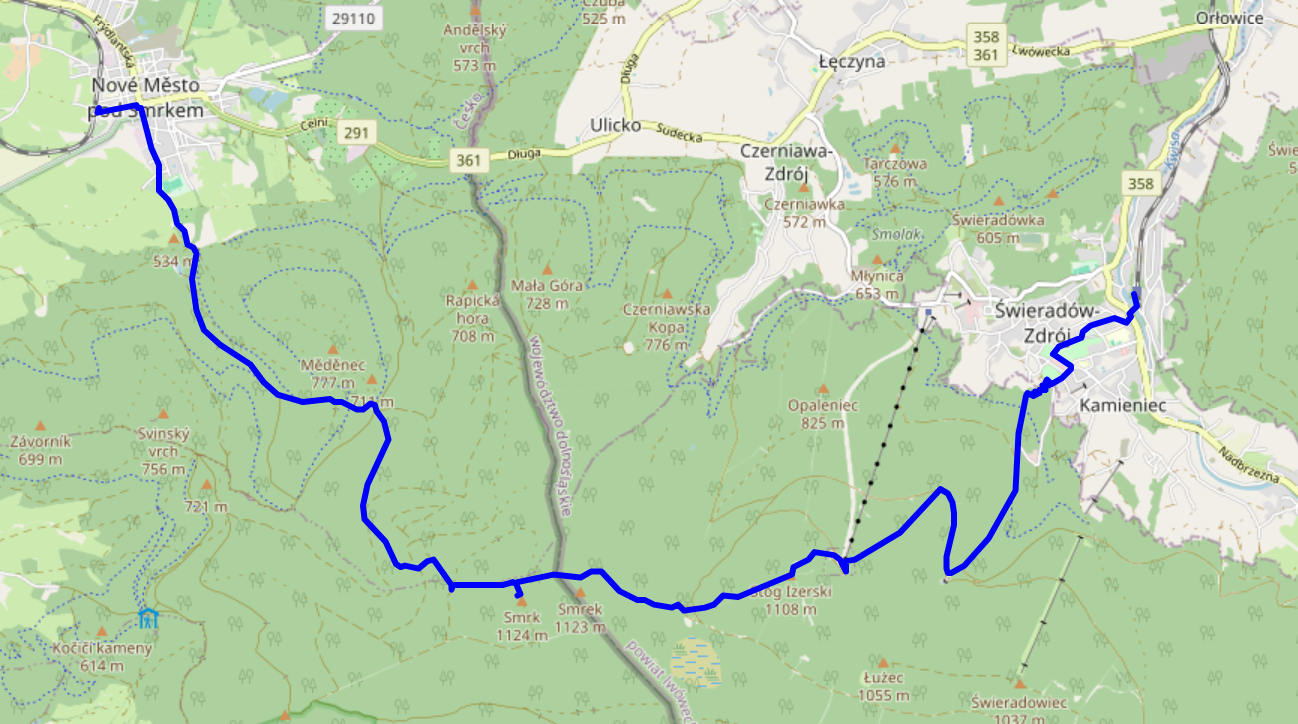
In late May 2025, dm2lct and I hiked across the Jizera mountains (CZ: Góry Izerskie / PL: Jizerské hory / DE: Isergebirge), right at the Czech – Polish border. It's a very nice hike with some stunning views, and doable as a single-day trip from and back to Dresden – even with rail replacement services here and there. Just note that you might want to wear water-tight boots – at least when we were up there, the majority of hiking trails on the summit were actually water streams.
See jizera-mountains.gpx for the approximate route we took. Note that I traced it after the fact, as we did not use GPS logs on our hike.

Arrival
We decided to start our climb from Świeradów-Zdrój (DE: Bad Flinsberg) on the Polish side of the mountains. We did have to get up at a slightly ungodly hour, but that was definitely worth it.
- TL RB60 Dresden Hbf (06:53) → Görlitz Hbf (08:33) – Deutschlandticket
As the direct connection to Zgorzelec was closed, apparently due to issues related to the German/Polish language level of the train drivers, the route to Świeradów-Zdrój included a nice little 50-minute detour through the twin towns of Görlitz and Zgorzelec. I think I'll come back for a proper visit to Görlitz old town on a later day. It even has a small tram network! Zgorzelec train station is quite cozy as well, featuring a small café right next to the waiting room.
- KD 69874 Zgorzelec (09:44) → Świeradów-Zdrój (10:55) – 18.75 PLN (4.45 €) each
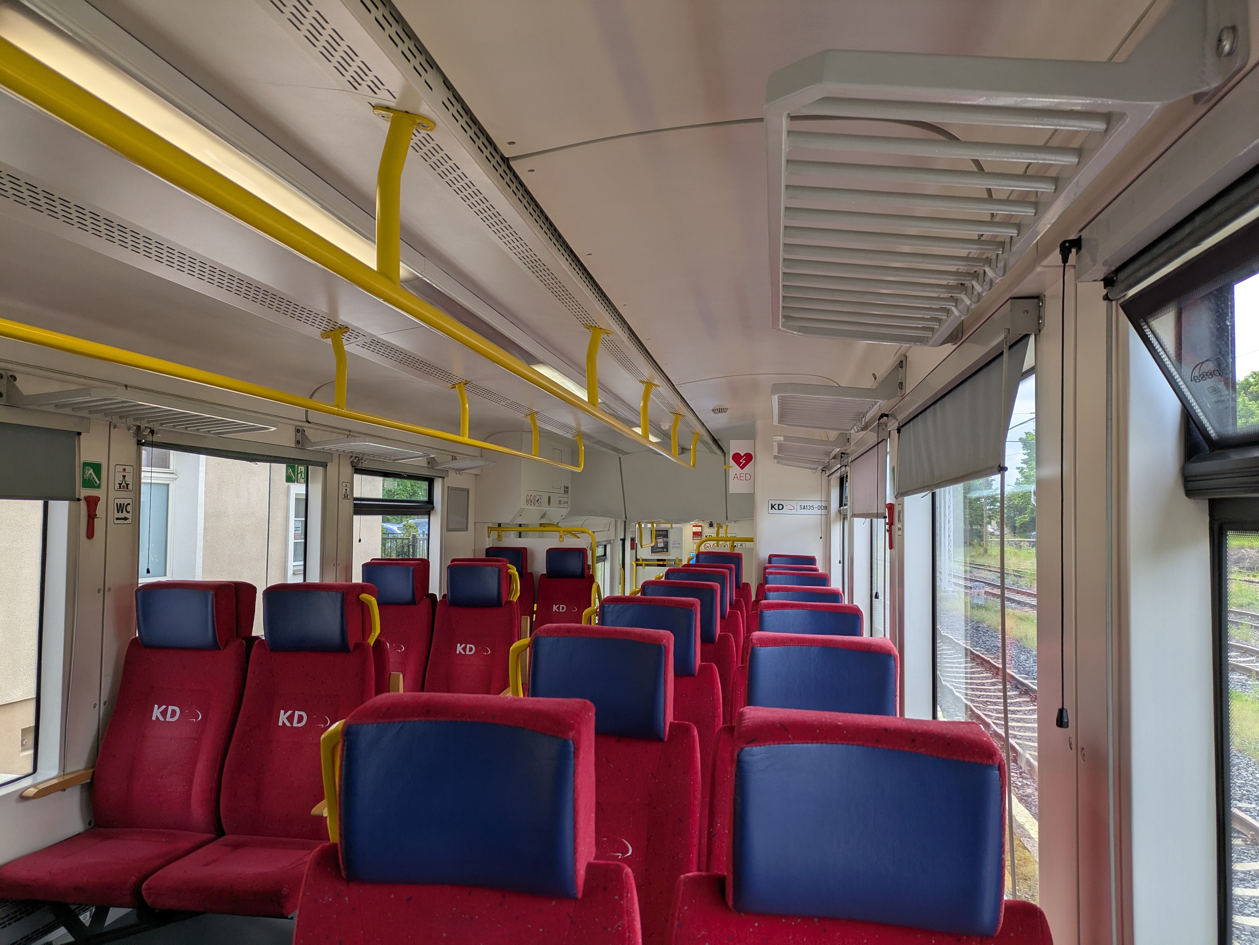
The tracks in Poland had very noticeable rail joints – and a tight curve in Lubań actually mannaged to topple our water bottle. Apart from that, it's a pretty standard Diesel train connection, ending at the single-platform terminus in Świeradów-Zdrój.
Going Up
Świeradów-Zdrój sits about 500 metres above sea level; the Jizera and Smrk peaks clock in at 1,107 and 1,124 metres, respectively. There's a cabin lift to Stóg Izerskie (DE: Heufuder) situated about a kilometre from the train station, seemingly operating year-round, but walking certainly is the more interesting option.
After a few hundred metres through the town itself, you're faced with two options: a (partially serpentine) road, or a more direct (and, thus, steep) gravel-rock-ish path. We chose the latter option, which seems to be marked with a red-on-white stripe.
The path was mostly dry, except for a short segment near the Świeradówka reservoir that basically consisted of walking through a sometimes stony and sometimes just outright muddy water stream. That segment is not mandatory: an asphalt road offers the same way up with a slight (but dry) detour.
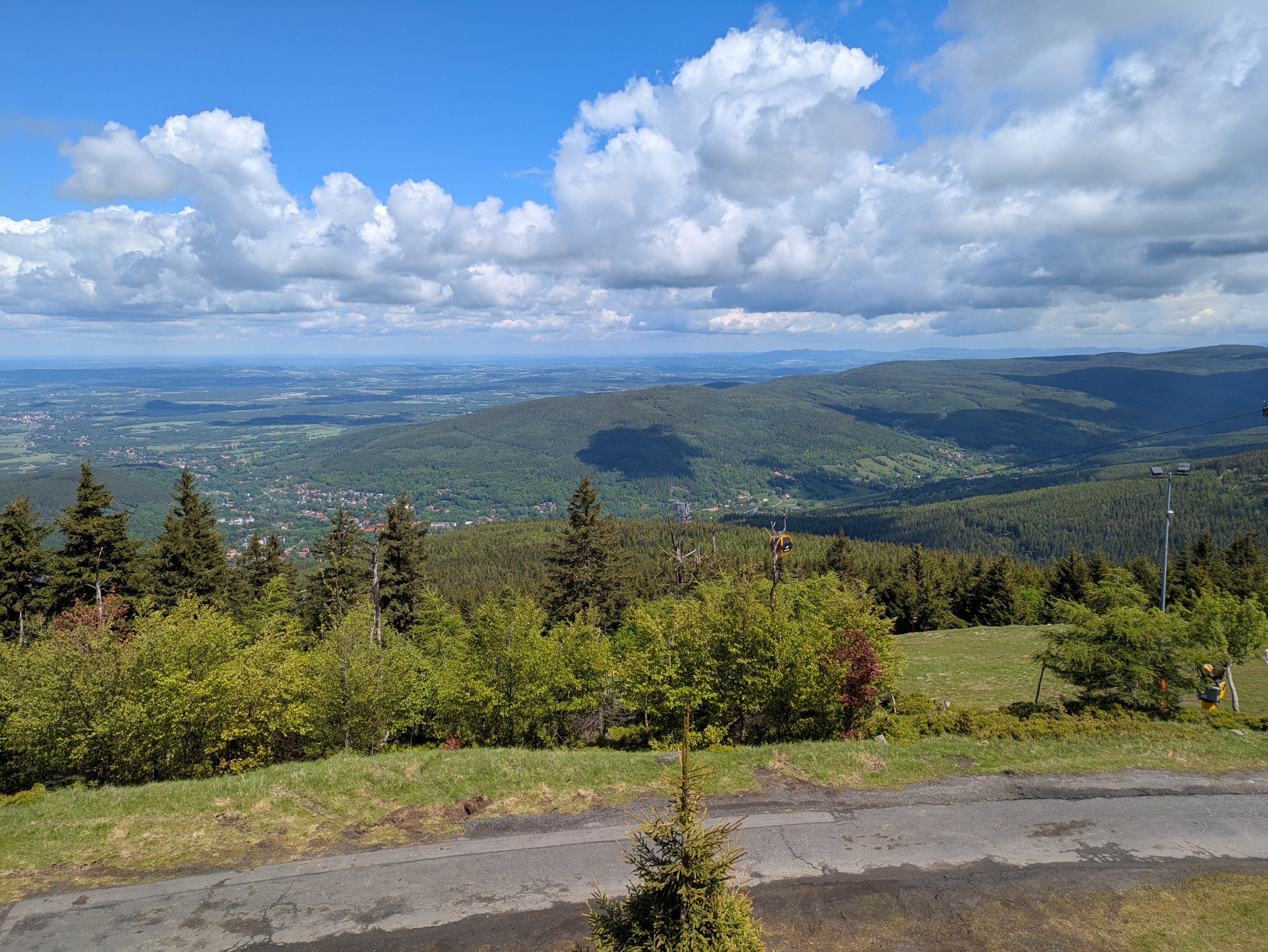
Apart from that, the way up already offers some very nice views into the valley – you just need to turn around and look back every now and then. The views include a wooden obseravtion tower sitting almost in the valley itself. I have no idea why it's there.
Lunch Break
Once atop Stóg Izerskie (DE: Heufuder, you can stop for lunch at Schronisko na Stogu Izerskim (DE: Heufuderbaude), a hostel/restaurant thingy offering typical Polish food such as Pierogi (a kind of dumplings). Otherwise, you can still go there and enjoy the views from the terrace.
Across the Ridge
Our next stop was Smrk (PL: Smrek / DE: Tafelfichte). It's three metres lower than the highest peak of the Jizera Mountains (namely, Wysoka Kopa / DE: Hinterberg), but features a nice observation deck.
The way to Smrk is comparatively even, but full of water streams that double as trails. It's pretty; just try not to get wet feet. It also features a border crossing from Poland to the Czech republic. In our case, the “welcome to Poland” sign on the way back was missing, but the border stone itself was still present.

View
It's pretty cold and drafty on the observation tower, but the views are absolutely worth it.
Going Down
While our original plan was to return to Świeradów-Zdrój, we spontaneously decided that Nové Město pod Smrkem on the Czech side should give for a more interesting trip. It was a bit of a close call – the last train to Liberec departed around 17:00, and there was just a single fallback connection near 19:00 that might still have taken us home in case we missed the one to Liberec. Note that this was regular weekday service.
From the observation tower, you can follow paths marked with a blue-on-white stripe for a reasonably direct, steep, and as often as not watery path down. The views alongside it do not disappoint at all, and even down in the valley there's still quite an angle to the nature around you.

Departure
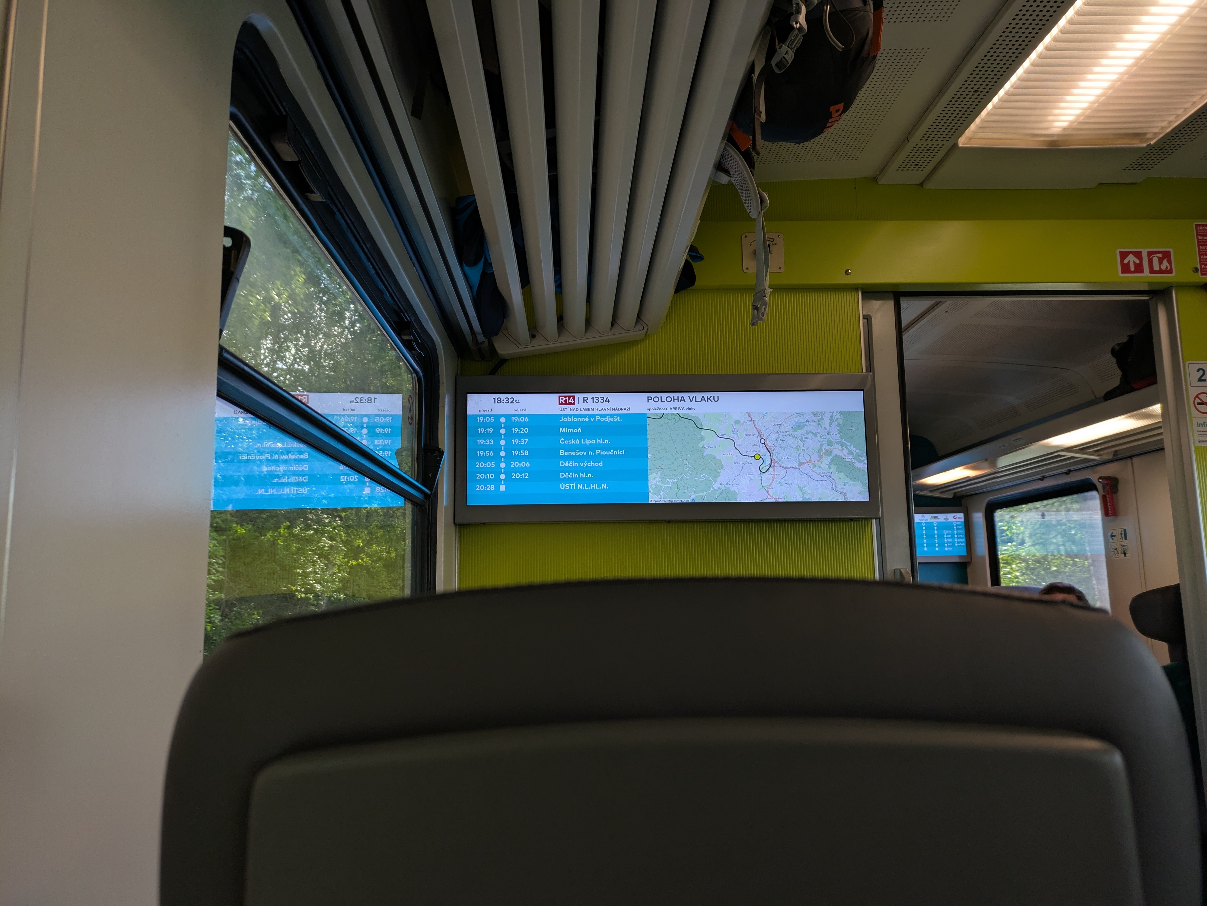
We arrived in Nové Město pod Smrkem at 16:45, 15 minutes before the last train to Liberec departed. Normally, there is a connection from Liberec to Zittau (DE) that would've taken us directly back to Dresden, but as there was only rail replacement bus service available we went with the slightly longer, but at least equally scenic route via Děčín – featuring a nice view towards Ještěd (DE: Jeschken) and its iconic tower. Even on the train, you really notice that the Czech Republic is in more of a mountainside than conventional countryside situation. Also, the ARV train used OpenStreetMap on its passenger information display, which is cool.
- Os 6381 Nové Město pod Smrkem (17:01) → Liberec (17:57) – 70 CZK (2.83 €) each
- ARV 1334 Liberec (18:28) → Děčín hl.n. (20:10) – 196 CZK (7.92 €) each
- RB U28 Děčín hl.n. (20:41) → Bad Schandau (21:09) – 1.80 € or so each
- S1 Bad Schandau (21:44) → Dresden Hbf (22:28) – Deutschlandticket
All pictures from the trip are available on lib.finalrewind.org/Góry Izerskie 2025.
Using cryptsetup / LUKS2 on SSHFS images
Occasionally, I need to open remote LUKS2 images (i.e., files) that I access via SSHFS. This used to work just fine: mount an sshfs, run cryptsetup luksOpen and access the underlying filesystem. However, a recent cryptsetup upgrade introduced (or changed?) its locking mechanism. Now, before opening an image file, it tries to aqcuire a read lock, which will fail with ENOSYS (Function not implemented) on sshfs mountpoints. This, in turn, causes cryptsetup to report "Failed to acquire read lock on device" and "Device ... is not a valid LUKS device.".
There doesn't seem to be a simple way of disabling this (admittedly, in 99% of cases desirable) feature, so for now I'm working around it by just having flock always return success, thanks to the magic of LD_PRELOAD and a flock stub:
#include <sys/file.h>

int flock(int fd, int operation)
{
    return 0;
}
Compile as follows:
> ${CC} -O2 -Wall -fPIC -c -o ignoreflock.o ignoreflock.c
> ${CC} -fPIC -O2 -Wall -shared -Wl,-soname,ignoreflock.so.0 -o ignoreflock.so.0 ignoreflock.o -ldl
And then call LD_PRELOAD=..../ignoreflock.so.0 cryptsetup luksOpen ...
(or sudo env LD_PRELOAD=..../ignoreflock.so.0 cryptsetup luksOpen ...).
ignoreflock provides a handy stub, Makefile and wrapper script for this.
2026